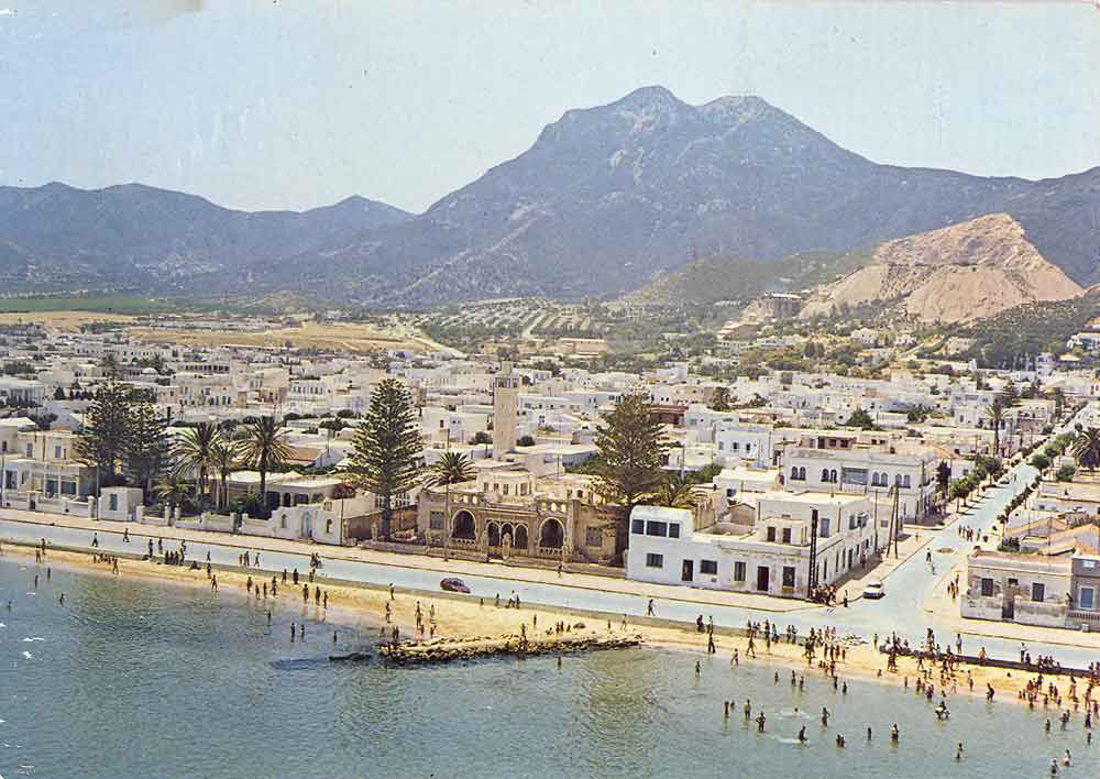
- Hammam-Lif
Infobox Settlement
official_name =Hammam-Lif
other_name =
native_name =
nickname =
settlement_type =
motto =
imagesize = 300px
image_caption =
flag_size =
image_
seal_size =
image_shield =
shield_size =
image_blank_emblem =
blank_emblem_type =
blank_emblem_size =
mapsize =
map_caption =
mapsize1 =
map_caption1 =
image_dot_
dot_mapsize =
dot_map_caption =
dot_x = |dot_y =
pushpin_
pushpin_label_position =bottom
pushpin_map_caption =Location in Tunisia
subdivision_type = Country
subdivision_name =
subdivision_type1 = Governorate
subdivision_name1 =Ben Arous Governorate
subdivision_type2 =
subdivision_name2 =
subdivision_type3 =
subdivision_name3 =
subdivision_type4 =
subdivision_name4 =
government_footnotes =
government_type =
leader_title =
leader_name =
leader_title1 =
leader_name1 =
leader_title2 =
leader_name2 =
leader_title3 =
leader_name3 =
leader_title4 =
leader_name4 =
established_title =
established_date =
established_title2 =
established_date2 =
established_title3 =
established_date3 =
area_magnitude =
unit_pref =Imperial
area_footnotes =
area_total_km2 =
area_land_km2 =
area_water_km2 =
area_total_sq_mi =
area_land_sq_mi =
area_water_sq_mi =
area_water_percent =
area_urban_km2 =
area_urban_sq_mi =
area_metro_km2 =
area_metro_sq_mi =
area_blank1_title =
area_blank1_km2 =
area_blank1_sq_mi =
population_as_of =2004
population_footnotes =
population_note =
population_total =38 401
population_density_km2 =
population_density_sq_mi =
population_metro =
population_density_metro_km2 =
population_density_metro_sq_mi =
population_urban =
population_density_urban_km2 =
population_density_urban_sq_mi =
population_blank1_title =Ethnicities
population_blank1 =
population_blank2_title =Religions
population_blank2 =
population_density_blank1_km2 =
population_density_blank1_sq_mi =
timezone = CET
utc_offset = 1
timezone_DST =
utc_offset_DST =
latd=36 |latm=44|lats= |latNS=N
longd=10|longm=20|longs=|longEW=E
elevation_footnotes =
elevation_m =
elevation_ft =
postal_code_type =
postal_code =
area_code =
blank_name =
blank_info =
blank1_name =
blank1_info =
website =
footnotes =Hammam-Lif ( _ar. حمام الأنف, pronounced hammam lanf in Standard but not
Tunisian Arabic ) is a coastal town about 20 km south-east ofTunis , the capital ofTunisia . It has been known since antiquity for its thermal springs originating in MountBou Kornine .History
Naro , which means fire, was Hammam-Lif's Roman name. In 1883, the French captain Ernest De Prudhomme discovered in his Hammam-lif residence the first archeological ruins of an ancientsynagogue that once stood in Hammam-Lif in 3rd-5th century AD.In the late 19th century, Hammam-Lif, and the rest of
Tunisia were conquered byFrance and incorporated into the French empire.Tunisia gained independence in 1956.During the French occupation, Hammam-Lif was also conquered byNazi Germany from November 1942 until May 1943.Hammam-Lif was once the home of Italian, Greek andJewish communities, especially before the end of French occupation.Hammam-Lif's most interesting site is probably Dar El
Bey , which was the residence ofAli II Bey , the 4th bey ofTunis .ports
The local soccer team
Club Sportif de Hammam-Lif won the Tunisian championship in 1952, 1954, 1955, 1956 and won the Tunisian Cup in 1946, 1947, 1948, 1949, 1950, 1985, 2001External links
* [http://www.hammam-lif.com// Information and pictures]
* [http://www.tunisia.com/Tunisia/Travel/Tunisia-Travel-Guides/Northern-Tunisia/Hammam-Lif Hammam-Lif travel guide]
* CSHL: Hammam-Lif's soccer teamReferences
* [http://www.fallingrain.com/world/TS/36/HammamLif.html FallingRain Map - elevation = 1m (Red dots are railways)]
Wikimedia Foundation. 2010.

