- Muncho Lake, British Columbia
-
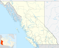
 Muncho LakeLocation of Muncho Lake in British Columbia
Muncho Lake is a highway services community in northern British Columbia, Canada, located at Mile 462 on Highway 97, the Alaska Highway, within Muncho Lake Provincial Park and on the south end of the lake of the same name.[1] The community consists almost entirely of travel and tourism-related businesses such as lodging, game outfitting, restaurants, gas stations and fishing outfitting.
Climate
Climate data for Muncho Lake Month Jan Feb Mar Apr May Jun Jul Aug Sep Oct Nov Dec Year Record high °C (°F) 10.5
(50.9)15
(59)15
(59)23.9
(75.0)34
(93)32.5
(90.5)34
(93)32.8
(91.0)30.5
(86.9)23
(73)13.3
(55.9)13
(55)35
(95)Average high °C (°F) −10.1
(13.8)−6.8
(19.8)−0.6
(30.9)7.6
(45.7)14
(57)18.4
(65.1)20.4
(68.7)18.9
(66.0)13.4
(56.1)6.1
(43.0)−4.4
(24.1)−7.9
(17.8)5.8 Average low °C (°F) −21
(−6)−19.1
(−2.4)−14
(7)−5.3
(22.5)0.5
(32.9)5.1
(41.2)7.4
(45.3)6.1
(43.0)1.9
(35.4)−3.3
(26.1)−13.7
(7.3)−18
(0)−6.1 Record low °C (°F) −50.4
(−58.7)−45
(−49)−40
(−40)−29
(−20)−14.4
(6.1)−3.5
(25.7)−0.6
(30.9)−5
(23)−12.8
(9.0)−32.5
(−26.5)−40
(−40)−48
(−54)−50.4
(−58.7)Precipitation mm (inches) 34.8
(1.37)24.8
(0.976)16.6
(0.654)13.9
(0.547)44.2
(1.74)61.4
(2.417)86.9
(3.421)70.1
(2.76)44.4
(1.748)37.2
(1.465)29.2
(1.15)32.4
(1.276)495.8
(19.52)Source: Environment Canada[2] See also
- Muncho Pass
- Sentinel Range (Canada)
References
- ^ "Muncho Lake (locality)". BC Geographical Names. http://apps.gov.bc.ca/pub/bcgnws/names/8268.html.
- ^ Environment Canada—1971–2000, accessed 25 March 2010
Coordinates: 58°56′17″N 125°46′03″W / 58.93806°N 125.7675°W
Categories:- Unincorporated settlements in British Columbia
- Northern Interior of British Columbia
- Populated places in the Northern Rockies Regional Municipality
- Canadian Rockies
- British Columbia Interior geography stubs

Wikimedia Foundation. 2010.