Cherryville, British Columbia

Cherryville, British Columbia
Location of Cherryville, British Columbia

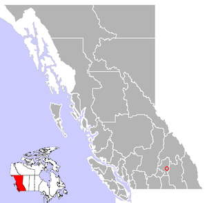
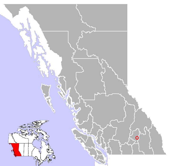
Cherryville is an unincorporated community in the foothills of the Monashee Mountains in British Columbia with a population of approximately 614.[1] It is located 14 miles (22 km) east of Lumby, along Highway 6.

The small community of Cherryville was an old gold mining camp founded in the 1860s by prospectors from the California Gold Rush who had come north to the British Columbia gold rushes. Between 1863 and 1895, the original town that is now known as Cherryville was a small mining camp located within the canyon walls of Cherry Creek. Its population was 100 people, half of which were Chinese miners.

With more and more miners heading into Cherry Creek area, a road was built from Lumby in 1877, through Blue Springs Valley, attracting new families to the area. The community was known by the post office name of Cherry Creek, then Hilton, which remained the name of the Cherryville for many years. Cherry Creek and Cherryville were named after the wild Choke Cherries (Prunus virginiana) that grew along the banks of the creek.

Services in Cherryville include accommodation, two general stores, restaurants, a library, a campground, shops and other amenities. Originally an area of orchards, ranching and logging are major industries in the community.

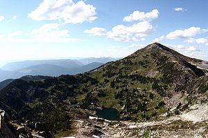
Hiking in the nearby Monashees.

Recreation opportunities in the Cherryville area include bird watching, gold panning, skiing, hiking, camping, horseback tours, and fishing.

References

External links

Coordinates: 50°14′N 118°37′W / 50.233°N 118.617°W / 50.233; -118.617


Wikimedia Foundation. 2010.

Игры ⚽ Поможем решить контрольную работу

Look at other dictionaries:

  • British Columbia Highway 6 — Infobox road province=BC type=Hwy route=6 maint= length km= length round= length ref= established= direction a= starting terminus= junction= direction b= ending terminus= previous type=Hwy previous route=5A next type=Hwy next route=7Highway 6 is… …   Wikipedia

  • List of museums in British Columbia — This list of museums in British Columbia, Canada contains museums which are defined for this context as institutions (including nonprofit organizations, government entities, and private businesses) that collect and care for objects of cultural,… …   Wikipedia

  • Cherryville — ist der Name mehrerer Orte in den Vereinigten Staaten: Cherryville (Idaho) Cherryville (Missouri) Cherryville (New Jersey) Cherryville (North Carolina) Cherryville (Oregon) Cherryville (Pennsylvania) in Kanada: Cherryville (British Columbia) …   Deutsch Wikipedia

  • List of settlements in British Columbia — This is a list of communities in British Columbia, a province in Canada. For the purposes of this list, a community is defined as either an incorporated municipality (including Indian reserves), or an unincorporated settlement inside or outside… …   Wikipedia

  • Cherryville — may refer to one of the following places: Cherryville, British Columbia Cherryville, Missouri Cherryville, North Carolina Cherryville, Pennsylvania Cherryville, South Australia This disambiguation page lists articles associated with the same… …   Wikipedia

  • List of communities in British Columbia — This is a list of communities in British Columbia, a province in Canada. For the purposes of this list, a community is defined as either an incorporated municipality (including Indian reserves), or an unincorporated settlement inside or outside… …   Wikipedia

  • Highway 6 (British Columbia) — Der Highway 6 in British Columbia bildet eine Verlängerung der Washington (Bundesstaat) State Route 31. Der Highway beginnt an der Grenze zu den Vereinigten Staaten südlich von Salmo und endet am Highway 97 in Vernon, er hat eine Gesamtlänge von… …   Deutsch Wikipedia

  • Cherryville — Administration Pays  Canada Province …   Wikipédia en Français

  • Whitecotton — CAN Dustin Whitecotton Personenbezogene Informationen Geburtsdatum 3. Mai …   Deutsch Wikipedia

  • List of mountains of Canada — Main article: Mountain peaks of Canada The vast majority of mountains in Canada lie in the western provinces of British Columbia and Alberta and the Yukon Territory. Mountains can be found all over British Columbia while those in Alberta are… …   Wikipedia

Share the article and excerpts

Direct link
Do a right-click on the link above
and select “Copy Link”