Mangrove Cay

Mangrove Cay
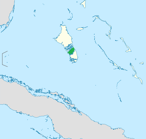
The Location of the District of Mangrove Cay

Mangrove Cay is one of the districts of the Bahamas, on Andros Island.

Coordinates: 24°10′N 77°47′W / 24.167°N 77.783°W / 24.167; -77.783


Wikimedia Foundation. 2010.

Игры ⚽ Поможем написать реферат

Look at other dictionaries:

  • Mangrove Cay — District de Mangrove Cay Administration Pays  Bahamas …   Wikipédia en Français

  • Mangrove Cay — Sp Mángrovių salà Ap Mangrove Cay L Bahamose …   Pasaulio vietovardžiai. Internetinė duomenų bazė

  • Mangrove Cay — Admin ASC 1 Code Orig. name Mangrove Cay Country and Admin Code BS.44 BS …   World countries Adminstrative division ASC I-II

  • Mangrove — World mangrove distribution …   Wikipedia

  • Grand Cay — Géographie Pays  Bahamas Archipel …   Wikipédia en Français

  • Rum Cay — Géographie Pays  Bahamas Archipel …   Wikipédia en Français

  • Great Guana Cay — Location map Bahamas label = Great Guana Cay lat deg = 26 lat min = 40 lat sec = 0 lat dir = N lon deg = 77 lon min = 7 lon sec = 0 lon dir = W caption = Location of Great Guana Cay within the Bahamas float = right width = 250Great Guana Cay is… …   Wikipedia

  • MAY — Mangrove Cay, Bahamas internationale Flughafen Kennung …   Acronyms

  • MAY — Mangrove Cay, Bahamas internationale Fughafen Kennung …   Acronyms von A bis Z

  • List of islands in the Caribbean — This is a list of islands of the Caribbean region, organized by the political territory each island belongs to.Anguilla* Anguilla * Anguillita * Blowing Rock * Cove Cay * Crocus Cay * Deadman s Cay * Dog Island * East Cay * Little Island * Little …   Wikipedia

Share the article and excerpts

Direct link
Do a right-click on the link above
and select “Copy Link”