- Massakory
-
Massakory Location in Chad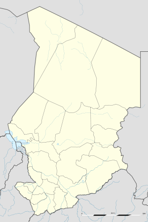
 Massakory
Coordinates: 13°0′N 15°44′E / 13°N 15.733°ECoordinates: 13°0′N 15°44′E / 13°N 15.733°E Country  Chad
ChadRegion Hadjer-Lamis Department Dagana Sub-Prefecture Massakory Population (2008) – Total 16 237 Time zone +1 Massakory is the capital of the Chadian region of Hadjer-Lamis and of the department of Dagana. The town was formerly in the prefecture of Fort-Lamy in the department of Bas-Chari.[1]
People
The territory around Massakory used to be ruled by the sultan of Ouaddaï. Two tribes dominate this region: the Dagana, nomadic herders, in the interior and the Kuori Kalé on the shores and islands of the western part of the lake.[2] The traditional head of the canton of Dagana-Moussakory is Koulbu, a dynasty distantly related to Kanembu people. A significant part of this family lives in the Gouré region of Niger. Their ancestor Moussa Kanembou arrived there about six generations ago. There are also Toundjour people in the town.[citation needed]
The Bulala, who live near Massagory, are said to be Arab in origin. They helped to found the Kanem kingdom, and helped to expel the Kanem royal family in the 13th century. They were later forced to move to the Yao region where they created a small Sultanate and settled into an agricultural lifestyle, although they are said to be good warriors.[3]
The French colonialists created the post of Massakory in the Dagana territory in 1901.[4] In 1925 the Bas-Chari region supplied 1,500 workers to work on the Congo-Ocean railway line.[5] During the French colonual era, laws were enforced harshly. In the Massakory circonscription of about 30,000 people in 1932, two percent were in jail.[6]
Economy
The population of the town of Massakory was 11,344 in 1993, and had increased to 16,237 by 2008.[7] In recent years the town and region has been "invaded" from the north by Libyan importers, as have other arid and semi-arid parts of northern Chad.[8] The cattle market, once important, has steadily declined due to the advance of the desert and political instability in the area around the shrinking Lake Chad.[9]
The town lies on the Nigeria/Niger corridor of Chad national highway system, running from N'Djamena to Bol. As of 2005, 77 kilometres (48 mi) between N'Djamena and Massaguet had been completed, while the remainder of the 249 kilometres (155 mi) corridor had yet to start due to lack of funding.[10] By 2008 the paved road had reached Massakory.[11] The road is intended to facilitate access to a new oil refinery that is being built at Djermaya to the north of the capital.[12] Massakory Airport is a civilian airport with an unpaved runway of 3,500 feet (1,100 m) in length.[13]
References
- ^ Durand 2002, pp. 62.
- ^ Durand 2002, pp. 349.
- ^ Azevedo 1998, pp. 13.
- ^ Durand-Prinborgne 1995, pp. 351.
- ^ Durand-Prinborgne 1995, pp. 360.
- ^ Azevedo 1998, pp. 83.
- ^ World Gazetteer.
- ^ Bennafla 2002, pp. 45.
- ^ Bennafla 2002, pp. 93.
- ^ IMF, pp. 33.
- ^ IBP USA, pp. 125.
- ^ African Development Bank 2009, pp. 158.
- ^ IBP USA, pp. 127.
Cited books
- African Development Bank, OECD - Organisation for Economic Co-operation and Development (2009). African Economic Outlook 2009: Country Notes: Volumes 1 and 2. OECD Publishing. ISBN 9264076182. http://books.google.ca/books?id=e91T-0zSWnAC&pg=PT160.
- Azevedo, Mario Joaquim (1998). Roots of violence: a history of war in Chad. Routledge. ISBN 9056995820. http://books.google.ca/books?id=qW_Nryt2GS0C&pg=PA13.
- Bennafla, Karine (2002) (in French). Le commerce frontalier en Afrique centrale: acteurs, espaces, pratiques. KARTHALA Editions. ISBN 284586230X. http://books.google.ca/books?id=tM4CwLVoId4C&pg=PA45.
- Durand, Claude (2002) (in French). Les anciennes coutumes pénales du Tchad: les grandes enquêtes de 1937 et 1938. Editions L'Harmattan. ISBN 2747525422. http://books.google.ca/books?id=vPXXFm3kyUsC&pg=PA349.
- Durand-Prinborgne, Claude (1995) (in French). Fiscalite et Politique les Redevances Coutumieres. Editions L'Harmattan. ISBN 273843665X. http://books.google.ca/books?id=apwqeOAXlVUC&pg=PA351.
- IBP USA (2008). Global Logistics Assesments Reports Handbook: Strategic Transportation and Customs Information for Selected Countries. Int'l Business Publications. ISBN 0739766031. http://books.google.ca/books?id=0x3TrjmWAsMC&pg=PA125.
- IMF (2007). Chad: poverty reduction strategy paper, 2005 annual implementation progress report. International Monetary Fund. http://books.google.ca/books?id=yhcxupvJcQYC&pg=PA33.
- World Gazetteer. "Tschad: Die wichtigsten Orte mit Statistiken zu ihrer Bevölkerung". http://bevoelkerungsstatistik.de/wg.php?x=&men=gcis&lng=de&dat=32&geo=-205&srt=pnan&col=aohdq&pt=c&va=x. Retrieved 2011-06-14.
Categories:- Hadjer-Lamis Region
- Populated places in Chad

Wikimedia Foundation. 2010.