- Lafayette Regional Airport
Infobox Airport
name = Lafayette Regional Airport

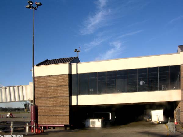
caption = Lafayette Regional Airport terminal from the tarmac
IATA = LFT
ICAO = KLFT
FAA = LFT
type = Public
owner =
operator = City & Parish of Lafayette
city-served =Lafayette, Louisiana
location =
elevation-f = 42
elevation-m = 13
coordinates = coord|30|12|19|N|091|59|15|W|region:US_type:airport
website = [http://www.lftairport.com/ www.LFTairport.com]
r1-number = 4L/22R
r1-length-f = 4,099
r1-length-m = 1,249
r1-surface = Asphalt
r2-number = 4R/22L
r2-length-f = 7,651
r2-length-m = 2,332
r2-surface = Asphalt
r3-number = 11/29
r3-length-f = 5,400
r3-length-m = 1,646
r3-surface = Asphalt
h1-number = H1
h1-length-f = 50
h1-length-m = 15
h1-surface = Asphalt
stat-year = 2006
stat1-header = Aircraft operations
stat1-data = 114,303
stat2-header = Based aircraft
stat2-data = 159
footnotes = Sources: airport website [http://www.lftairport.com/ Lafayette Regional Airport] ] and FAAFAA-airport|ID=LFT|use=PU|own=PU|site=07589.*A, effective 2008-06-05]Lafayette Regional Airport airport codes|LFT|KLFT|LFT is a public use
airport located twonautical mile s (4 km) southeast of thecentral business district of Lafayette, a city in Lafayette Parish,Louisiana ,United States . It is owned by the City & Parish of Lafayette.It is located on US Highway 90, on the southeast side of the city, in a population center close to the petroleum wells of the
Gulf of Mexico . Lafayette Regional is home to the largest helicopter company in the world,PHI, Inc. (formerly Petroleum Helicopters International). Although the airport does not currently have international flights, it flies into four major hubs in the southeast: Atlanta, Dallas, Houston and Memphis. The airport serves the Lafayette Metropolitan Area, which consists of approximately 600,000 people.Facilities and aircraft
Lafayette Regional Airport covers an area of 746
acre s (302 ha) at anelevation of 42 feet (13 m) abovemean sea level . It has threeasphalt pavedrunway s: 4L/22R measuring 4,099 x 75 feet (1,249 x 23 m), 4R/22L measuring 7,651 x 150 feet (2,332 x 46 m), and 11/29 measuring 5,400 x 148 feet (1,646 x 45 m). It also has onehelipad measuring 50 x 50 ft. (15 x 15 m).For the 12-month period ending February 28, 2006, the airport had 114,303 aircraft operations, an average of 313 per day: 38%
general aviation , 36%air taxi , 24% commuter/cargo, 2% military and 1% scheduled commercial. At that time there were 159 aircraft based at this airport: 57% single-engine, 27% multi-engine, 9% jet and 7%helicopter .Airlines and destinations
*
American Airlines
** American Eagle (Dallas/Fort Worth)
*Continental Airlines
**Continental Connection operated byColgan Air (Houston-Intercontinental)
**Continental Express operated byExpressJet Airlines (Houston-Intercontinental)
*Delta Air Lines
**Delta Connection operated byAtlantic Southeast Airlines (Atlanta)
*Northwest Airlines
**Northwest Airlink operated byMesaba Airlines (Memphis)Future
The future for Lafayette Regional seems bright due to continuous record breaking traffic year after year. The airport is currently working on adding a US Customs center with permanent customs agents. This would enable the airport to receive certification as an international airport. On June 1, 2008, the prop planes which service Dallas/Fort Worth will be replaced with more efficient jets, halfing the flight time. The airport will also be adding non stop service to Chicago in the fall, despite the high fuel prices.
References
External links
*
*
*
Wikimedia Foundation. 2010.
