- El Kef
Infobox Settlement
official_name =El Kef
other_name =
native_name =
nickname =
settlement_type =
motto =
imagesize = 240px
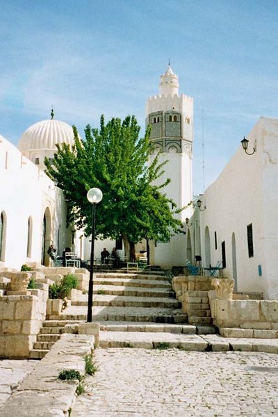
image_caption = A mosque in El Kef
flag_size =
image_
seal_size =
image_shield =
shield_size =
image_blank_emblem =
blank_emblem_type =
blank_emblem_size =
mapsize =
map_caption =
mapsize1 =
map_caption1 =
image_dot_
dot_mapsize =
dot_map_caption =
dot_x = |dot_y =
pushpin_
pushpin_label_position =bottom
pushpin_map_caption =Location in Tunisia
subdivision_type = Country
subdivision_name =
subdivision_type1 = Governorate
subdivision_name1 =Kef Governorate
subdivision_type2 =
subdivision_name2 =
subdivision_type3 =
subdivision_name3 =
subdivision_type4 =
subdivision_name4 =
government_footnotes =
government_type =
leader_title =
leader_name =
leader_title1 =
leader_name1 =
leader_title2 =
leader_name2 =
leader_title3 =
leader_name3 =
leader_title4 =
leader_name4 =
established_title =
established_date =
established_title2 =
established_date2 =
established_title3 =
established_date3 =
area_magnitude =
unit_pref =Imperial
area_footnotes =
area_total_km2 =
area_land_km2 =
area_water_km2 =
area_total_sq_mi =
area_land_sq_mi =
area_water_sq_mi =
area_water_percent =
area_urban_km2 =
area_urban_sq_mi =
area_metro_km2 =
area_metro_sq_mi =
area_blank1_title =
area_blank1_km2 =
area_blank1_sq_mi =
population_as_of =2004
population_footnotes =
population_note =
population_total =45,191
population_density_km2 =
population_density_sq_mi =
population_metro =
population_density_metro_km2 =
population_density_metro_sq_mi =
population_urban =
population_density_urban_km2 =
population_density_urban_sq_mi =
population_blank1_title =Ethnicities
population_blank1 =
population_blank2_title =Religions
population_blank2 =
population_density_blank1_km2 =
population_density_blank1_sq_mi =
timezone = CET
utc_offset = 1
timezone_DST =
utc_offset_DST =
latd=36 |latm=10|lats=56 |latNS=N
longd=8|longm=42|longs=53|longEW=E
elevation_footnotes =
elevation_m =
elevation_ft =
postal_code_type =
postal_code =
area_code =
blank_name =
blank_info =
blank1_name =
blank1_info =
website =
footnotes =El Kef ( _ar. الكاف, also transliterated as "Al-Kāf" or "Le Kef") is a city in northwestern
Tunisia . It is located at around coord|36|10|56|N|8|42|53|E. It is the capital of theKef Governorate . Its name at the time of theRoman Empire was "Sicca Veneria". [cite book|title=Tunisia|author= By Anthony Ham, Abigail Hole|year=2004|publisher=Lonely Planet|url=http://books.google.com/books?vid=ISBN1741041899&id=z4lQNCHfS4gC&pg=PA142&lpg=PA142&ots=VjV4Gwpxkx&dq=Tunisia+%22El+Kef%22&ie=ISO-8859-1&output=html&sig=5ZxIXldy_If6KKf7VwHOvLF5Jho|id=ISBN 1741041899]The old town is built on the cliff face of the table-top
Jebel Dyr mountain. El Kef was the provisional capital of Tunisia duringWorld War II . It was the command centre of the FLN ("Front de Libération Nationale") during theAlgerian War of Independence against the French in the 1950s. It has a population of 45,191 (2004 census).References
External links
* [http://lexicorient.com/tunisia/kef.htm Lexicorient]
Wikimedia Foundation. 2010.

