- Crimmitschau
-
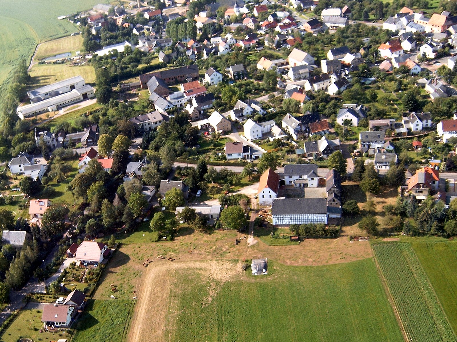
Crimmitschau Mannichswalde, which is part of Crimmitschau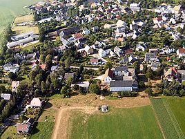


 CrimmitschauLocation of the town of Crimmitschau within Zwickau district
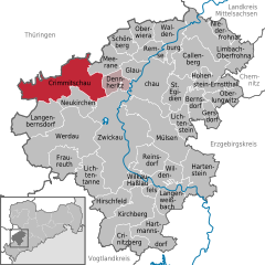

Coordinates 50°49′5″N 12°23′15″E / 50.81806°N 12.3875°ECoordinates: 50°49′5″N 12°23′15″E / 50.81806°N 12.3875°E Administration Country Germany State Saxony Admin. region Chemnitz District Zwickau Town subdivisions 13 Mayor Holm Günther Basic statistics Area 61.04 km2 (23.57 sq mi) Elevation 273 m (896 ft) Population 20,901 (31 December 2010)[1] - Density 342 /km2 (887 /sq mi) Other information Time zone CET/CEST (UTC+1/+2) Licence plate Z Postal code 08451 Area code 03762 Website www.crimmitschau.de Crimmitschau (German pronunciation: [ˈkʁɪmɪtʃaʊ]) is a town in the district of Zwickau in the Free State of Saxony.
Contents
Geography
Crimmitschau lies on the River Pleiße in the northern foothills of the Erzgebirge.
Neighboring municipalities
Adjacent communities include: Zwickau, Dennheritz, Neukirchen, Meerane, and Langenbernsdorf in Landkreis of Zwickau; Heyersdorf, Jonaswalde, Ponitz and Thonhausen in Thuringian Landkreis of Altenburger Land; as well as Braunichswalde, Rückersdorf, and Seelingstädt in Thuringia in Landkreis of Greiz.
Municipality subdivisions
Crimmitschau's subdivisions are Rudelswalde, Lauenhain, Langenreinsdorf, Mannichswalde, Frankenhausen, Wahlen, Gösau, Gosel, Gablenz, Blankenhain, Großpillingsdorf, and Harthau.
History
In the course of German eastward expansion, the city of Crimmitschau and a castle of the same name (now called the Schweinsburg) were established from around 1170 to 1200 as an organized German colony. The settlement's existence is first documented in 1212. In 1414 Crimmitschau received town privileges from Markgraf Wilhelm II.
On March 15, 1844, Crimmitschau was connected to the German rail network (on the Saxon-Bavarian Railroad, which was later extended to Bavaria)
Around the turn of the century, Crimmitschau was the site of a large concentrated textile industry, and was called "The City of 100 chimneys" (Stadt der 100 Schornsteine).
From August 22, 1903 to January 18, 1904, it was the site of one of the largest and longest strikes in the German Empire, which affected the entire nation.
In 1944, some Crimmitschau property was bombed by Allied Forces.
At the end of the 1980s, a great part of the old and inner cities were torn down and replaced with prefabricated concrete buildings. Similar plans existed for the southern suburb, but were not put in place after the regime change in 1990.
Population
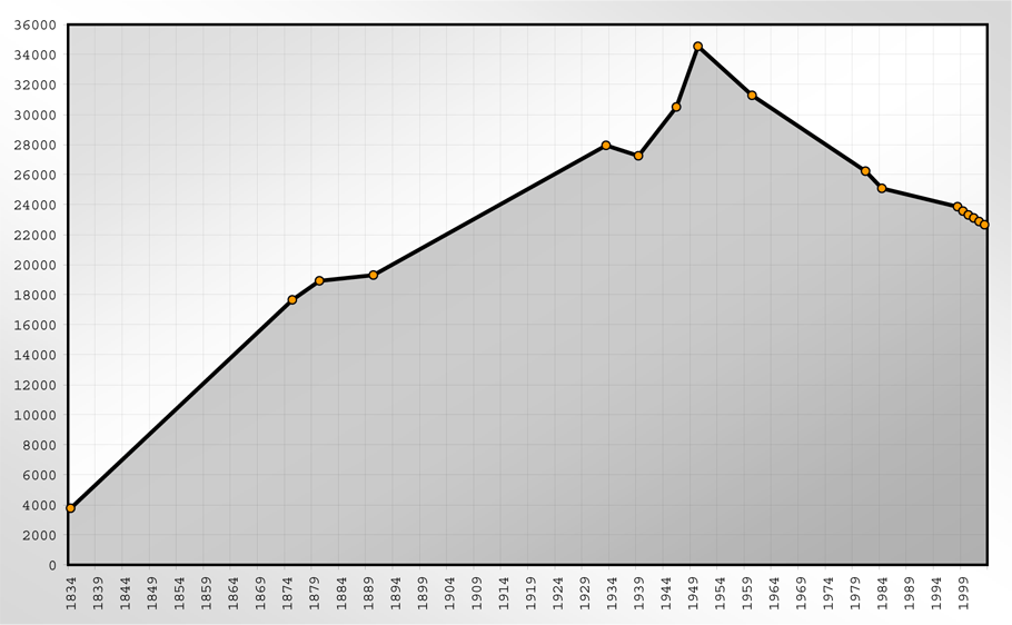
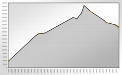 Population of Crimmitschau
Year Population 1834 3,767 1875 17,649 1880 18,925 1890 19,300 1933 27,938 1939 27,247 1946 30,504 1950 34,541 1960 31,279 1981 26,229 1984 25,086 Year Population 1995 23,888 1997 23,420 1998 23,854 1999 23,570 2000 23,305 2001 23,104 2002 22,874 2003 22,660 2004 22,528 2005 22,306 2006 21,953 Year Population 2007 21,680 Religion
Even though almost 50 percent of the people in the Crimmitschau area are Atheists,[citation needed] there are some Protestant parishs and even a catholic parish, belonging to the Diocese of Dresden-Meissen. The most important churches are: St. Laurentius-Kirche, Johanniskirche, and the Lutherkirche.
International relations
Main article: List of twin towns and sister cities in GermanyCrimmitschau is twinned with:
Museums
- Western Saxon Textile Museum, which is located in a fully functional textile factory, former known as "Gebrüder Pfau KG"
- The Agricultural and Open-Air Museum of Schloss Blankenhain
Buildings
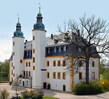 Castle Blankenhain
Landmarks include the town hall, the late gothic parish church of Saint Larentus (1513), with its star and cross ribbed arches, a former Cistercian Convent (founded around 1290) in the district of Frankenhausen and the open air museum of Schloss Blankenhain located at the castle of the same name.
Music
- Helmut Bräutigam, composer
Parks
- The Zöffelpark, which was built in the pre-war period and named after Emil Oskar Zöffel, an important textile manufacturer and Philanthropist in the history of the city.
- The Bismarck-Hain, a former cemetery, named after Reichskanzler Otto von Bismarck. This park was known as Friedenspark (Peace-park) during GDR-times.
- The Sahnpark, located north of the city center, is the largest park in Crimmitschau and harbours an old open-air bath, an animal park and the stadium of ETC Crimmitschau.
Sports
Crimmitschau has a well-known ice hockey club, the ETC Crimmitschau, which plays in the second highest German league. The city also has a soccer team, FC Crimmitschau and an American Football Team, the Tornados Crimmitschau.
Business and Infrastructure
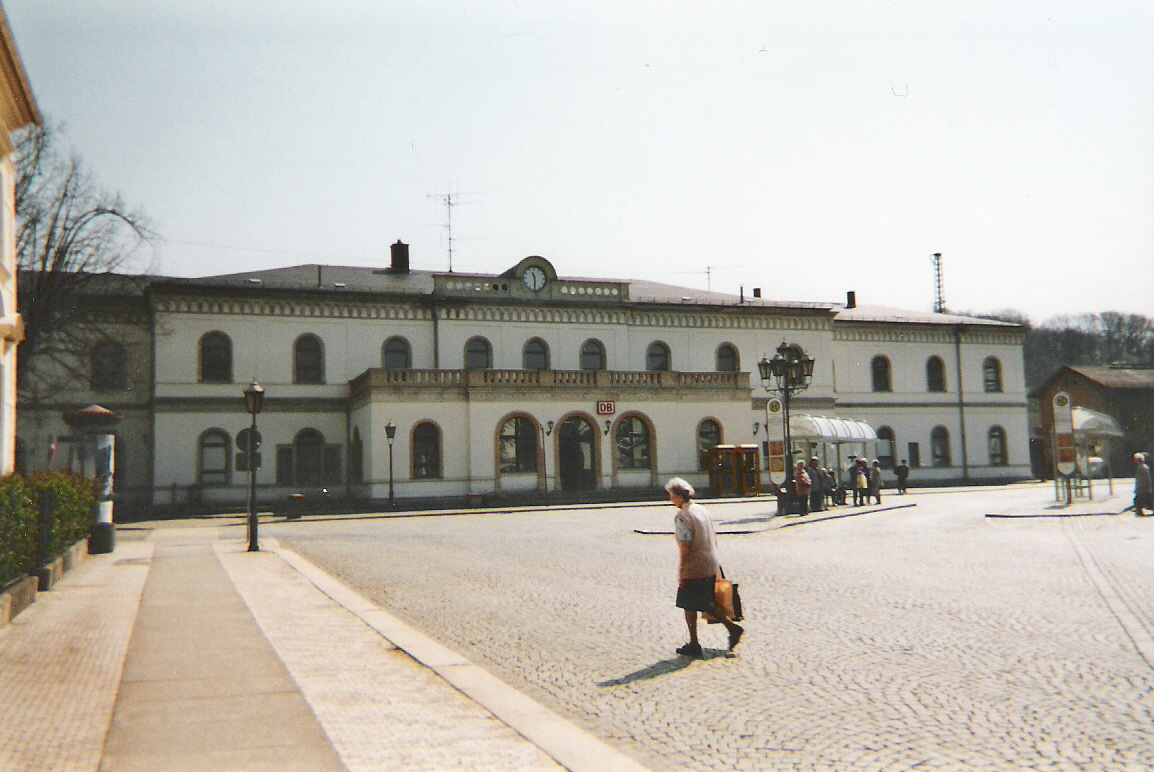
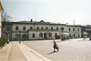 The Crimmitschau Train Station
Crimmitschau lies directly at the Autobahn A4 and can be reached through the exits Schmölln and Meerane. The Deutsche Bahn AG provides connections to Zwickau, Leipzig, Hof.
Education
There are 3 elementary schools (Grundschule), two secondary schools (Mittelschule), a high school (Gymnasium), and a special education school (Förderschule) in Crimmitschau:
- Käthe-Kollwitz-Grundschule
- Grundschule Frankenhausen
- Grundschule Blankenhain
- Käthe-Kollwitz-Mittelschule
- Mittelschule Sahnschule
- Julius-Motteler-Gymnasium
- Förderschule Lindenschule
Personalities
- 1909 - Heinrich Mauersberger, (d. 1982 in Bestensee), Engineer and inventor in the textile industry.
- 1954 - Klaus Gruner, Handballer, Olympic champion 1980
- 1955 - Udo Kießling, ice hockey player
- 1961 - Gabriele Zange, speed skater
See also
 Media related to Crimmitschau at Wikimedia Commons
References
- The information in this article is based on and/or translated from its German equivalent.
References
- ^ "Bevölkerung des Freistaates Sachsen jeweils am Monatsende ausgewählter Berichtsmonate nach Gemeinden" (in German). Statistisches Landesamt des Freistaates Sachsen. 31 December 2010. http://www.statistik.sachsen.de/download/010_GB-Bev/Bev_Gemeinde.pdf.
External links
- Coat of Arms
- (German) ETC-Crimmitschau
- (German) the West Saxon Textile Museum of Crimmitschau
- (German) Agricultural and Open-Air Museum of Schloss Blankenhain
- (German) the Julius-Motteler-Gymnasium of Crimmitschau
Bernsdorf | Callenberg | Crimmitschau | Crinitzberg | Dennheritz | Fraureuth | Gersdorf | Glauchau | Hartenstein | Hartmannsdorf bei Kirchberg | Hirschfeld | Hohenstein-Ernstthal | Kirchberg | Langenbernsdorf | Langenweißbach | Lichtenstein | Lichtentanne | Limbach-Oberfrohna | Meerane | Mülsen | Neukirchen | Niederfrohna | Oberlungwitz | Oberwiera | Reinsdorf | Remse | Sankt Egidien | Schönberg | Waldenburg | Werdau | Wildenfels | Wilkau-Haßlau | Zwickau Categories:
- Towns in Saxony
- Zwickau District


Wikimedia Foundation. 2010.