- Elephant Butte Dike
Infobox_nrhp | name =Elephant Butte Dam
nrhp_type =
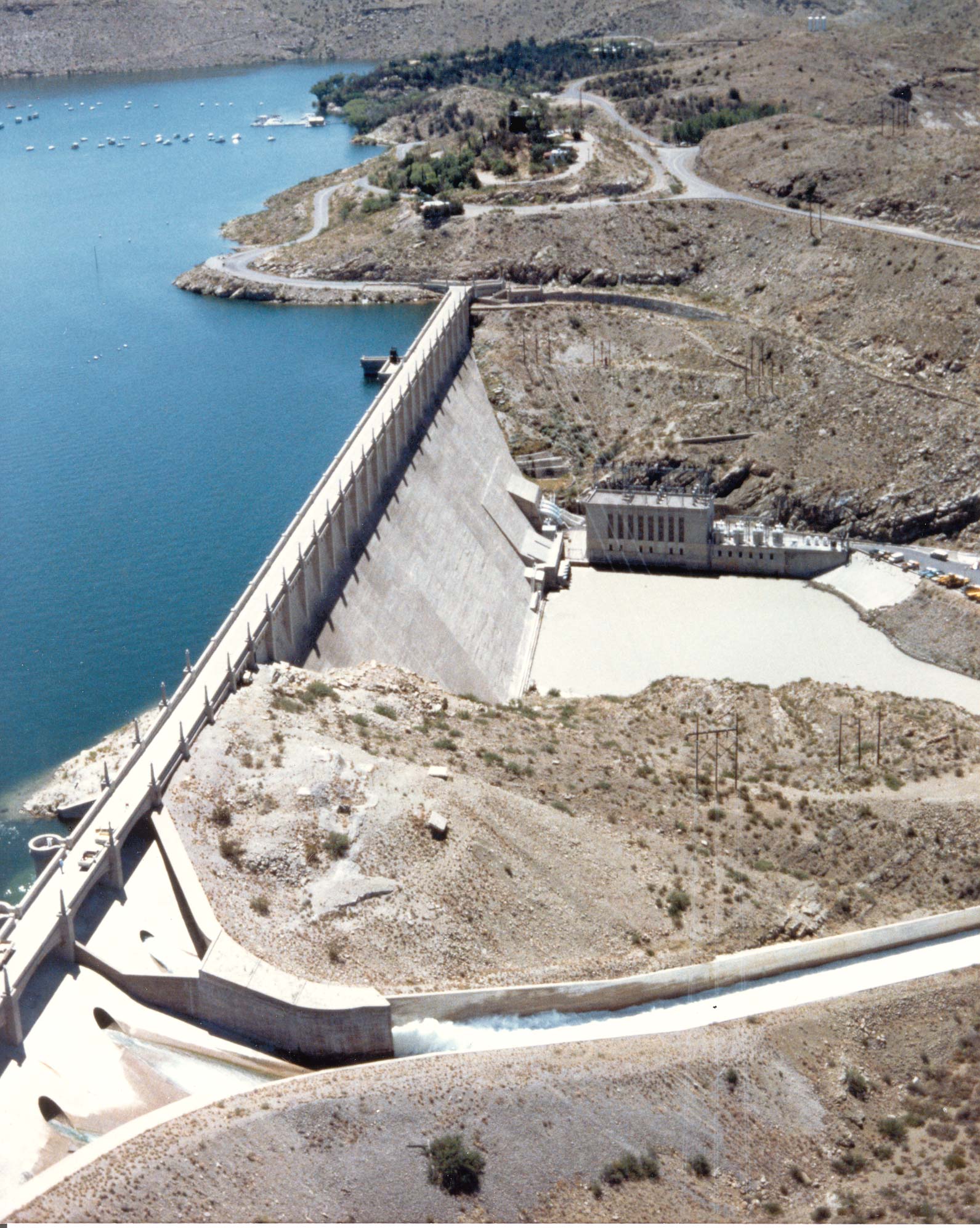
caption = The spillway is in the lower left corner of the picture and the power plant is located at the base of the opposite side of the dam.
nearest_city= Elephant Butte,New Mexico
area =
built =1910
architect= Louis C. Hill
architecture= Other
added =April 9 ,1979
governing_body = BUREAU OF RECLAMATION
refnum=79001556cite web|url=http://www.nr.nps.gov/|title=National Register Information System|date=2007-01-23|work=National Register of Historic Places|publisher=National Park Service]Elephant Butte Dike or Elephant Butte Dam is a concrete gravity dam on the
Rio Grande nearTruth or Consequences, New Mexico . The river was dammed here, impounding theElephant Butte Reservoir for recreation and agriculture, lessening the downstream flow from a "Rio Bravo" to a stream a foot deep.The dam is part of the Rio Grande Project, a project to provide power and irrigation to south-central New Mexico and west
Texas . The United States Congress authorized construction of the dam onFebruary 25 ,1905 . It was completed in 1916 but allowed to begin filling in 1915.cite web | date =December 28 2005 | url = http://www.usbr.gov/power/data/sites/elephant/elephant.html | title = Elephant Butte Powerplant | work = Rio Grande Project | publisher = Bureau of Reclamation | accessmonthday = October 11 | accessyear = 2006]Elephant Butte Dam is 301 feet (91.7 m) high, 1,674 feet (510.2 m) long including the spillway and is made from 618,785 cubic yards (473,095 m³) of concrete. The width at the top of the dam is 18 feet (5.5 m) at the top and 228 feet (69.5 m) at the base.cite web | date =
August 22 2006 | url = http://www.usbr.gov/dataweb/dams/nm00129.htm | title = Elephant Butte Dam | work = Dataweb | publisher = Bureau of Reclamation | accessmonthday = October 11 | accessyear = 2006]The dam can hold 2,065,010 acre-feet (2,547,152,330 m³) of water from a drainage of 28,900 square miles (74,850 km²). It provides irrigation to 178,000 acres (720 km²) of land. The dam also contains a 27,945-kilowatt hydroelectric powerplant. The current turbine was installed in 1940 and generates 38,449,061 kWh per year (as of 2005). It is at an elevation of 4390 ft (1338 m). [cite web | url=Gnis3|923899 | title=Elephant Butte Dike | work=
Geographic Names Information System | publisher=United States Geological Survey | accessdate=2006-05-12]The name "Elephant Butte" refers to a volcanic core similar to Devils Tower in
Wyoming . It is now an island in the lake. The butte was said to have the shape of anelephant .References
External links
Wikimedia Foundation. 2010.