- Desventuradas Islands
-
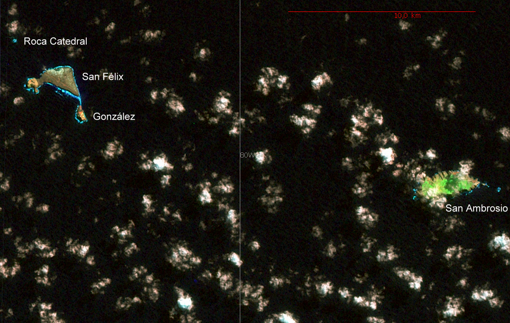
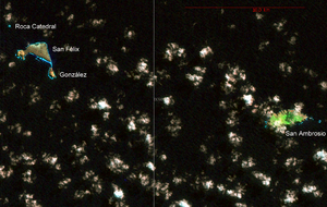 NASA Landsat 7 Pseudo Geocover 2000, Worldwind
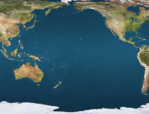
 Desventuradas IslandsLocation of the Desventuradas Islands in the Pacific Ocean
 Map of Desventuradas Islands (Chile)
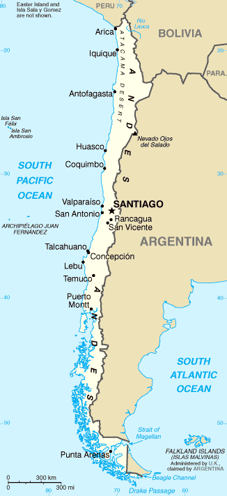
 Location of Desventuradas Islands in Chile
The Desventuradas Islands, also known as Islas de los Desventurados,[1] (Spanish: Unfortunate Islands) is a group of four small islands located 850 kilometres (530 mi) off the coast of Chile, northwest of Santiago in the Pacific Ocean.[2] The islands together have a total land area of four square kilometers.
The vegetation is a miniature mosaic of matorral, barren rock, various size trees, and shrubs mixed with ferns and perennial herbs. There are no permanent sources of fresh water on the islands. Vertebrates inhabiting both islands are exclusively limited to birds. Ten species of marine birds and one land bird species, some of them endangered, make their nests on or visit the islands.
Because of their isolation and difficulty of access, there are no human settlements on these islands, but a detachment of the Chilean Navy is stationed on Isla San Félix, which also hosts a 2,000 meter runway (ICAO code for the airfield: SCFX).
Contents
History
The islands were sighted by Juan Fernández in 1574, and perhaps earlier by Ferdinand Magellan in 1520. Pedro Sarmiento de Gamboa wrote in 1579 that "they are now called after St Felix and St Ambor (i.e. Felix and Nabor)". However, by linguistic corruption, the name of the martyr Ambor (Nabor) became confused with that of the more famous bishop Saint Ambrose (San Ambrosio).[3]
San Felix played a part in the Falklands war. In May 1982 the Chilean government allowed RAF Nimrod MR2's to fly maritime reconnaissance sorties from the island, gathering information on the movements of the Argentine Navy.[4]
List of islands and location
Desventuradas Islands ('Unfortunate Islands'), from east to west:
Island/Rock Area
(km²)Peak
Elevation (m)Geographical
CoordinatesSan Ambrosio 2.2 479 26°20′37″S 79°53′28″W / 26.34361°S 79.89111°W San Felix group Islote González 0.25 173 26°18′36″S 80°05′06″W / 26.31°S 80.085°W San Félix 1.4 Cerro Amarillo, 193 26°17′30″S 80°05′42″W / 26.29167°S 80.095°W Roca Catedral 0.01 53 26°16′25″S 80°07′15″W / 26.27361°S 80.12083°W Desventuradas 3.9 479 References
- ^ An Archaeological Exploration of Robinson Crusoe Island
- ^ Desventuradas Islands
- ^ B. Glanvill Corney, "The Isles of San Felix and San Nabor," The Geographical Journal, Vol. 56, No. 3 (September 1920), pp. 196–200
- ^ http://www.spyflight.co.uk/chile.htm
External links
Categories:- Geography of Chile
- Islands of the Pacific Ocean
- Archipelagoes of Chile
- Temperate broadleaf and mixed forests
- Ecoregions of Chile
- Uninhabited islands of Chile
- Geography of Valparaíso Region
- Neotropic


Wikimedia Foundation. 2010.