Owaka

Owaka
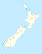
Owaka is located in New Zealand
{{{alt}}}
Owaka

Owaka is a small town in Otago, in the southern South Island of New Zealand. It is the largest community in the rugged, forested Catlins area, close to the border with Southland, some 35 km (22 mi) south of Balclutha on the Southern Scenic Route. The town's population was 334 in the 2006 census, a decrease of 39 from 2001. In the census figures, 72.9% of the population were European, and 15% were Māori.[1]

The town's name comes from the Māori for "the place of canoes",[2] a reference to the town's location close to the Owaka River, which joins the Catlins River three kilometres (2 miles) from the town, close to the coast. The town was originally called Catlins River, then Quakerfield.

On 22 June 1896, Owaka became the terminus of the Catlins River Branch railway, and it retained this status until an extension of the branch line to Ratanui was opened on 1 August 1904. The railway ultimately terminated in Tahakopa, but as traffic declined on the line in its later years, the Tuesday freight train (one of four per week) ran only as far as Owaka after 1958. The branch closed on 27 February 1971, and little evidence of its existence remains in or around Owaka besides some of the line's old formation, as the last substantial relic, Owaka station's goods shed, was removed in 1986.

References

  1. ^ Quickstats about Owaka
  2. ^ A W Reed (2002). The Reed Dictionary of New Zealand Place Names. p. 375. ISBN 0-7900-0761-4. 

Coordinates: 46°27′S 169°40′E / 46.45°S 169.667°E / -46.45; 169.667


Wikimedia Foundation. 2010.

Игры ⚽ Поможем написать реферат

Look at other dictionaries:

  • Owaka — Owaka …   Deutsch Wikipedia

  • Owaka — es una pequeña localidad en Otago, al sur de la Isla Sur de Nueva Zelanda. Es la mayor comunidad del área boscosa de Catlins, cerca de la frontera con la región Southland, a unos 35 km al sur de Balclutha. La población total se estima en 400 …   Wikipedia Español

  • Owaka River — Der Owaka River ist ein kleiner Fluss in der Region Otago auf der Südinsel Neuseelands. Er entspringt etwa 3 km südlich von Purekireki, durchfließt die Siedlung Owaka Valley und fließt im Norden am größten Ort der Catlins, Owaka vorbei. Er… …   Deutsch Wikipedia

  • Owaka River — The Owaka River flows southeastward through The Catlins, an area of the southern South Island of New Zealand. Its total length is 30 kilometres (19 mi), and it shares the estuary of the Catlins River, flowing into the Pacific Ocean at… …   Wikipedia

  • Río Owaka — Saltar a navegación, búsqueda Owaka Nos falta una foto de este río. País que atraviesa …   Wikipedia Español

  • taka owaka — {{/stl 13}}{{stl 8}}pot. {{/stl 8}}{{stl 7}} wyrażanie zastępujące najbardziej obraźliwe wyzwiska używane w stosunku do kobiet : {{/stl 7}}{{stl 10}}Ty taka owaka! żebym cię tu nigdy więcej nie widziała! {{/stl 10}} …   Langenscheidt Polski wyjaśnień

  • The Catlins — (sometimes referred to as The Catlins Coast) comprises an area in the southeastern corner of the South Island of New Zealand. The area lies between Balclutha and Invercargill, straddling the boundary between the Otago and Southland regions. It… …   Wikipedia

  • Catlins — The Catlins (manchmal auch The Catlins Coast) ist ein Gebiet im Südwesten der Südinsel Neuseelands zwischen Balclutha und Invercargill. Es streift die Grenze zwischen den Regionen Otago und Southland und umfasst auch den südlichsten Punkt der… …   Deutsch Wikipedia

  • The Catlins — Localización de The Catlins en la Isla Sur de Nueva Zelanda. Localización País: Nueva Zelanda Isla: Isla Sur …   Wikipedia Español

  • The Catlins — (manchmal auch The Catlins Coast) ist ein Gebiet im Südwesten der Südinsel Neuseelands zwischen Balclutha und Invercargill. Es streift die Grenze zwischen den Regionen Otago und Southland und umfasst auch den südlichsten Punkt der Südinsel, Slope …   Deutsch Wikipedia

Share the article and excerpts

Direct link
Do a right-click on the link above
and select “Copy Link”