Ystrad Mynach railway station

Ystrad Mynach railway station

Infobox UK station
name=Ystrad Mynach
code=YSM


manager=Arriva Trains Wales
locale=Ystrad Mynach
borough=Caerphilly
platforms=2
start=
usage0405=0.210
usage0506=0.214

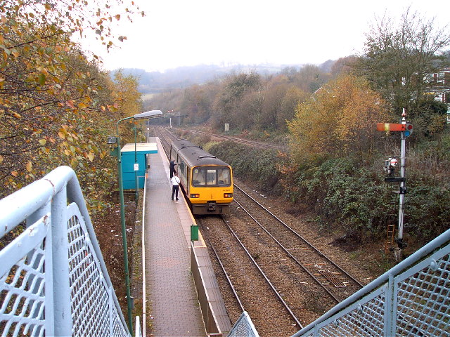
Ystrad Mynach railway station is a railway station serving the town of Ystrad Mynach, south Wales. It is a stop on the Rhymney Line of the Valley Lines network.

There is a dedicated rail linc bus that that links with the train. It is only available to rail passengers and operates to Maesycwmmer, Pontllanfraith and Blackwood.

Ystard Mynach railway station was used as a location for one of Ronnie Barker's Porridge episodes.

Ystrad Mynach railway station was on the Rhymney Railway, enacted in 1855 and opened in 1858. It consisted of staggered platforms on the main line as well as a separate platform on the Dowlais line. Nearby Penallta Junction gave access to the Great Western Railway and the Aberdare Valley, opened 1 April 1871 and the Cylla branch opened on 1 August 1906 to access the new Powell Duffryn Steam Coal Co. colliery.

ervice

External links


Wikimedia Foundation. 2010.

Игры ⚽ Поможем решить контрольную работу

Look at other dictionaries:

  • Ystrad Mynach — infobox UK place country = Wales welsh name= constituency welsh assembly= official name= Ystrad Mynach unitary wales= Caerphilly lieutenancy wales= Gwent constituency westminster= Caerphilly post town= HENGOED postcode district = CF82 postcode… …   Wikipedia

  • Cardiff Central railway station — Infobox UK station name=Cardiff Central other name=Caerdydd Canolog manager=Arriva Trains Wales locale=Cardiff borough=City and County of Cardiff owner=Network Rail code=CDF usage0405=7.743 usage0506=8.358 usage0607=9.127 platforms=7 years=1850… …   Wikipedia

  • Merthyr Tydfil railway station — Merthyr Tydfil Merthyr Tudful …   Wikipedia

  • Mountain Ash railway station — Coordinates: 51°40′54″N 3°22′35″W / 51.6817°N 3.3765°W / 51.6817; 3.3765 …   Wikipedia

  • Merthyr Vale railway station — Merthyr Vale Ynysowen Locatio …   Wikipedia

  • Cross Inn railway station — Cross Inn Location Place Llantrisant Area Rhondda Cynon Taf Coordinates …   Wikipedia

  • Dinas Rhondda railway station — Coordinates: 51°37′03″N 3°26′14″W / 51.6174°N 3.4371°W / 51.6174; 3.4371 …   Wikipedia

  • Dingle Road railway station — Coordinates: 51°26′24″N 3°10′48″W / 51.4400°N 3.1801°W / 51.4400; 3.1801 …   Wikipedia

  • Ninian Park railway station — Ninian Park Parc Ninian …   Wikipedia

  • Newbridge (Caerphilly) railway station — Newbridge Trecelyn 15 …   Wikipedia

Share the article and excerpts

Direct link
Do a right-click on the link above
and select “Copy Link”