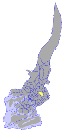
Itäharju-Varissuo — (Finnish; Österås Kråkkärret in Swedish) is a ward ( suuralue , storområde ) of Turku, Finland, also known as Ward 4. The ward is located to the east of the city and named after Itäharju and Varissuo, two major districts in the ward.Itäharju… … Wikipedia
Districts of Turku — The city of Turku, Finland is divided into nine wards (see Wards of Turku), which in turn are divided into 78 non governmental districts (kaupunginosat in Finnish, stadsdelar in Swedish). These are composed of individual suburbs, and in the very… … Wikipedia
Nummi — on a map of Turku. For the village in Uusimaa, see Nummi Pusula. For the GM/Toyota joint venture, see NUMMI. for the neighborhood of Rauma, Finland see Nummi, Rauma Nummi (Finnish; Nummis in Swedish) is a district and a suburb of the city of … Wikipedia
Pääskyvuori — (Finnish; Svalberga in Swedish) is a district in the Itäharju Varissuo ward of the city of Turku, in Finland. It is located to the east of the city, between Varissuo and Itäharju and is largely a low density residential suburb. Pääskyvuori also… … Wikipedia
Districts of Turku by population — This is a list of the districts of Turku, Finland, sorted by population as of 2004[update]. Runosmäki (Runosbacken), 10,269 Varissuo (Kråkkärret), 8,760 VII, 8,749 Nummi (Nummis), 7,011 VI, 6,187 I, 6,177 VIII Port Arthur, 4,760 Pääskyvuori… … Wikipedia
Wards of Turku — The city of Turku, in Finland, is divided into nine wards ( suuralueet in Finnish, storområden in Swedish), which are further divided into 78 districts ( see Districts of Turku ). The ward division does not always follow district boundaries.The… … Wikipedia
City Centre, Turku — City Centre on a map of Turku. City Centre (Keskusta in Finnish, Centrum in Swedish) is a ward (suuralue, storområde) of Turku, Finland, also known as Ward 1. The ward s boundaries correspond approximately to those of the city s central business… … Wikipedia
Koroinen (ward) — Koroinen (Finnish; Korois in Swedish) is a ward ( suuralue , storområde ) of Turku, Finland, also known as Ward 5. The ward is located to the northeast of the city centre and named after Koroinen, a district in the centre of the ward.The ward has … Wikipedia
Naantalintie (ward) — Naantalintie on a map of Turku. Naantalintie (Finnish; Nådendalsvägen in Swedish) is a ward (suuralue, storområde) of Turku, Finland, also known as Ward 8. The ward is located to the west of the city and named after the major route that passes… … Wikipedia
Huhkola — is a district in the Itäharju Varissuo ward of the city of Turku, in Finland. It is located to the east of the city, and is mainly a low density residential suburb.The current (as of 2004) population of Huhkola is 986, and it is decreasing at an… … Wikipedia
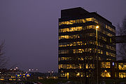
 Media related to Itäharju at Wikimedia Commons


