Marl Mountains

Marl Mountains
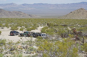
Southward view from Marl Springs on the east side of the Marl Mountains.

The Marl Mountains are located in the Mojave National Preserve in eastern California in the United States, northeast of the Kelso Mountains. The Marl Mountains lie just east of Kelbaker Road, which connects the town of Baker with the small community of Kelso, California.

Like the Beale Mountains to the east, the range is one of the smallest mountain ranges in the nation, and is only about four miles long.

The Marl Mountains are often visited by travelers on the historic Mojave Road wagon trail, which passes Marl Spring on the east side of the mountains. Marl Spring was an important source of water to travelers crossing the dry Mojave Desert. The cistern at Marl Spring is still often full of water today, although the water should be treated by a water filter before drinking it.

Coordinates: 35°09′37″N 115°40′25″W / 35.16028°N 115.67361°W / 35.16028; -115.67361[1]

References

  • Allan, Stuart (2005). California Road and Recreation Atlas. Benchmark Maps. p. 97. ISBN 0-929591-80-1. 


Wikimedia Foundation. 2010.

Игры ⚽ Поможем написать курсовую

Look at other dictionaries:

  • Pindus Mountains — ▪ mountains, Europe Modern Greek  Oroseirá Píndhou,         principal range and backbone of mainland Greece, trending north northwest–south southeast from Albania to central Greece north of the Peloponnese.       In antiquity, the name Pindus… …   Universalium

  • Jura Mountains — /joor euh/; Fr. /zhyuu rddann / a mountain range in W central Europe, between France and Switzerland, extending from the Rhine to the Rhone. Highest peak, Crêt de la Neige, 5654 ft. (1723 m). Also called Jura. * * * Mountain range, central Europe …   Universalium

  • Cantabrian Mountains — Spanish: Cordillera Cantábrica Range …   Wikipedia

  • Elbe Sandstone Mountains — [ mesas in the Saxon part of the Elbe Sandstone Mountains] The Elbe Sandstone Mountains ( cs. Labské pískovce; de. Elbsandsteingebirge) is a mountain range straddling the border between the state of Saxony in southeastern Germany and the Czech… …   Wikipedia

  • Mojave National Preserve — Schlackenkegel nördlich von Kelso …   Deutsch Wikipedia

  • Mojave National Preserve — IUCN Category V (Protected Landscape/Seascape) …   Wikipedia

  • Geology of the Iberian Peninsula — The geology of the Iberian Peninsula consists of the study of the rock formations on the Iberian Peninsula, which includes Spain, Portugal, Andorra, and Gibraltar. The peninsula contains rocks from every age from Ediacaran to Recent, and almost… …   Wikipedia

  • Everglades National Park — IUCN Category Ib (Wilderness Area) …   Wikipedia

  • GEOGRAPHICAL SURVEY — Names The name Ereẓ Israel (the Land of Israel) designates the land which, according to the Bible was promised as an inheritance to the Israelite tribes. In the course of time it came to be regarded first by the Jews and then also by the… …   Encyclopedia of Judaism

  • Swiss plateau — Satellite image of the Swiss plateau between the Jura and the Alps The Swiss Plateau or Central Plateau (plateau suisse in French, Schweizer Mittelland in German, altipiano svizzero in Italian) constitutes one of the three major landscapes in… …   Wikipedia

Share the article and excerpts

Direct link
Do a right-click on the link above
and select “Copy Link”