- Lautém
Infobox East Timor District
name = Lautém
tetum = Lautein
capital =Lospalos
area = 1,702
arearank = 3rd
population = 55,921
population_as_of = 2004
populationrank = 7th
density = 32.9
densityrank = 12th
households = 12,998
households_as_of = 2004
householdsrank = 7th
isocode = TL-LA
subdistricts =Iliomar , Lautém,Lospalos ,Luro ,Tutuala
map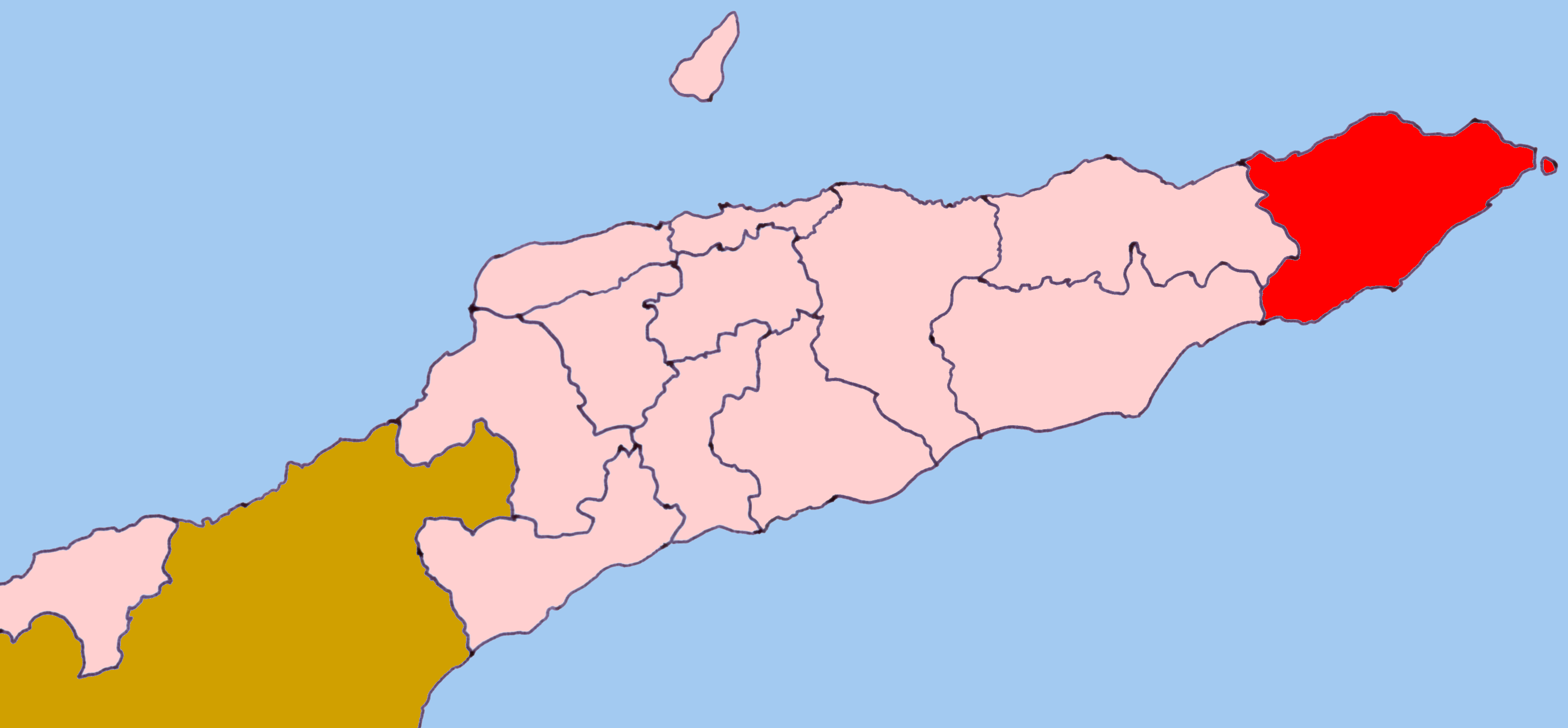
Lautém (
Tetum : "Lautein") is one of the districts ofEast Timor , on the eastern end of the island ofTimor . It has a population of 57,453 (census 2004) and an area of 1,702 km². Its capital isLospalos , which lies 248 km east of the national capital,Dili . The subdistricts areIliomar , Lautém,Lospalos ,Luro , andTutuala .To the west the district borders the districts of Baucau and Viqueque. To the north lies the
Banda Sea , and to the south theTimor Sea . The district also includes the easternmost point of the island, "Kap Cutcha" in the subdistrict ofTutuala , and the small island Jaco.The district of Lautém is identical to what was the council of the same name in
Portuguese Timor . At that time, many of the localities had Portuguese names, such as "Vila Nova de Malaca" (today Lautém), "Nova Nazaré" (Com), "Nova Sagres" (Tutuala ), "Nova Âncora" (Laivai ) and "Silvícola" (Loré ).Lautém has beautiful sand beaches and a wild, mountainous, and raw rugged unspoilt landscape. Many of the endemic birds of East Timor live here. Near the city of Lautém there are cave drawings. Numerous stone sarcophagi and animistic shrines are found throughout the district.
In addition to the official languages of Portuguese and
Tetum , in the district there are 30,000 speakers of thePapuan language Fataluku , mainly in the east of the province, many of whom do not speak a second language.External links
* [http://www.ling.hawaii.edu/~uhdoc/FatalukuWeb/Fataluku.html Fataluku language website]
* [http://www.ethnologue.com/show_language.asp?code=ddg Ethnologue page for Fataluku]
Wikimedia Foundation. 2010.