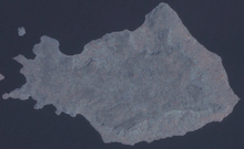
- Mfangano Island
-
Mfangano Island lies in the eastern part of Lake Victoria, at the mouth of the Winam Gulf. Part of Kenya, it lies west of Rusinga Island. The island is 65 km² in area and rises to 1,694 m at Mount Kwitutu. It had a population of 16,282 as of 1999 census of population. Administratively, Mfangano is one of five divisions of Suba District of Nyanza Province.
The island is home to the largest population of Olusuba or Suba people language speakers in Kenya. Olusuba is becoming rarer, in part because of intermarriage between Suba men and Luo women from the mainland, as it is traditional for children to learn "mother tongue," that is, the language of their mother. Other languages spoken on the island include Luo, Swahili, and English. Members of the Luo tribe are concentrated on the eastern side of the island, most of whom are fishermen and subsistence farmers. Some of the inhabitants of Mfangano are believed to be descendants of emigrants from the Buganda kingdom in Uganda who arrived after the controversial early nineteenth century killing of the kabaka juju.
Most inhabitants live near the water for ease in fishing and collecting the day's water supply. The water's edge of the island is quite rocky with a few black sandy shores. Transportation consists mostly walking and of boat travel in small wooden handmade boats that sometimes have a sail. There are a few bicycles now that the government has begun to cut in a road that will circle the island on which motorbikes will run. The first ever car to be driven on the island's soil was on Feb 2 2007. It was driven 500 m. In it was Road and Public Services Hon. Simeon Nyachae, MP. There is a small dirt landing strip for small planes. This is used mostly for tourists and mission workers.
Mfangano is also known for its ancient rock art, possibly 2,000 years old and thought to have been created by early forager-hunters, perhaps a Twa people.
Sources
- Ogone John Obiero. "A Case of a Mother Tongue and Another Mother Tongue in School: Efforts at Revitalization of Olosuba Language in Kenya." Journal of Third World Studies. vol. 27, no. 2, pp. 267-291.
Coordinates: 0°28′S 34°01′E / 0.467°S 34.017°E
Categories:- Suba District
- Islands of Lake Victoria
- Islands of Kenya
- Rock art in Africa
- Nyanza Province, Kenya geography stubs
Wikimedia Foundation. 2010.

