Kilsby Tunnel

Kilsby Tunnel

Infobox tunnel
name = Kilsby Tunnel


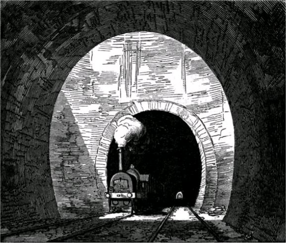
caption = Air shaft in the Kilsby Tunnel, illustrated in an 1852 railway publication.
line =
location = Northamptonshire
coordinates =
system =
status =
start = Kilsby
end = Crick
stations =
open =
owner = Network Rail
operator = West Coast Main Line
character =
linelength =
tracklength =2,223
notrack =Two
gauge =
el =
speed =
hielevation =
lowelevation= |

The Kilsby Tunnel is a railway tunnel on the West Coast Main Line railway in England. It was designed and engineered by Robert Stephenson.

The tunnel is located near the village of Kilsby in Northamptonshire roughly 5 miles (8 km) southeast of Rugby. The tunnel is 2,432 yards (2,223 m) long.

The tunnel was opened in 1838 as a part of the London and Birmingham Railway. It is today the 18th longest tunnel on the British railway system.

The tunnel took far longer, and cost far more money to build than had been anticipated. This was because the tunnel builders encountered unexpected quicksand which trial borings into the hill had not revealed. The excess water from the quicksand had to be pumped out, a process which took several years. Similar problems were encountered with nearby Blisworth tunnel on the Grand Union Canal a few decades earlier.

The length of time it took to build the tunnel delayed the opening of the London and Birmingham Railway.

It took three years, and cost £320,000 to build — three times the original estimate (£23,758,000 in 2005 pounds). [According to Table 1 of http://www.parliament.uk/commons/lib/research/rp2006/rp06-009.pdf, the RPI index in 1838 was 10.2 and had risen to 757.3 in 2005, giving a conversion factor of 74.245.
(An estimate of today's cost, using machines but no fatalities, would be interesting.)
]

External links

* [http://www.spartacus.schoolnet.co.uk/RAkilsby.htm Kilsby Tunnel] includes the classic image of the tunnel under construction.

References


Wikimedia Foundation. 2010.

Игры ⚽ Поможем сделать НИР

Look at other dictionaries:

  • Kilsby — Infobox UK place country = England official name= Kilsby latitude= 52.336061 longitude= 1.17435 civil parish= Kilsby population = 1,221 (2001 Census) shire district= Daventry district shire county= Northamptonshire region= East Midlands… …   Wikipedia

  • Northampton Loop Line — A London Midland Class 350 local train calls at Long Buckby. Overview Type Heavy rail …   Wikipedia

  • Robert Stephenson — Infobox Engineer image width = 150px caption = Robert Stephenson name = Robert Stephenson nationality = English birth date = 16 October 1803 birth place = Willington Quay, Northumberland death date = Death date and… …   Wikipedia

  • London and Birmingham Railway — This is about the 19th century railway company. For the 21st century train operating company, see London Midland The London and Birmingham Railway (L BR) was an early railway company in the United Kingdom from 1833 until 1846, at which date it… …   Wikipedia

  • Dunchurch — This article is about the village in England. For the community in Ontario, Canada see Dunchurch, Ontario Coordinates: 52°20′12″N 1°17′23″W / 52.33675°N 1.28961°W …   Wikipedia

  • Denbigh, Buckinghamshire — Denbigh is a district in Milton Keynes, ceremonial Buckinghamshire, England, to the north of Fenny Stratford and on the eastern side of the West Coast Main Line and northern side of the Marston Vale Line, from Bletchley proper. It is in the civil …   Wikipedia

  • Robert Stephenson — Robert Stephenson …   Deutsch Wikipedia

  • Stephenson, Robert — born Oct. 16, 1803, Willington Quay, Northumberland, Eng. died Oct. 12, 1859, London British civil engineer and builder of long span railroad bridges. The son of George Stephenson, he assisted his father in constructing the Rocket and several… …   Universalium

  • Denbigh, Milton Keynes — Denbigh is a district in Milton Keynes, ceremonial Buckinghamshire, England, to the north of Fenny Stratford and on the eastern side of the West Coast Main Line and Bletchley proper. It is in the civil parish of Bletchley and Fenny Stratford and… …   Wikipedia

  • Oxford Canal — The Oxford Canal as seen from Napton on the Hill in Warwickshire The Oxford Canal is a 78 mile long (126 km) narrow canal in central England linking Oxford with Coventry via Banbury and Rugby. It connects with the River Thames at Oxford, to… …   Wikipedia

Share the article and excerpts

Direct link
Do a right-click on the link above
and select “Copy Link”