- Lulu Island
Infobox Islands
name = Lulu
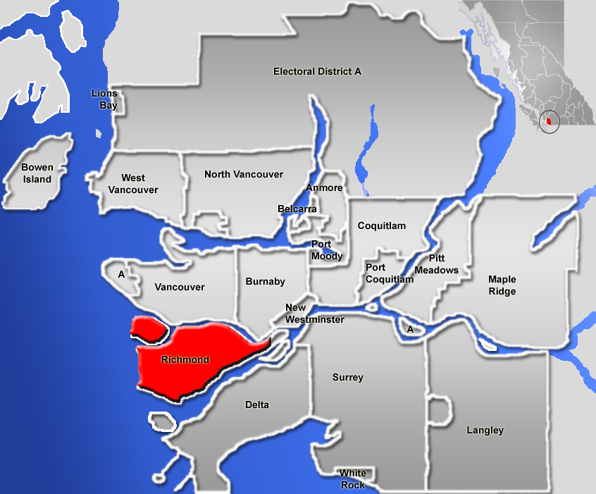
image caption = Richmond, British Columbia is on Lulu Island, the larger of the two red islands
image size =
locator
Location map|British Columbia|lat=49.168056|long=-123.080556
map_custom = yes
native name =
native name link =
nickname =
location =Fraser River
coordinates = coord|49|10|05|N|123|04|50|W|display=inline
archipelago =
total islands =
major islands =
area =
length =
width =
highest mount =
elevation =
country = Canada
country admin divisions title = Province
country admin divisions = flag|British Columbia
country admin divisions title 1 = City
country admin divisions 1 = City of Richmond
country admin divisions title 2 =
country admin divisions 2 =
country largest city =
country largest city population =
population = 168,162
population as of =
density =
ethnic groups =
additional info =Lulu Island is the geographic name of the island making up most of the City of Richmond, a major suburb of
Vancouver, British Columbia . It is situated between the two principal arms of theFraser River estuary downstream from City of New Westminster, a part of which, the Queensborough community, is included at the extreme eastern end of the island. The Middle Arm of the Fraser River separates it on the northwest from Sea Island, the site of the Vancouver International Airport but also part of the City of Richmond. At the western edge of the island lies Sturgeon Bank, a largesandbank which falls off into theStrait of Georgia on its western edge.History
Lulu Island was named in 1862 for
Lulu Sweet [ [http://ilmbwww.gov.bc.ca/bcgn-bin/bcg10?name=37944 BCGNIS listing "Lulu Island"] ] , a popular showgirl, possibly of Kanaka (Hawaiian) origin, who was dating the mayor of New Westminster when the island was named (she had bought property there).The island enjoyed good connections to the new port city of
Vancouver thanks to theLulu Island & Steveston Railway line of theBritish Columbia Electric Railway , which began at what is today the north end of theGranville Street Bridge . The route of the Lulu Island Railway is today the so-called Arbutus Corridor, which runs west throughKitsilano before turning south toKerrisdale andMarpole before crossing the North Arm of the Fraser to reach Lulu Island and the City of Richmond.The southwestern corner of Lulu Island is home to Steveston, a fishing port and now-busy tourist centre that has a history interconnected with that of the
Japanese-Canadians prior to their internment to the Interior duringWorld War II .Geohazards
Because the island is composed partly of glacial
silt brought down by theFraser River , there is a fear of liquefaction of its sands if a strong-enough tremor were to shake it. In such an eventuality, it is anticipated that large portions of it would slide west into theStrait of Georgia , causing incalculable destruction. [cite journal
first=H.A.
last=Christian
coauthors=D.J. Woeller, P.K. Robertson, and R.C. Courtney
title=Site investigations to evaluate flow liquefaction slides at Sand Heads, Fraser River delta
journal=Can. Geotech. J.
volume=34
year=1997
url=http://article.pubs.nrc-cnrc.gc.ca/ppv/RPViewDoc?_handler_=HandleInitialGet&journal=cgj&volume=34&calyLang=eng&articleFile=t97-004.pdf
format=PDF
pages=384–397
accessdate=2006-07-27
doi=10.1139/cgj-34-3-384]References
Wikimedia Foundation. 2010.