Kings Highway (BMT Sea Beach Line)
- Kings Highway (BMT Sea Beach Line)
Infobox NYCS
name = Kings Highway
font_color = black
font_color_2 = black
bg_color = #FFC800
line = BMT Sea Beach Line
service = Sea Beach local
platforms = 2 side platforms
tracks = 4
borough = Brooklyn
open_date = June 22, 1915
north_station = Bay Parkway
north_line = BMT Sea Beach Line
north_service = Sea Beach local
south_station = Avenue U
south_line = BMT Sea Beach Line
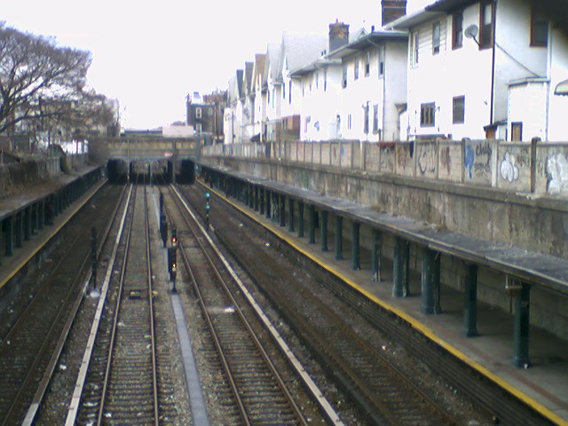
south_service = Sea Beach localKings Highway is a station on the BMT Sea Beach Line of the New York City Subway, located at Kings Highway and West 7th Street in Brooklyn. The main exit at the north end leads to Kings Highway, and a high-turnstile exit at the south end leads to Highlawn Avenue.
Bus connection
*B82 east to Midwood, Flatlands, Canarsie, Spring Creek Towers; west to Bensonhurst, Coney Island via Kings Highway & Flatlands Avenue
External links
*NYCsubway ref|http://www.nycsubway.org/perl/stations?210:21004|BMT Sea Beach Line|Kings Highway
*Station Reporter — [http://www.stationreporter.net/ntrain.htm N Train]
Wikimedia Foundation.
2010.
Look at other dictionaries:
BMT Sea Beach Line — The N train serves the entire BMT Sea Beach Line at all times Overview Type Rapid transit System … Wikipedia
Kings Highway (línea Sea Beach) — Kings Highway Estación del Metro de Nueva York … Wikipedia Español
BMT Sea Beach Line — Sea Beach Line Метрополитен Нью Йорка Sea Beach Line Открытие первого участка: 22 июня … Википедия
Avenue U (BMT Sea Beach Line) — Infobox NYCS name = Avenue U font color = black font color 2 = black bg color = #FFC800 line = BMT Sea Beach Line service = Sea Beach local platforms = 2 side platforms tracks = 4 borough = Brooklyn open date = June 22, 1915 north station = Kings … Wikipedia
Bay Parkway (BMT Sea Beach Line) — Infobox NYCS name = Bay Parkway font color = black font color 2 = black bg color = #FFC800 image caption = Bay Parkway headhouse line = BMT Sea Beach Line service = Sea Beach local platforms = 2 side platforms tracks = 3 borough = Brooklyn open… … Wikipedia
Kings Highway (New York City Subway) — Kings Highway is the name of three stations of the New York City Subway:*Kings Highway (NYCS Brighton) on the BMT Brighton Line *Kings Highway (NYCS Culver BMT) on the BMT Culver Line *Kings Highway (NYCS Sea Beach local) on the BMT Sea Beach… … Wikipedia
Kings Highway (Brooklyn) — Kings Highway is an avenue runs through the New York City borough of Brooklyn. The street has over 100 stores and shops. The west end is at Bay Parkway and 78th street. After intersecting with Ocean Avenue the street becomes mostly residential,… … Wikipedia
Línea Sea Beach — La línea Sea Beach es una línea subterránea de la división BMT del metro de la ciudad de Nueva York, que conecta la línea de la Cuarta Avenida por medio de cuatro carriles con dirección hacia hacia Coney Island en Brooklyn. La línea fue una vez… … Wikipedia Español
36th Street (BMT Fourth Avenue Line) — Infobox NYCS name = 36th Street font color = black font color 2 = white bg color = #FFC800 bg color 2 = #FF6E1A line = BMT Fourth Avenue Line service = Fourth 36th platforms = 2 island platforms tracks = 4 borough = Brooklyn open date = September … Wikipedia
BMT Brighton Line — The BMT Brighton Line is a rapid transit line of the B Division of the New York City Subway in Brooklyn, New York City, United States. Local service is provided full time by Q trains, and B trains run along the express tracks during the daytime,… … Wikipedia