- Allesley
Infobox Settlement
official_name = Allesley
other_name =
native_name =
nickname =
settlement_type = Village
motto =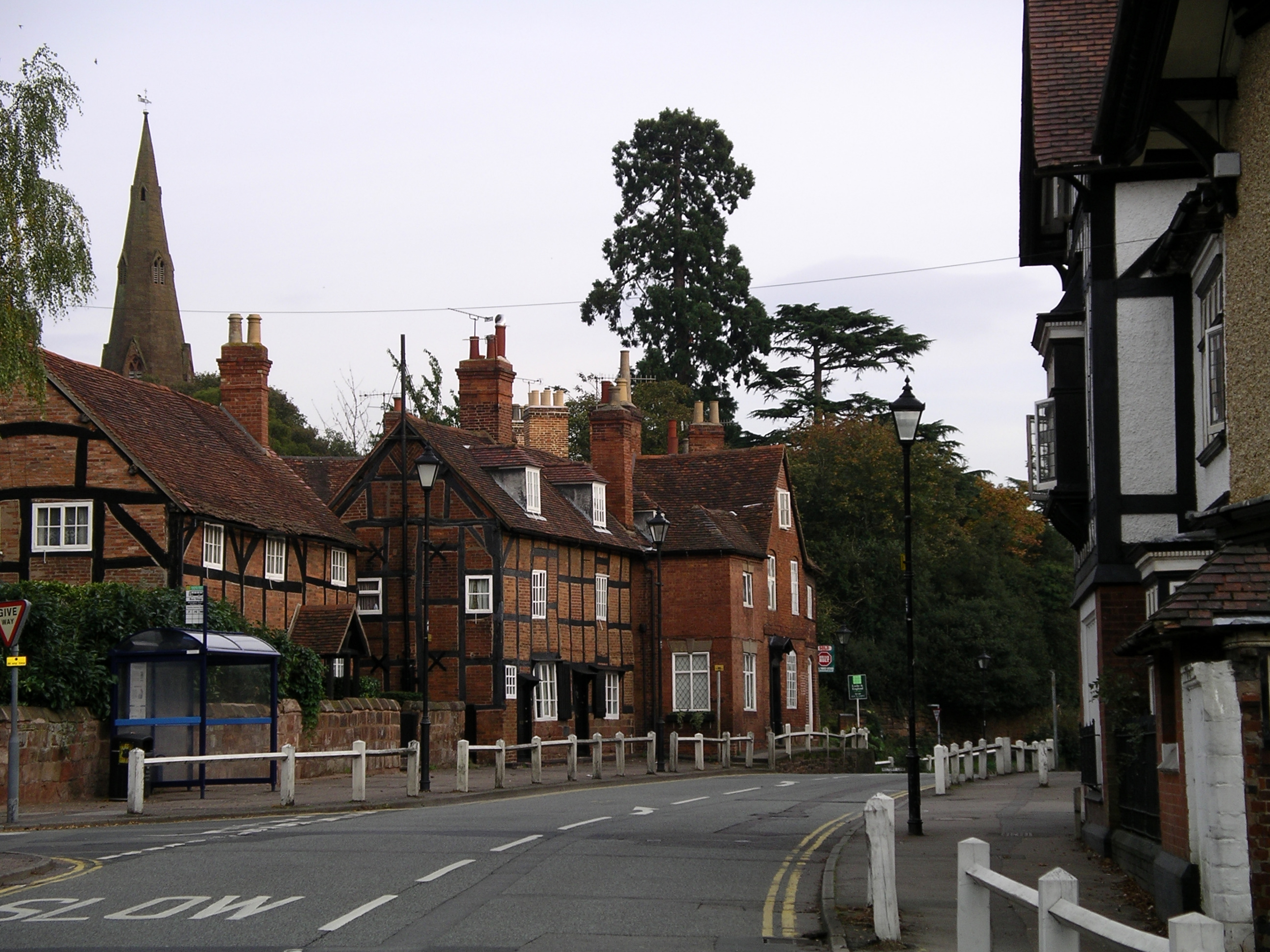
imagesize =
image_caption = Birmingham Road, Allesley Village,Coventry
flag_size =
image_
seal_size =
image_shield =
shield_size =
city_logo =
citylogo_size =
mapsize =
map_caption =
mapsize1 =
map_caption1 =
image_dot_
dot_mapsize =
dot_map_caption =
dot_x = |dot_y =
pushpin_
pushpin_label_position =
pushpin_map_caption =
pushpin_mapsize =
subdivision_type = Country
subdivision_name =United Kingdom
subdivision_type1 = County
subdivision_name1 = West Midlands
subdivision_type2 = City
subdivision_name2 =Coventry
subdivision_type3 =
subdivision_name3 =
subdivision_type4 =
subdivision_name4 =
government_footnotes =
government_type =
leader_title =
leader_name =
leader_title1 =
leader_name1 =
leader_title2 =
leader_name2 =
leader_title3 =
leader_name3 =
leader_title4 =
leader_name4 =
established_title = Settled
established_date = circa 1100
established_title2 =
established_date2 =
established_title3 =
established_date3 =
area_magnitude =
unit_pref = Imperial
area_footnotes =
area_total_km2 =
area_land_km2 =
area_water_km2 =
area_total_sq_mi =
area_land_sq_mi =
area_water_sq_mi =
area_water_percent =
area_urban_km2 =
area_urban_sq_mi =
area_metro_km2 =
area_metro_sq_mi =
population_as_of = 2001
population_footnotes =
population_note =
population_total = 805
population_density_km2 =
population_density_sq_mi =
population_metro =
population_density_metro_km2 =
population_density_metro_sq_mi =
population_urban =
population_density_urban_km2 =
population_density_urban_sq_mi =
population_blank1_title =
population_blank1 =
population_density_blank1_km2 =
population_density_blank1_sq_mi =
timezone = GMT
utc_offset =
timezone_DST =
utc_offset_DST =
latd= |latm= |lats= |latNS=
longd= |longm= |longs= |longEW=
elevation_footnotes =
elevation_m =
elevation_ft =
postal_code_type = CV
postal_code =
area_code =
blank_name =
blank_info =
blank1_name =
blank1_info =
website =
footnotes = Allesley (pronounced|ˈɔ:lzli) is a village andcivil parish on the northwestern edge of the City of Coventry, West Midlands,England , about 3 miles (5 km) west ofCoventry City Centre . According to the 2001 census the parish had a population of 805. Until recently it has been home to a factory belonging to the car maker, Jaguar.Allesley is The Windmill Hill, Browns Lane and Butt Lane areas. Although there is a division of where Allesley begins and ends, there are many confusions regarding the geographical boundaries within Allesley.
*Allesley Village is essentially the area off the Birmingham Road including West Point. Allesley Village is not much more than a suburb of Coventry, but retains several of the aspects of a village. It is hemmed in on all sides; by the open land of Coundon Wedge to the east, Allesley Park to the south, the A45 to the west and by the Jaguar factory to the north.
*Allesley Park is the estate on the other side of the by-pass situated south of Allesley park (home to an 18-hole golf course).
*Allesley Green is an area the other side of the A45 opposite the Coventry Hill Hotel.
*The Parish of Allesley is a much larger area based around Washbrook Lane and the top of Browns Lane via Hawkesmill Lane. The Parish incorporates the Ancient Ardens of Pinketts Booth, Pickford, Pickford Green, Harvest Hill, Hawkes End, Hollyberry End, Wall Hill, and Brownshill Green.Most of the Old Village (the area nearest the church) is in a conservation area on a low ridge of high ground between the
River Sherbourne and the Pickford Brook, a tributary.The suburbs of Allesley Park (built mainly in late-1950s and 1960s) and Allesley Green (built in the late-1980s) lie to the south and west of the village
History
Allesley grew around the 800 year old All Saints Church, the spire of which is prominent on the skyline of the village. Originally built around 1130, it was rebuilt in 1863 and remains relatively unaltered since then.
There is reference in old records to an Allesley Castle but none of its ruins can be foundFact|date=September 2007. It was supposedly on a high knoll of ground at the rear of Allesley Hall in Allesley Park. All that remains is an old Norman well in a large hollow in a wooded area.
The Birmingham Road which runs through the village, is part of the main road built between 1828 and 1831 by
Thomas Telford fromHolyhead toLondon . A toll house originally stood at the junction of the Holyhead Road and Allesley Old Road, and users of the Holyhead or Turnpike Road were charged a toll as a means of contributing towards the cost of building the road. Around 1930, the charges were discontinued and the toll house was demolished in the mid 1930s.References
*David Fry and Albert Smith: (1991). "The Coventry We Have Lost." Vol 1. Simanda Press, Berkswell ISBN 0-9513867-1-9
*David Fry and Albert Smith: (1993). "The Coventry We Have Lost." Vol 2. Simanda Press, Berkswell ISBN 0-9513867-2-7
Wikimedia Foundation. 2010.