- Norwood (SEPTA station)
-
Norwood
SEPTA regional rail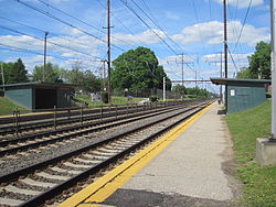
Station statistics Address Norwood & West Winona Avenues
Norwood, PA 19074Coordinates 39°53′29″N 75°18′08″W / 39.891360°N 75.302221°WCoordinates: 39°53′29″N 75°18′08″W / 39.891360°N 75.302221°W Lines Wilmington/Newark LinePlatforms 2 side platforms Tracks 4 Parking 88 spaces Other information Electrified 1928 Accessible 
Owned by SEPTA Fare zone 2 Services Preceding station SEPTA Following station toward NewarkWilmington/Newark Line toward Temple UniversityNorwood is a SEPTA train station on the Wilmington/Newark Line. While on tracks owned by the company, Amtrak trains do not stop here, as it is served only by SEPTA. The line offers southbound service to Marcus Hook, Wilmington and Newark, Delaware and northbound service to Philadelphia and points beyond (most commonly Norristown).
The station, located at Winona & Welcome Avenues in Norwood, PA, includes a 62-space parking lot on its outbound platform side (along Harrison Avenue). Pedestrian walkways and staircases connect the inbound and outbound platforms via the Amosland Road Bridge, which overpasses the tracks. Opposite the tracks from the SEPTA designated parking lot is metered street and lot parking.
The station's inbound platform and ticket office is located next to the Norwood Public Library, a branch of the Delaware County Library System.
Dorwart-Gentile Suicides
On the morning of February 25, 2010, two teenage girls, Vanessa Dorwart, 15, and Gina Gentile, 16, were struck and killed by a high-speed Acela Express Amtrak train at the Norwood station. The deaths were later determined to be the result of a suicide pact between the girls.[1]
References
External links
- SEPTA - Norwood Station
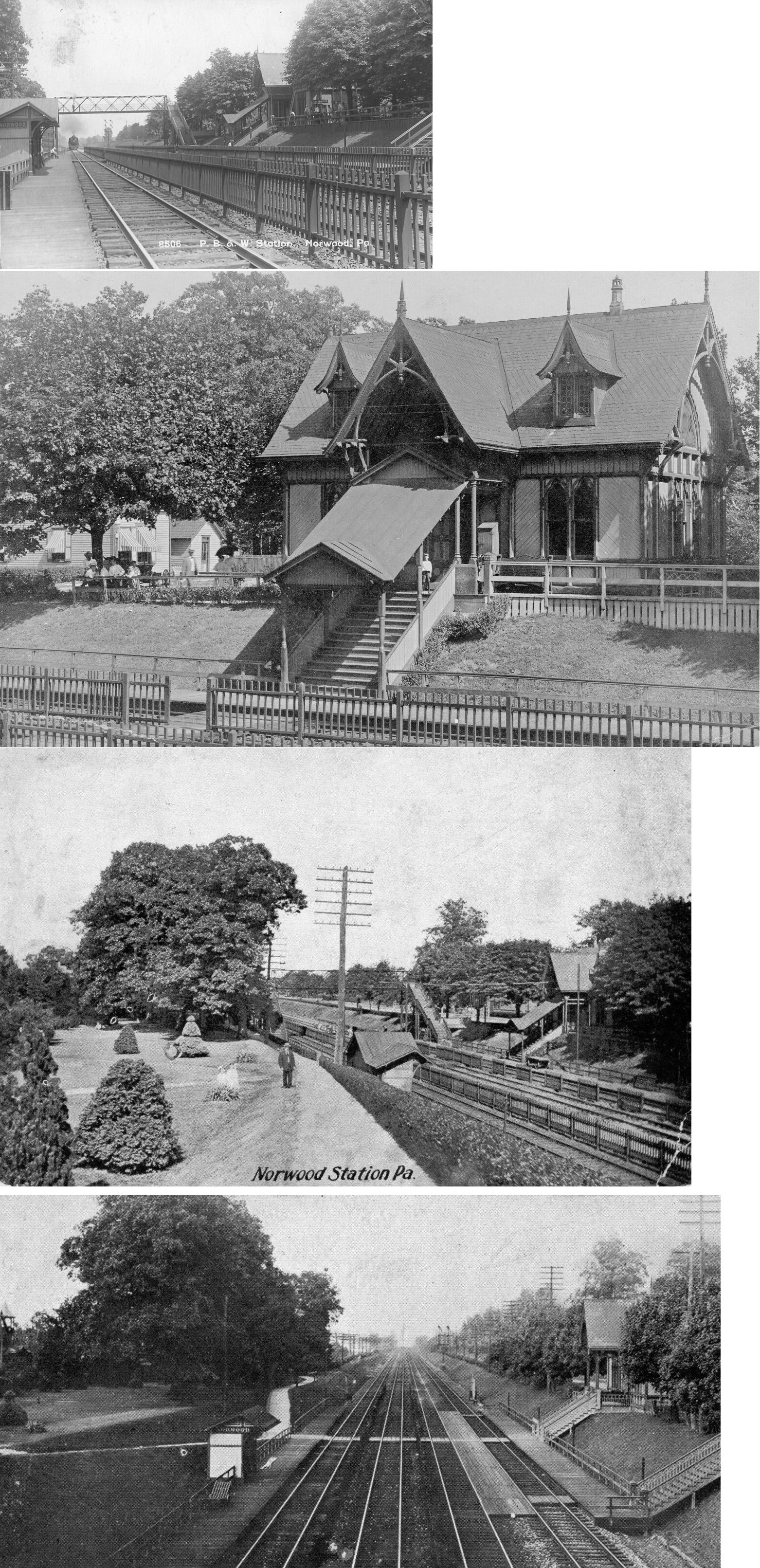
- Original Norwood PB&W(Philadelphia, Baltimore and Wilmington) Station image
- Amosland Road entrance from Google Maps Street View
- Winona Avenue entrance from Google Maps Street View
Categories:- SEPTA stubs
- SEPTA Regional Rail stations
- Stations along Philadelphia, Baltimore and Washington Railroad lines
- Transportation in Delaware County, Pennsylvania

Wikimedia Foundation. 2010.