- 1887 Atlantic hurricane season
Infobox hurricane season full|name=1887 Atlantic hurricane season
basin=Atlantic hurricane
first storm formed=May 15 ,1887 (One)
last storm dissipated=December 12 ,1887 (Nineteen)
strongest storm=#7 - 110 knots (130 mph) - 952 mbar
total storms=19
major storms=2
total da
total fatalities=2+
five seasons=1885, 1886, 1887, 1888, 1889 The 1887 Atlantic hurricane season ran through the summer and the first half of fall in 1887.The 1887 season is the third most-active hurricane season on record, with 19 recorded tropical cyclones forming during the season (tied with the 1995 season). However, most of the cyclones were weak or went out to sea.
The 1887 season lasted 212 days (May 15 -
December 12 1887 ), making it the fourth longest season recorded behind the 1952, 1908 and 2003 seasons. When Tropical Storm Nineteen formed on December 7, it made the 1887 season the year with the most off-season storms (five). This final storm was also the only recorded storm to make landfall inCosta Rica .1887 is the earliest known season to produce 13 or more tropical storms. 1887 held the record for the most active Atlantic season for 46 years until the 1933 season broke the record with 21 storms (2005 broke the record later 72 years later with 28 storms).
It is important to note, however, that prior to the 1960s, inaccuracies were inevitable since storms or depressions that did not approach populated land or shipping lanes, especially those of relatively short duration, were likely to remain undetected without today's technology (such as satellite monitoring). As a result, there may have been several more storms in the eastern and central Atlantic.
torms
Tropical Storm One
infobox hurricane small
name=Tropical Storm One
category=storm
type=tropical storm
formed=May 15
dissipated=May 18
highest winds=70 mph (115 km/h)
lowest pressure=997 mbar [http://www.aoml.noaa.gov/hrd/hurdat/excelfiles_centerfix/1887/STORM1.XLS STORM 1- HURDAT] ]The first storm of the season formed south of
Bermuda onMay 15 , outside of the season boundaries and moved to the northwest, staying out to sea. After peaking at convert|70|mi/h|km/h|abbr=on late the next day, it turned northward, and became extratropical on the 18th over Newfoundland.Tropical Storm Two
infobox hurricane small
name=Tropical Storm Two
category=storm
type=tropical storm

formed=May 18
dissipated=May 21
highest winds=60 mph (95 km/h)
lowest pressure=1002 mbar [http://www.aoml.noaa.gov/hrd/hurdat/excelfiles_centerfix/1887/STORM2.XLS STORM 2- HURDAT] ]Another May storm formed south of
Jamaica onMay 17 , way outside of the season and moved generally northward. It crossedCuba on the 19th as a convert|60|mi/h|km/h|abbr=on tropical storm, and moved out to sea. Two peaked at convert|60|mi/h|km/h|abbr=on twice, once on May 18 and May 20. Two dissipated on the 21st in theAtlantic Ocean . When this storm and the first storm were active simultaneously from the 17th to the 18th, it became the earliest for two storms to be active at one time.Tropical Storm Three
infobox hurricane small
name=Tropical Storm Three
category=storm
type=tropical storm
formed=June 11
dissipated=June 14
highest winds=40 mph (65 km/h)
pressure=1004 mbarA weak tropical storm, which began its life in the northwest Caribbean Sea onJune 11 . Three peaked at 40mph and moved northward through the Gulf of Mexico, and dissipated on the 14th after making landfall inMississippi .Hurricane Four
infobox hurricane small
name=Hurricane Four
category=cat2
type=hurricane
formed=July 20
dissipated=July 28
highest winds=105 mph (170 km/h)
lowest pressure=1002 mbar [http://www.aoml.noaa.gov/hrd/hurdat/excelfiles_centerfix/1887/STORM4.XLS STORM 4- HURDAT] ] The 4th storm of the season moved through theLesser Antilles onJuly 20 , and traversed theCaribbean Sea , reaching winds of convert|105|mi/h|km/h|abbr=on, as a strong Category 2 hurricane on July 22nd before turning northward. It weakened after crossing theYucatán Peninsula , and made landfall in Florida before dissipating on the 28th of July.Tropical Storm Five
infobox hurricane small
name=Tropical Storm Five
category=storm
type=tropical storm

formed=July 30
dissipated=August 2
highest winds=60 mph (95 km/h)
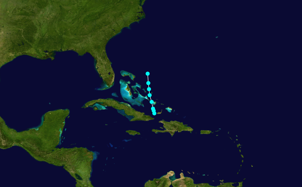
lowest pressure=1001 mbar [http://www.aoml.noaa.gov/hrd/hurdat/excelfiles_centerfix/1887/STORM5.XLS STORM 5- HURDAT] ] Tropical Depression Five formed east of theWindward Islands on the 30th of July and moved northwestward across the Caribbean Sea, strengthening into a storm and reaching peak winds of convert|60|mi/h|km/h|abbr=on on August 2nd near St. Vincent before dissipating near Cuba the same day.Hurricane Six
infobox hurricane small
name=Hurricane Six
category=cat3
type=hurricane

formed=August 14
dissipated=August 22
highest winds=120 mph (195 km/h)
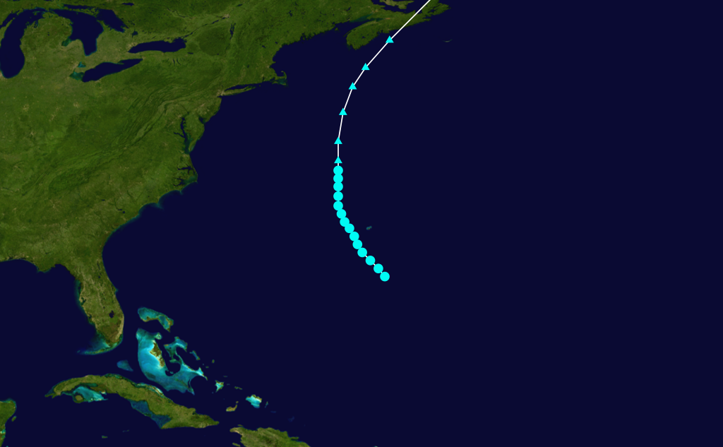
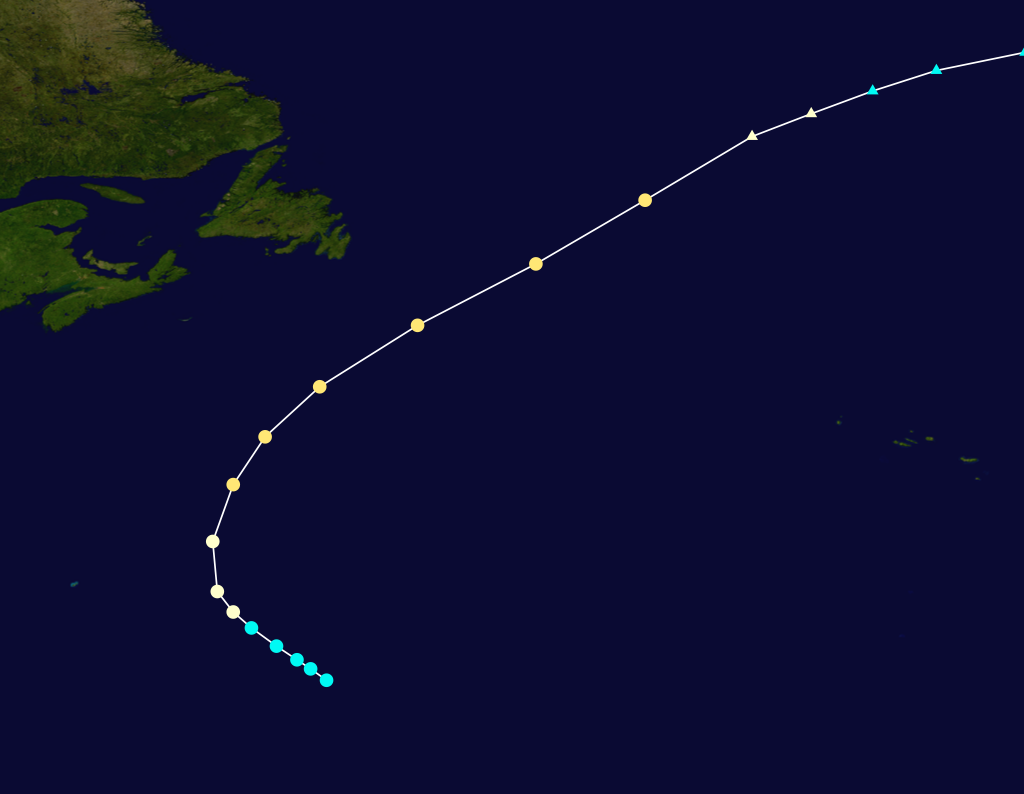
lowest pressure=967 mbar [http://www.aoml.noaa.gov/hrd/hurdat/excelfiles_centerfix/1887/STORM6.XLS STORM 6 - HURDAT] ] The season's first of two major hurricanes, both following a very similarCape Verde-type hurricane path in mid-August, but remained offshore. Six formed onAugust 14 in the middle of theAtlantic Ocean . Six started moving toward the Carolina coast and moved far north and peaked at convert|120|mi/h|km/h|abbr=on & 967 mbar major hurricane on the 20th and rapid weakening began. Six was declaredextratropical two days later.Hurricane Seven
infobox hurricane small
name=Hurricane Seven
category=cat3
type=hurricane
formed=August 18
dissipated=August 27
highest winds=125 mph (200 km/h)
lowest pressure=952 mbar [http://www.aoml.noaa.gov/hrd/hurdat/excelfiles_centerfix/1887/STORM7.XLS STORM 7- HURDAT] ]The season's second of two major hurricanes, both following a very similar
Cape Verde-type hurricane path in mid-August, but remained offshore. Seven formed from a depression on August 18 into Tropical Storm 7 and followed the same track as Six. Seven peaked at convert|125|mi/h|km/h|abbr=on winds for three straight days as a major hurricane and rapid weakening began. Seven was declared extratropical onAugust 27 .Hurricane Eight
infobox hurricane small
name=Hurricane Eight
category=cat2
type=hurricane
formed=September 1
dissipated=September 6
highest winds=105 mph (170 km/h)
lowest pressure=963 mbarOnSeptember 1 , a tropical storm formed in the central Atlantic Ocean. It moved northwestward, becoming a hurricane on the 2nd. The hurricane turned to the northeast, and peaked at convert|105|mi/h|km/h|abbr=on as a Category 2 hurricane before becoming extratropical on the 4th. The extratropical storm remained until the 6th, when it dissipated off the coast ofIreland . Eight was the strongest storm of the season with a minimum pressure of 963 mbar.Hurricane Nine
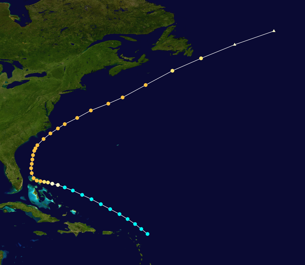
infobox hurricane small
name=Hurricane Nine
category=cat2
type=hurricane

formed=September 11
dissipated=September 22
highest winds=100 mph (160 km/h)
lowest pressure=973 mbar [http://www.aoml.noaa.gov/hrd/hurdat/excelfiles_centerfix/1887/STORM9.XLS STORM 9- HURDAT] ] A hurricane, which was first observed onSeptember 11 to the east of theLesser Antilles , traversed the Caribbean Sea, remaining away from land until hitting extreme northeastYucatán Peninsula on the 17th. It moved across the Gulf of Mexico, and hit nearBrownsville, Texas on the 21st as a convert|100|mi/h|km/h|abbr=on hurricane. The storm rapidly weakened over Texas and northeast Mexico, and dissipated on the 22nd.Rainfall was reported at 8 inches at Brownsville, Texas and on
September 21 and convert|2.26|in|mm onSeptember 22 .Hurricane Ten
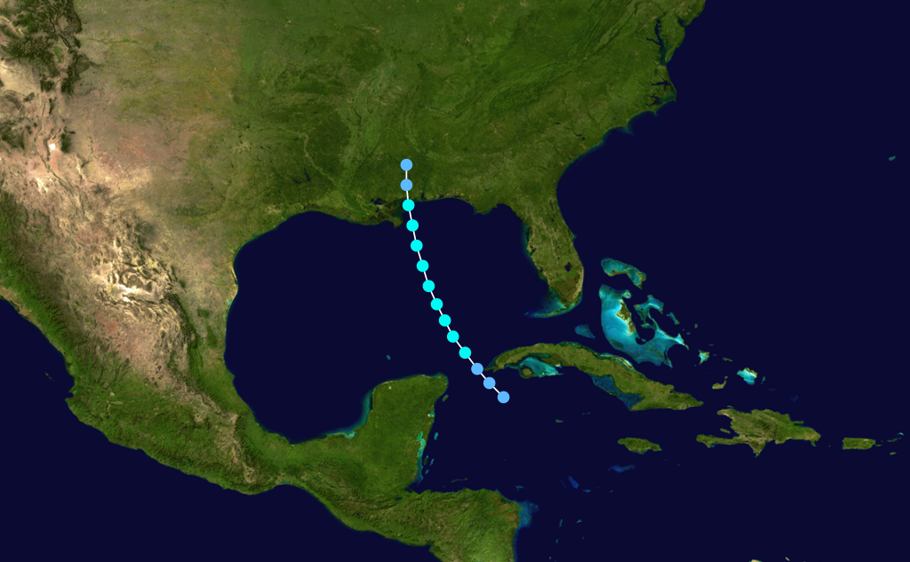
infobox hurricane small
name=Hurricane Ten
category=cat1
type=hurricane

formed=September 14
dissipated=September 18
highest winds=80 mph (130 km/h)
lowest pressure=983 mbarOnSeptember 14 , the tenth storm formed in the centralAtlantic Ocean and moved northward. The storm peaked at convert|80|mi/h|km/h|abbr=on with pressure of 983 mbar on the 16th and started losing its tropical characteristics while northeast of Newfoundland onSeptember 18 and was soon declared as an extratropical storm.Tropical Storm Eleven
infobox hurricane small
name=Tropical Storm Eleven
category=storm
type=tropical storm

formed=October 6
dissipated=October 9
highest winds=55 mph (90 km/h)
pressure=1004 mbarThe eleventh tropical storm of the season developed in the western Caribbean Sea on
October 6 . The storm peaked at convert|55|mi/h|km/h|abbr=on, then started moving westward through the Yucatán Peninsula and Bay of Campeche. Eleven dissipated onOctober 9 after making its second landfall inMexico .Tropical Storm Twelve
infobox hurricane small
name=Tropical Storm Twelve
category=storm
type=tropical storm
formed=October 8
dissipated=October 9
highest winds=70 mph (115 km/h)
lowest pressure=994 mbar [http://www.aoml.noaa.gov/hrd/hurdat/excelfiles_centerfix/1887/STORM12.XLS STORM 12- HURDAT] ] A depression strengthened into Tropical Storm Twelve onOctober 8 and peaked at convert|70|mi/h|km/h|abbr=on winds later that day. After passing overBermuda , Twelve dissipated the next day. Twelve was the shortest lived storm in the 1887 season lasting only two days (October 8th & 9th).Hurricane Thirteen
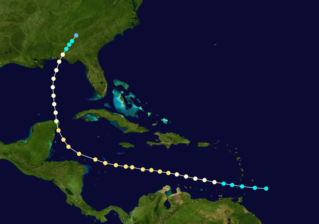
infobox hurricane small
name=Hurricane Thirteen
category=cat1
type=hurricane
formed=October 9
dissipated=October 21
highest winds=85 mph (135 km/h)
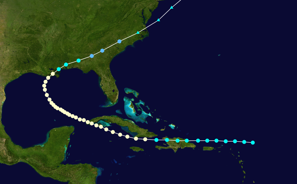
lowest pressure=990 mbar [http://www.aoml.noaa.gov/hrd/hurdat/excelfiles_centerfix/1887/STORM13.XLS STORM 13- HURDAT] ] The thirteenth storm was first seen onOctober 9 to the northeast of theLesser Antilles . It moved westward intoPuerto Rico andHispaniola , and strengthened into a hurricane while south of Cuba.Thirteen peaked at 85mph for four straight days. In the Gulf of Mexico, 13 turned northeastward, and hit southeasternLouisiana before becoming extratropical overNorth Carolina early on the 21st over the ocean.Hurricane Fourteen
infobox hurricane small
name=Hurricane Fourteen
category=cat1
type=hurricane

formed=October 10
dissipated=October 12
highest winds=85 mph (135 km/h)
lowest pressure=994 mbar [http://www.aoml.noaa.gov/hrd/hurdat/excelfiles_centerfix/1887/STORM14.XLS STORM 14- HURDAT] ]On
October 10 , a depression strengthened into TS14 and moved across the ocean. Fourteen peaked with 85mph winds as a Category 1 hurricane on the 11th. On the 12th, Fourteen weakened and was declared extratropical. AroundOctober 14 , a storm moved overBelize , causing moderate crop damage and disruption in the southern part of the country. Because the 13th storm of the season existed at the same time to its northeast, this system was not included, though further research is under way to determine if it was a new storm or a variation of the 13th storm of the season.Hurricane Fifteen
infobox hurricane small
name=Hurricane Fifteen
category=cat2
type=hurricane

formed=October 15
dissipated=October 19
highest winds=105 mph (170 km/h)
lowest pressure=975 mbar [http://www.aoml.noaa.gov/hrd/hurdat/excelfiles_centerfix/1887/STORM15.XLS STORM 15- HURDAT] ] A tropical storm was discovered on late afternoon ofOctober 15 and was named Tropical Storm Fifteen on that day with convert|80|mi/h|km/h|abbr=on winds. FromOctober 15 to 16th, Fifteen peaked at convert|105|mi/h|km/h|abbr=on winds making it a Category 2 hurricane. Fifteen stayed out to sea and dissipated onOctober 19 .Tropical Storm Sixteen
infobox hurricane small
name=Tropical Storm Sixteen
category=storm
type=tropical storm

formed=October 27
dissipated=November 6
highest winds=70 mph (115 km/h)
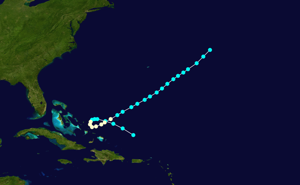
lowest pressure=993 mbarA tropical storm formed on October 27th and took a long, erratic track across theCaribbean Sea and theAtlantic Ocean . Sixteen made landfall and moved acrossFlorida as a tropical storm on the 30th . Sixteen paralleled the Carolina coastline and peaked at an 70mph storm with a tropical pressure of 993 mbar onOctober 31 . Sixteen was declared extratropical a day later and hit an extratropical peak of 80mph and a 990 mbar extratropical pressure. The storm was dissipated on the 6th of November. Sixteen caused a ship to capsize, killing 2 sailors, and resulted in the loss of four other ships.Hurricane Seventeen
infobox hurricane small
name=Hurricane Seventeen
category=cat1
type=hurricane
formed=November 27
dissipated=December 4
highest winds=80 mph (130 km/h)
pressure=1004 mbarOnNovember 27 , a tropical storm formed north ofPuerto Rico . It moved to the west-northwest, and looped to the northeast. While looping, it peaked at convert|80|mi/h|km/h|abbr=on, but rapid weakening began while the storm was moving to the northeast. The storm was last seen onDecember 4 in the open Atlantic Ocean.Hurricane Eighteen
infobox hurricane small
name=Hurricane Eighteen
category=cat1
type=hurricane

formed=December 4
dissipated=December 9
highest winds=75 mph (120 km/h)
pressure=1004 mbarThe 18th storm was first seen to the northeast of theLesser Antilles onDecember 4 . It moved northwestward at first, then turned to the northeast, strengthening into a hurricane onDecember 7 before rapid weakening began and Eighteen was declared an extratropical storm on the 9th.Tropical Storm Nineteen
infobox hurricane small
name=Tropical Storm Nineteen
category=storm
type=tropical storm
formed=December 7
dissipated=December 12
highest winds=60 mph (95 km/h)
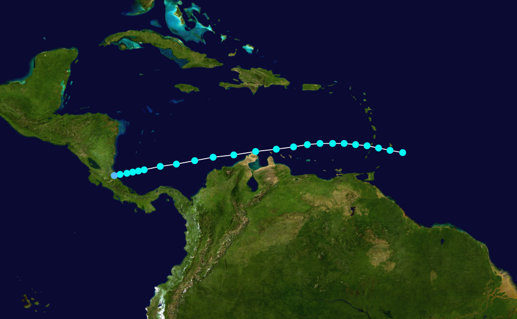
pressure=1004 mbarThe 19th and final tropical storm formed onDecember 7 and moved westward through theCaribbean Sea . Nineteen peaked in intensity on the 10th with 60mph winds. Nineteen passed by St. Vincent and continued westward until dissipating near the coast ofCosta Rica on the 12th. When Tropical Storm Nineteen formed on December 7, it made 1887 the year with the most off-season storms (five). Nineteen is the only tropical cyclone recorded to make landfall in Costa Rica.Possible Storms
In addition to the 19 storms named above, during the re-analysis of the hurricane database, the Hurdat research team identified an additional four possible storms.
*The first storm existed from
June 10 through the 15th, though lack of data of a warm core led to it being classified an extratropical storm.
*The next storm had two reports of gale force winds fromSeptember 1 through the 5th, but it was uncertain if a closed circulation existed.
*In late September, a tropical depression passed nearSt. Kitts with a pressure of 1008 mb, though not enough information led to it not being included in the archive.
*A system fromOctober 22 to the 23rd had some data, though not enough to determine if it had been a tropical storm or a depression.Accumulated Cyclone Energy Rating (ACE)
The table below shows the ACE for each storm in the season. The ACE is, broadly speaking, a measure of the power of the hurricane multiplied by the length of time it existed for, so hurricanes that lasted a long time (such as #7 and #9) have higher ACEs. ACE is only calculated for full advisories on tropical systems at or exceeding 35 knots (39 mph/63 km/h) or tropical storm strength.
See also
*
List of tropical cyclones
*List of Atlantic hurricane seasons References
External links
* [http://www.aoml.noaa.gov/general/lib/lib1/nhclib/mwreviews/1887.pdf Monthly Weather Review]
* [http://www.weather.unisys.com/hurricane/atlantic/1887/index.html 1887 Track Map]
* [http://www.aoml.noaa.gov/hrd/hurdat/metadata_1886-90.htm#1887_additional Possible storms]

Wikimedia Foundation. 2010.