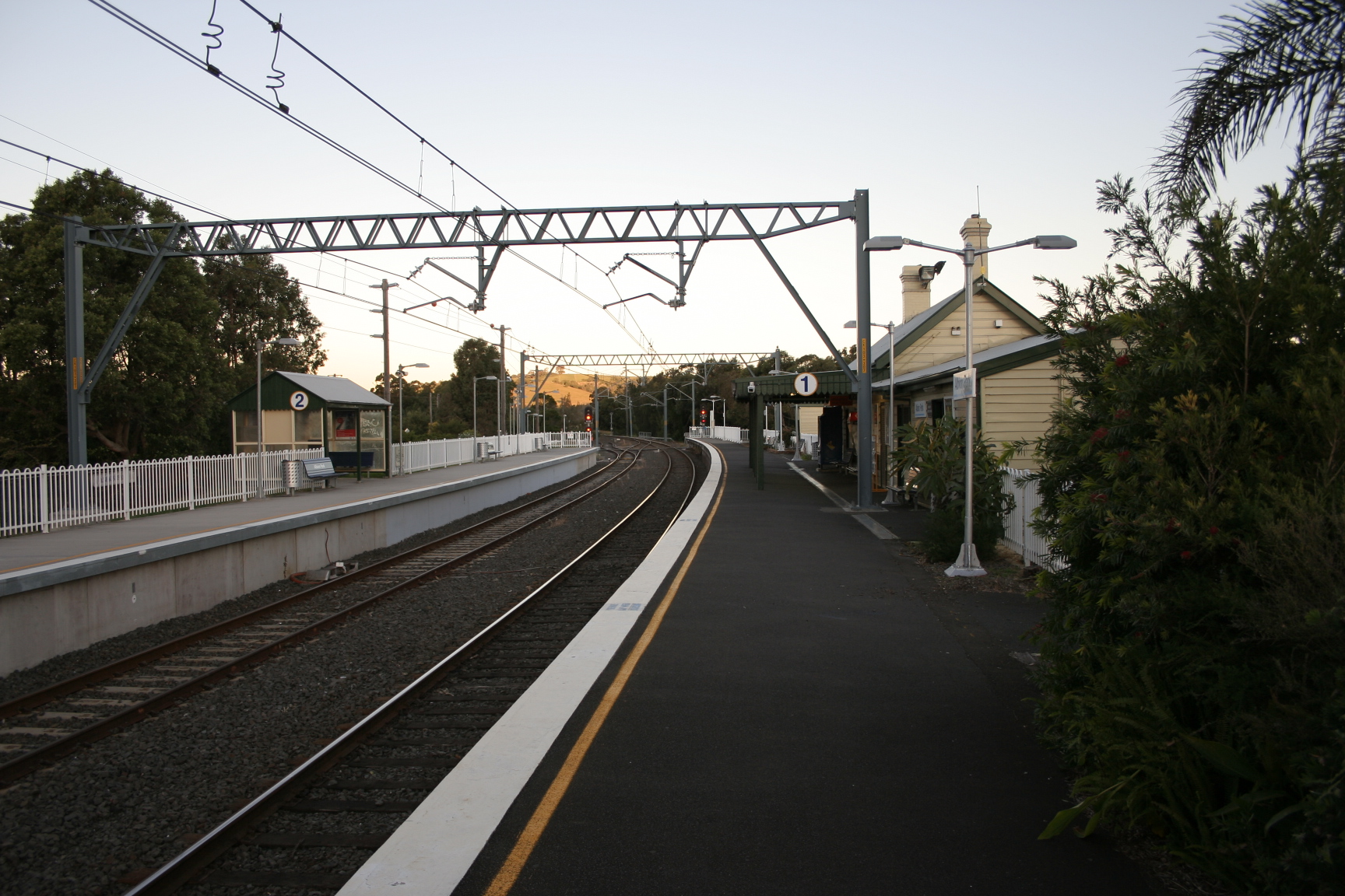
Albion Park railway station, New South Wales
- Albion Park railway station, New South Wales
Cityrail Station alt|station_name=Albion Park|
servicearea=South Coast Line|servicearea_color=#South Coast line colour|servicearea_textcolor=white
code=ALP|suburb=Albion Park|street=Princes Hwy|distance=103.34|altitude=?|traintype=Intercity|platforms=2|tracks=2|platform_arr=2 Side|stationtype=Ground|gates=No|connect=Bus|disabled=Yes (Assisted)
facilities= [http://www.cityrail.info/facilities/facilities.jsp?n=3&giveOutput=true&facility= Link]
Albion Park railway station is on the Cityrail South Coast line in New South Wales, serving the township of Albion Park Rail. This township is east of the town of Albion Park proper. The station opened in 1887 (as Oak Flats), [cite web | title = Albion Park railway station | url=http://www.nswrail.net/locations/show.php?name=NSW:Albion+Park&line=NSW:south_coast:0 | publisher= www.nswrail.net | accessdate = 2007-06-26 ] and a second platform was opened in 2001 as part of the extension of electrification to Kiama. [ Gullick, J. "Kiama Electrification- some facts and figures". Railway Digest, January 2002.] A station 3 km north of the present station opened in 1887 as 'Albion Park', but was later renamed 'Yallah' [ Wollongong City Library [http://www.wollongong.nsw.gov.au/library/localinfo/yallah/history.html Yallah History] , accessed 10 July 2007] and closed in 1974. [cite web | title = Yallah railway station | url=http://www.nswrail.net/locations/show.php?name=NSW:Yallah&line=NSW:south_coast:0 | publisher= www.nswrail.net | accessdate = 2007-07-10 ]
Platforms/Service
Platform 1:
*South Coast line colour>South Coast Line - Trains to Dapto, Wollongong and Sydney TerminalPlatform 2:
*South Coast line colour>South Coast Line - Trains to Kiama and Bomaderry(Nowra)
Transport Links
Premier Illawarra runs seven routes to and fron Albion Park railway station:
*37 - Wollongong Loop.
*43 - Between Dapto and Port Kembla.
*51 - to University of Wollongong.
*54 - to Wollongong station.
*57 - Wollongong Loop.
*70 - to Shellharbour District.
*76 - to Shellharbour District.
ee also
*
Neighbouring stations
References
Wikimedia Foundation.
2010.
Look at other dictionaries:
Wollongong railway station, New South Wales — Cityrail Station alt|station name=Wollongong| servicearea=South Coast Line|servicearea color=#South Coast line colour|servicearea textcolor=white code=WOL|town=Wollongong|street=Lowden Sq|distance=82.92|altitude=?|traintype=Intercity|platforms=4|t… … Wikipedia
South Coast railway line, New South Wales — Public transport infrastructure in Sydney logo= name=South Coast line transport mode=Interurban rail line Coach service line owner=CityRail operation area=Wollongong Shellharbour Kiama Shoalhaven map colour=Blue/Grey line length=153 km stations… … Wikipedia
Albion Park, New South Wales — Albion Park Wollongong, New South Wales An aerial picture of the suburb Population … Wikipedia
Unanderra-Moss Vale railway line, New South Wales — Public transport infrastructure in Sydney logo= name= Unanderra Moss Vale transport mode=Coach service line owner=RailCorp operation area=Illawarra, Southern Highlands map colour=Blue stations number=9 interchange names=Wollongong Dapto Bowral… … Wikipedia
Albion Park Rail, New South Wales — Infobox Australian Place | type = suburb name = Albion Park Rail city = Wollongong state = nsw caption = Albion Park Rail is on the top left of this aerial photo, with Albion Park on the right lga = City of Shellharbour postcode = 2527… … Wikipedia
Dapto, New South Wales — Dapto Wollongong, New South Wales Population: 10,480 … Wikipedia
Corrimal, New South Wales — Corrimal Wollongong, New South Wales Aerial photo of Corrimal to Tarrawanna Pop … Wikipedia
Wollongong, New South Wales — Infobox Australian Place type = city name = Wollongong state = nsw imagesize = 270 caption = pop = 263,535 pop footnotes = poprank = 9th density = 385.3 density footnotes = est = postcode = 2500 coordinates =… … Wikipedia
Illawarra bus routes, New South Wales — Public transport infrastructure in Sydney logo= name=Illawarra transport mode=Commuter bus line owner=Ministry of Transport operation area=Wollongong Shellharbour Kiama Wingecarribee line length=37 routes interchange names=Wollongong station… … Wikipedia
Otford, New South Wales — This article is about the town in NSW. For the village in England, see Otford. Otford Wollongong, New South Wales Otford Lookout … Wikipedia