Saint Heliers

Saint Heliers

Infobox New Zealand suburbs
name =St Heliers
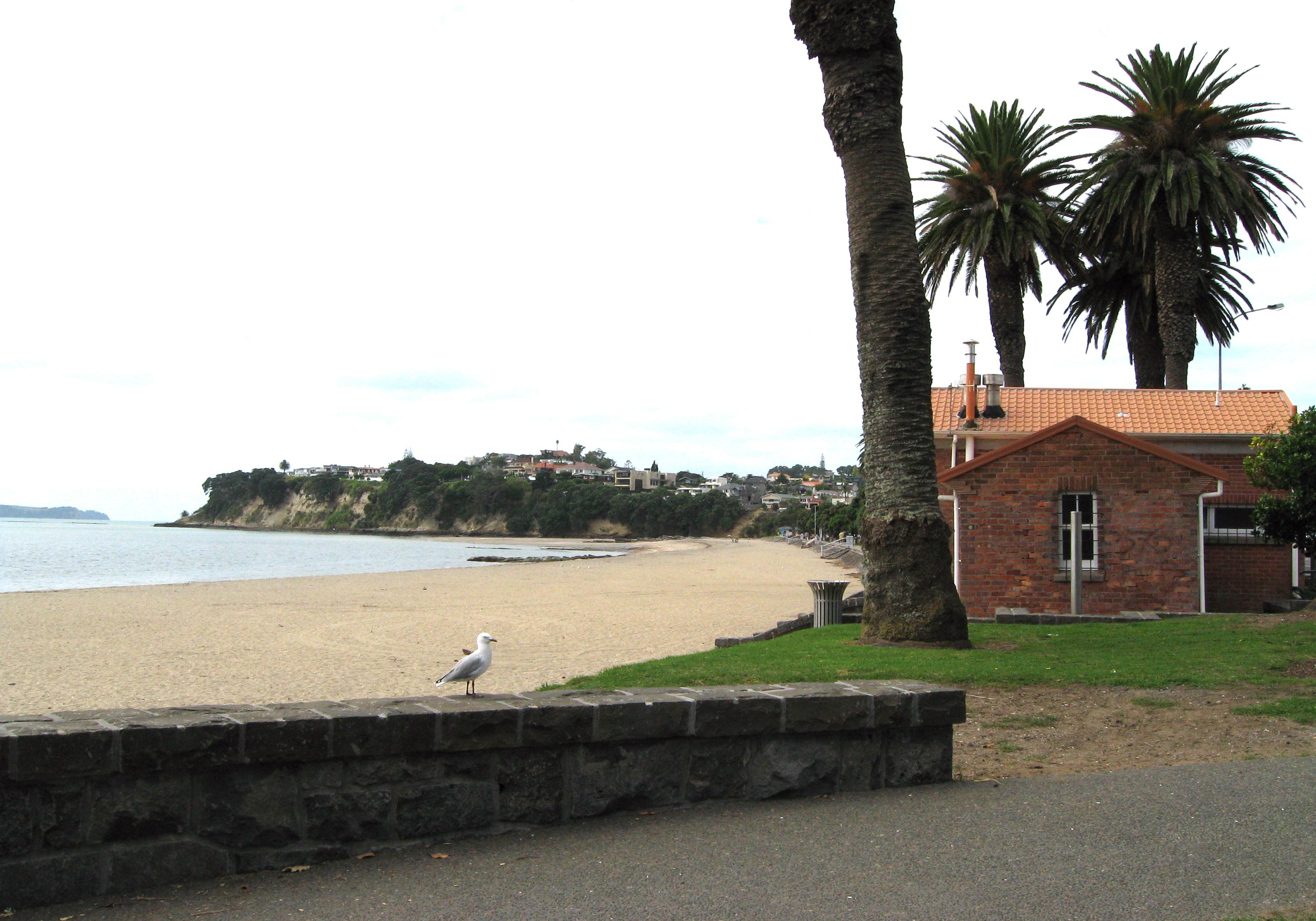


caption1 =St Heliers beach looking west towards Achilles Point
city1 =Auckland City
city2 =
ward =
established =
area =
population =6,339
popdate =
trainstations =
ferryterminals =
airports =
hospitals =
north =Hauraki Gulf
northeast =
east =Bucklands Beach
southeast =Glendowie
south =Glen Innes
southwest =Saint Johns
west =Orakei
northwest =Kohimarama


caption2 =

Saint Heliers is a residential Auckland City suburb, located at the eastern end of the city, where the Tamaki estuary divides it from Manukau City.

This area was originally called Glen Orchard after Lieutenant-Colonel William Taylor's farm. Under later owners it was a stud farm managed by a Major Walmsley who apparently suggested the name Saint Heliers Bay because of its resemblance to the Bay of St Heliers, a fashionable holiday resort on the Channel Island of Jersey.

The "St Heliers and Northcote Land Company" was formed in 1882. The purpose of this company was not only to sell land but to provide a horse tram service for Auckland. Land sales were poor and the scheme eventually failed but the company did build a 1500 ft long pier at St Heliers before becoming insolvent.

St Heliers was usually reached by boat, the trip from Auckland taking only 30 minutes, whereas the eight mile land route via Newmarket, Remuera and Meadowbank was usually far too onerous. During this period St Heliers was a centre for local farmers and the location of the villas of a few rich business people. After Tamaki Drive was built in the late 1920s St Heliers became a commuter suburb and a destination for sunday drives, altering its genteel image.

The wharf is long gone but there is periodically talk of rebuilding it, especially when Tamaki Drive is gridlocked with traffic. Some years a temporary wharf is put in place during the summer months.

Geography

St Heliers has one relatively unknown volcano, which erupted as far as 50,000 years back. Its crater had formed a lake by the time Europeans arrived, and was later converted into the sports fields of Glover Park. On the seaward side, a has once stood, and the landward side is marked by the water tower at its highest point."St Heliers" - "City of Fire", insert magazine in the "The New Zealand Herald", Friday 15 February 2008]

Gallery

References

*"The Heart of Colonial Auckland, 1865-1910" - Terence Hodgson. Random Century NZ Ltd, 1992.
* "Delving Into The Past Of Auckland's Eastern Suburbs: Section 6, Saint Heliers Bay" - Elizabeth T. Jackson. Premier Print Services, 1976


Wikimedia Foundation. 2010.

Игры ⚽ Нужен реферат?

Look at other dictionaries:

  • Saint Helier (disambiguation) — Saint Helier or St. Helier refers to Saint Helier or to various places named thereafter:*Helier a saint and hermit of Jersey *Saint Helier a parish in the island of Jersey *St. Helier, London a suburb in the London Boroughs of Merton and Sutton… …   Wikipedia

  • Saint Johns, New Zealand — Suburb:Saint JohnsCity:Auckland CityIsland:North IslandSurrounded by to the north to the north east to the east to the south east to the south to the south west to the west to the north west Kohimarama (2.0 km) Saint Heliers (3.0 km) Glen Innes… …   Wikipedia

  • Saint Hélier — (spr. ßent hélljer, auch St. Heliers), Hauptstadt von Jersey, einer der britischen Kanalinseln, auf der Südseite, mit zum Teil engen Straßen und (1891) 29,100 Einw. (wovon über die Hälfte Engländer und Ausländer). Von ansehnlichen Gebäuden… …   Meyers Großes Konversations-Lexikon

  • St Heliers Correctional Centre — Infobox Prisons prison name=St Heliers Correctional Centre location=Muswellbrook, New South Wales status=Operational classification=Minimum (Male) capacity=256 opened=September 1989 closed= managed by=Department of Corrective Services St Heliers… …   Wikipedia

  • St. Philip's Anglican Church — St Philips Anglican Church is situated in the Auckland, New Zealand suburb of Saint Heliers. Vision The vision of St Philip s is to grow a Christian family of all ages. St Philip’s is a faith community which is part of the Anglican Church of… …   Wikipedia

  • Glen Innes, New Zealand — Suburb:Glen InnesCity:Auckland CityIsland:North IslandSurrounded by to the north to the north east to the east to the south east to the south to the west to the north west Saint Heliers Glendowie Wai O Taiki Bay Tamaki River Point England Saint… …   Wikipedia

  • Glendowie, New Zealand — Suburb:GlendowieCity:AucklandIsland:North IslandSurrounded by to the north to the east to the south to the south west to the north west Hauraki Gulf Tamaki River Wai O Taiki Bay Glen Innes Saint Heliers Glendowie is an Auckland suburb.Glendowie… …   Wikipedia

  • Auckland volcanic field — The Auckland volcanic field is a generally monogenetic volcanic field in the North Island of New Zealand. Basaltic in nature, it underlies much of the metropolitan area of Auckland. The field s many vents have produced a diverse array of… …   Wikipedia

  • Auckland City — This article is about the former local government area. For the football team, see Auckland City FC. For the greater metropolitan area, see Auckland. Auckland City   Territorial authority of New Zealand   …   Wikipedia

  • Suburbs of Auckland — There are many suburbs in the Auckland metropolitan area. They are listed below, grouped by local authority (currently excluding Waitakere City and Rodney District): Auckland City*Arch Hill *Avondale *Blockhouse Bay *Balmoral *Eden Terrace… …   Wikipedia

Share the article and excerpts

Direct link
Do a right-click on the link above
and select “Copy Link”