- Hazelwood Park, South Australia
Infobox Australian Place | type = suburb
name = Hazelwood Park
city = Adelaide
state = sa
caption =
lga =City of Burnside
postcode = 5066
pop = 1,717 (2006 Census) [Census 2006 AUS|id=SSC41731|name=Hazelwood Park (State Suburb)|quick=on|accessdate=2007-06-30]
est = 1848
area =
propval = [http://www.domain.com.au/Public/SuburbReport.aspx?searchTerm=5066&mode=+%24257%2C000 $510,000] (2005)
stategov = Bragg
fedgov = Sturt
near-nw = Heathpool
near-n = Leabrook
near-ne = Erindale
near-w = Tusmore
near-e = Burnside
near-sw = Linden Park
near-s = Beaumont
near-se = Burnside
dist1 =
location1=Hazelwood Park is a
suburb in theCity of Burnside ,Adelaide ,South Australia with a census area population of 1,717 people. The suburb is about 5kilometre s east of the Central business district. Hazelwood Park, a suburban park inside the suburb, is the major attraction in the suburb. This includes theBurnside Swimming Centre , a popular site during Adelaide's hot weather. Much of the remainder of the suburb is residential but there is a small shopping area along Glynburn Road on the eastern edge. The area was first settled by Europeans in 1848 but has seen many community changes over the years.The suburb is split in half by Greenhill Road, to the north there are residential dwellings and the park. To the south and east are the foothills of the
Mount Lofty Ranges with continued residential properties. Hazelwood Park is bounded to the north by Knightsbridge Road, to the east by Glynburn Road, to the south by Cooper Place and to the west by Devereux Road and a line along the back of the blocks between Hazelwood and Tusmore avenues.History
Aboriginal Culture
The
Kaurna people were stone-age hunter gatherers who inhabited the Adelaide Plains and surrounding regions. Among their unique customs were burn-offs (controlledbushfires ) in theAdelaide Hills which the early Europeans spotted before the Kaurna people were pushed out by settlement. By 1852, the total population (by census count) of the Kaurna was 650 in the Adelaide region and steadily decreasing. The Kaurnas' main presence was on theRiver Torrens and the creeks that flowed into it, including Hazelwood Park's First Creek. These were also the most prized areas for the new European settlers. Displaced abruptly and then afflicted by European diseases that they had no natural immunity for, the Aboriginal population went into steady decline.An early settler of the neighbouring suburb of Beaumont, James Milne Young, described the local Kaurnas: "At every creek and gully you would see their wurlies [simple Aboriginal homes made out of twigs and grass] and their fires at night... often as many as 500 to 600 would be camped in various places... some behind the Botanic Gardens on the banks of the river; some toward the Ranges; some on the Waterfall Gully." ref|burnside_history
European Settlement
The area that is now the suburbs of Leabrook and Erindale, along with portions of the current suburbs of Burnside and Hazelwood Park, was originally known by the name Knightsbridge when a village was laid out under that name in 1848. The village was laid out in section 298 in the land between First and Second Creeks. Unlike other more brilliantly designed early villages (such as Beaumont) Knightsbridge was laid out by a Captain Hall, originally from
Port Adelaide . He simply divided the land into eight blocks and ran Knightsbridge Road through them. Much of the land was sold to timber merchants, who quickly made use of the suburb's thick bushland. The first house in the suburb, which remains to this day on 12 Hazelwood Avenue, was built by George Taylor, a local grocer, in 1854. Named Knightsbridge House, it was unique in having much of the ground floor situated half-underground to cope with the fierce Australian summers. The total property owned by Taylor amounted to thirty-three acres, which included much of today's suburb. He returned toEngland in 1856 and leased the property out.Notably, an orphanage was established on the land by the Sisters of
St. Joseph , aCatholic Organisation. They cared for forty to sixty children on the property between the years 1875 and 1887. The orphanage was known for providing much care to the children, with the Adelaide daily the "Register" noting that 'the good Sisters of St. Joseph were perfect slaves to these children'. With better accommodation provided at Woodville, the orphanage moved and the Knightsbridge farm attempted a sale, but was once again leased out. In the years 1888 to 1950 it was a large dairy farm under the Coote family. The remaining part of section 298, much of it owned by a Mr Debney and not part of Knightbridge Farm, was further subdivided in 1880 and became the village of Leabrook.The remainder of today's suburb of Hazelwood Park, south of Greenhill Road, was originally known as Linden. It lent its name to today's suburb of Linden Park, and it is notable that Linden Park's name remained so, even after Linden became part of Hazelwood Park. Linden had some of the best arable land in the area, and was a highly-sought after area. ref|paddocksbeneath
After
World War II , with Adelaide rapidly expanding both in the metropolitan region and in the hills area various plans were laid out to replace the windy and dangerous Mount Barker Road. One of these proposals was the Burnside-Crafers Highway, which envisioned leaving Greenhill Road once reaching Hazelwood Park. It was then to pass through Hazelwood Park and Beaumont, wind around the hills ofWaterfall Gully and then go overEagle on the Hill to meet Crafers. The Burnside Council put much effort into this proposal, widening Linden Avenue (which runs NW to SE) in preparation for the highway.ref|highway The proposal was eventually rejected in favour of upgrading Mount Barker Road and Linden Avenue remained a huge out-of-place road running through an otherwise peaceful suburb. After years of drivers racing down the 2 km long avenue, the Burnside Council constructed a large median strip in 2005. ref|lindenavThe actual Hazelwood Park was acquired by the State Government free of charge in July 1915, and gazetted as a 'pleasure resort'. This came from the old "Hazelwood" estate, owned by the Francis Clark family.ref|clark The Burnside Council sought to acquire the park from the State Government after finding notes from a government meeting in 1944 that were to see the park sold to a private owner. The major of Burnside at the time, George Bolton, had a grand vision for what the park should become; notably in the construction of an Olympic-sized swimming pool. After years of effort, the Burnside Council eventually acquired the park in May 1963 after negotiations with the Premier, Sir Thomas Playford. As part of the acquisition, the Burnside Council was to retain the name 'Hazelwood' and was to maintain the park at a level satisfactory to the State Government. The deed was transferred on 2 January 1964 for the 2.2 ha of Section 298 that is Hazelwood Park. In 1966, after much political wrangling, a 3-pool swimming center opened at Hazelwood Park. It was named after Mayor George Bolton who had been the leading voice in advocating its construction. The George Bolton Swimming Center remains open to this day, and saw renovations in 1996 which added further facilities. ref|paddocksbeneath
Geography
Hazelwood Park's original vegetation was similar to the rest of the area. Blue and Red gum woodland existed primarily to the north of Greenhill Road, while Grey box
woodland existed roughly to its south. The Grey box woodland, when still in existence at the time of settlement, was called the 'Black Forest'. The park in the suburb is a good example of the remaining Blue and Red Gum. ref|burnside_nativevegetationModern vegetation is relatively dense, but contains many introduced floral species. The Burnside Council in recent years has paid particular attention to retaining and planting native plant species when upgrading/maintaining its reserves. This is in stark comparison to past times when native vegetation was replaced by European species in keeping with the wishes of the then population. First Creek, which has its origins in the
Mount Lofty Ranges andAdelaide hills flows through both the suburb and the park. It is a seasonal creek and runs dry throughout much of the summer months. The creek winds down from Waterfall Gully, through Burnside into Hazelwood Park and then continues on to join theRiver Torrens near the Adelaide Botanical Gardens. Apart from Hazelwood Park, the only other notable reserve is the Ray Cooper Gardens, situated near the midpoint of Linden Avenue.Transport
For the Hazelwood Park census area, like most Australian areas, transport is primarily car based, with on average 1.56 cars per household. This is typified in that 68.5% of all residents drive to work and only 5.8% were passengers.ref|transport Traffic congestion is relatively light in Hazelwood Park and only occurs during peak periods on the two main thoroughfares, Greenhill and Glynburn Roads. The city can typically be reached in ten minutes, and fifteen in peak periods using Greenhill Road. Like most Adelaide suburbs, the major roads have a 60 km/h speed limit and the side streets a 50 km/h limit. Hazelwood Park's road network (with few exceptions) follows the usual Adelaide grid pattern.
Only 7.5% took the bus to work, using
Adelaide Metro buses, the only public transport in the suburb. Normal routes into the CBD are by the 142 or 143 which both run into or close to the suburb. The 820/821 bus travels from theAdelaide Hills into the CBD along Greenhill Road. Buses typically run on 30 minute intervals during weekdays and one hour intervals at other times.Residents
According to the 2006 Census the population of the Hazelwood Park census area was 1,717 people. Approximately 52.8% of the population were female, 73.7% are Australian born and over 89.5% of residents are Australian citizens. Hazelwood Park has an educated population with over 40% of the population holding a degree or diploma. This level of education attainment is reflected in the suburb's employment patterns: the most popular industries for employment were education, health and community services (30.7%) and finance, insurance and business services (23.5%). The median weekly household income is AUD$1,182 or more per week, compared with $924 in Adelaide overall.
Hazelwood Park has a higher than average stable family population with a large segment of both children and their mature aged parents. Most residences are family occupied but the number of older empty-nesters (whose children have left home) is growing. Retired population is relatively low, but continuing to grow. 79.2% of dwellings were detached houses but this figure is falling in favour of attached dwellings. Subdivisions are also becoming very much of a common sight in recent years. Interestingly the number of development approvals has been falling since the 2001-02 financial year. ref|residents
Attractions
The biggest attraction in the suburb is the park and accompanying
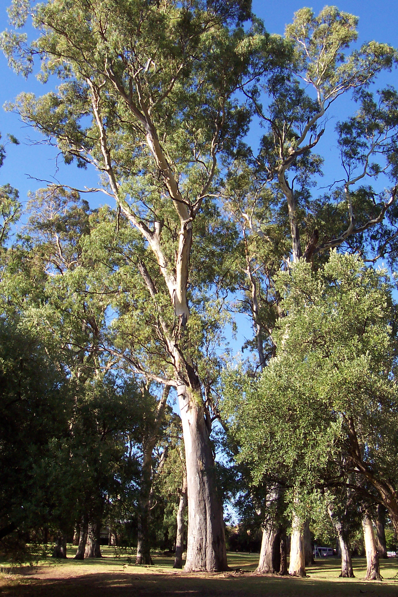
Burnside Swimming Centre . There is a lap pool, plus a 25 metre kids pool and a wading pool. There is also a sauna and steamroom, plus two playgrounds and a kiosk. This location is only open through summertime because it is an outdoor pool and is very popular on hot days in Adelaide (greater than 320C) when it is open late.ref|swimcent First creek continues its journey from the hills through the park, the water flowing from Waterfall Gully and into Tusmore. The creek cuts through the middle of the park and is dammed at one point to create a pond. This is a popular place for children to feed the ducks and families to sit by. There is one playground in the north-east of the park and there are several sets of tables and a fewBBQ s dotted throughout the park. The park is relatively large by local standards and there are no playing fields. It is more strongly characterised by massive oldGum tree s that can be seen from blocks away. Although it has good facilities, it is normally not as popular as the nearby smaller Tusmore Park. It is also the location of a very popular traditional carols night, held annually on the first Sunday in December. ref|lionsHazelwood Park contains a number of small commercial precincts, concentrated around the Glynburn/Greenhill Road roundabout. The area was known previously as "The Feathers", and many stores have adopted this moniker into their names. The shops situated along Greenhill Road are part of the Feathers Shopping Center, and include the local fish and chip shop, an Indian restaurant and a Pizza Bar. At the western corner of Greenhill and Glynburn is a medium-sized commercial center, containing a Goodlife
gym , a Fasta Pasta restaurant and a number of small offices. Opposite this complex to the north is the FeathersHotel , the only one in the immediate area, situated in the neighbouring suburb of Burnside. A local supermarket is also situated near the Waterfall Terrace/Glynburn Road intersection. Larger shopping complexes in the area are located outside of the suburb - at nearbyBurnside Village , Marryatville Shopping Center and the Norwood Parade.Politics
Hazelwood Park is part of the state electoral district of Bragg, which has been held since 2002 by Liberal MP
Vickie Chapman . In federal politics, the suburb is part of thedivision of Sturt , and has been represented byChristopher Pyne since 1993. The results shown are from the closest polling station to Hazelwood Park — which is located outside of the suburb — at St David's Church Hall on nearby Glynburn Road (Burnside).Similar to the rest of the City of Burnside, Hazelwood Park's political leanings are overwhelmingly in favour of the Liberal Party. This could be attributed to the Liberal Party's traditional middle-upper class support base, of which Hazelwood Park easily fits the bill. The Australian Democrats vote was substantial (running at about 10%) until the party was crushed in the 2004 Elections. Minor party showings are on par with the national average and the Labor party consistently picks up only one fifth to a quarter of votes.
Notes
# "History of the City of Burnside" [http://www.burnside.sa.gov.au/site/page.cfm?u=668]
# "Elizabeth Warburton, The Paddocks Beneath"
# "Ozroads: Princes Highway History" [http://www.ozroads.com.au/SA/New/1/PrincesM/history.htm]
# "City of Burnside Capital Works: New Roadworks Projects" [http://www.burnside.sa.gov.au/site/page.cfm?u=689]
# "City of Burnside - Street Names and Origins", Accessed 11/2/06 [http://www.burnside.sa.gov.au/webdata/resources/files/onames.doc]
# "Elizabeth Warburton, The Paddocks Beneath"
# "Native Vegetation of the City of Burnside" [http://www.burnside.sa.gov.au/site/page.cfm?u=796 ]
# "City of Burnside Community Profile for Hazelwood Park / Tusmore: How do we get to work?" [http://www.id.com.au/burnside/commprofile/default.asp?id=139&gid=160&pg=17]
# "City of Burnside Community Profile for Hazelwood Park / Tusmore: How many people live here?" [http://www.id.com.au/burnside/commprofile/default.asp?id=139&gid=160&pg=1]
# "Lions Club Burnside - What we do" [http://www.burnsidelions.org.au/what%20we%20do.htm]
# "Burnside Swimming Centre" [http://www.burnsideswimmingcentre.sa.gov.au/home/swim3.html]
# "State Election 2002 - Polling Booth Results (Burnside, Bragg), courtesy State Electoral Commission" [http://www.seo.sa.gov.au/results/polling403.htm]
# "Federal Election 2004 - Polling Booth Results (Burnside, Sturt), courtesy Australian Electoral Commission" [http://results.aec.gov.au/12246/results/HousePollingPlaceFirstPrefs-12246-7294.htm]References
External links
Wikimedia Foundation. 2010.