- Kelimutu
-
Kelimutu 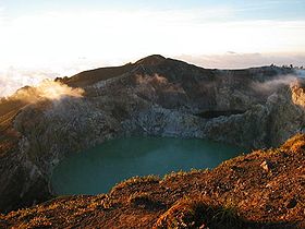
Elevation 1,639 m (5,377 ft) [1] Listing List of volcanoes in Indonesia
Spesial RibuLocation Kelimutu

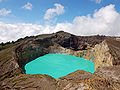
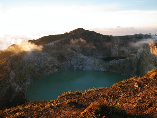
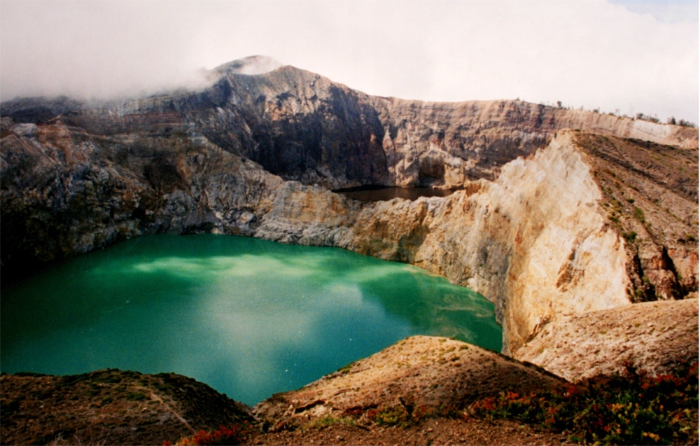
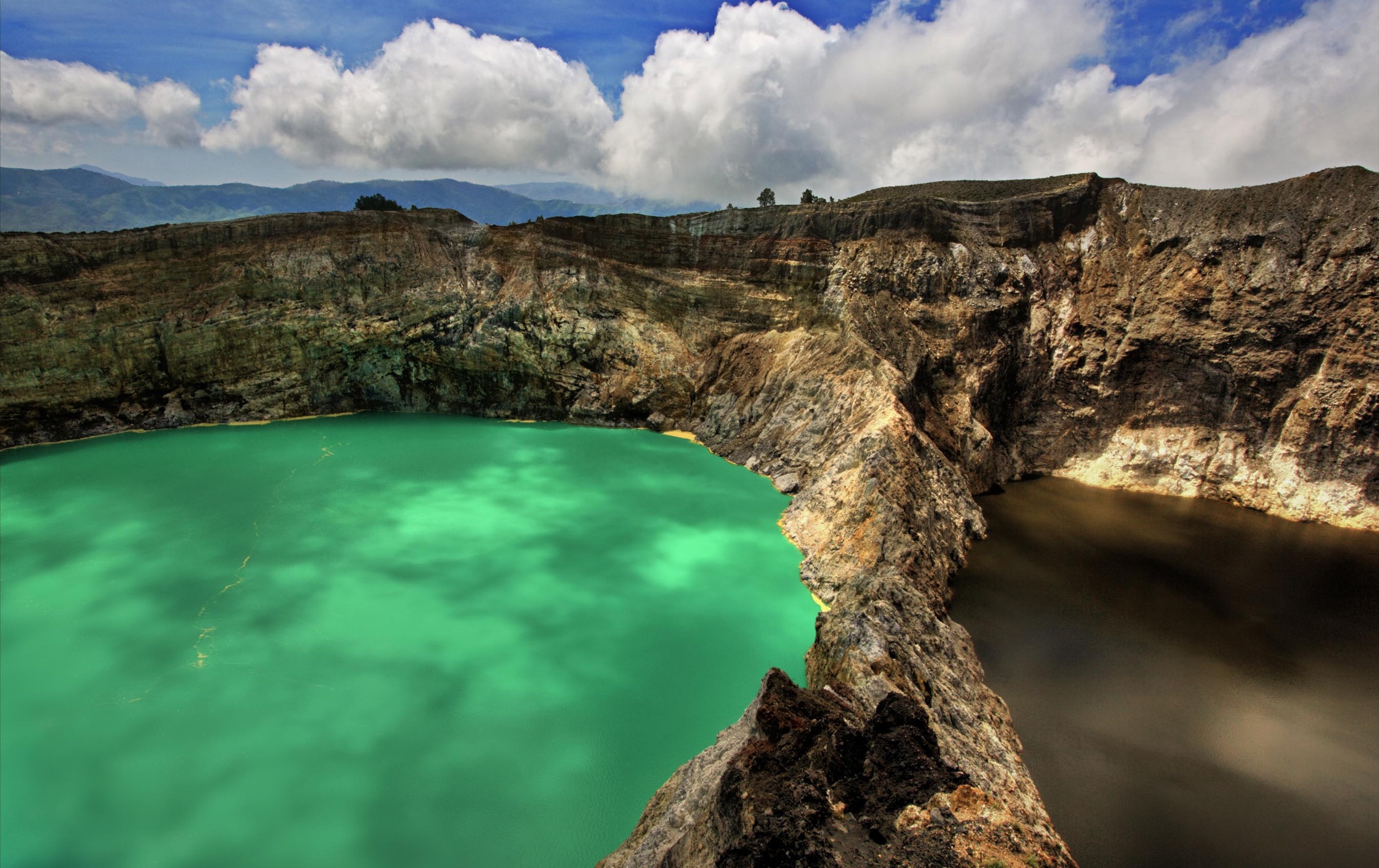
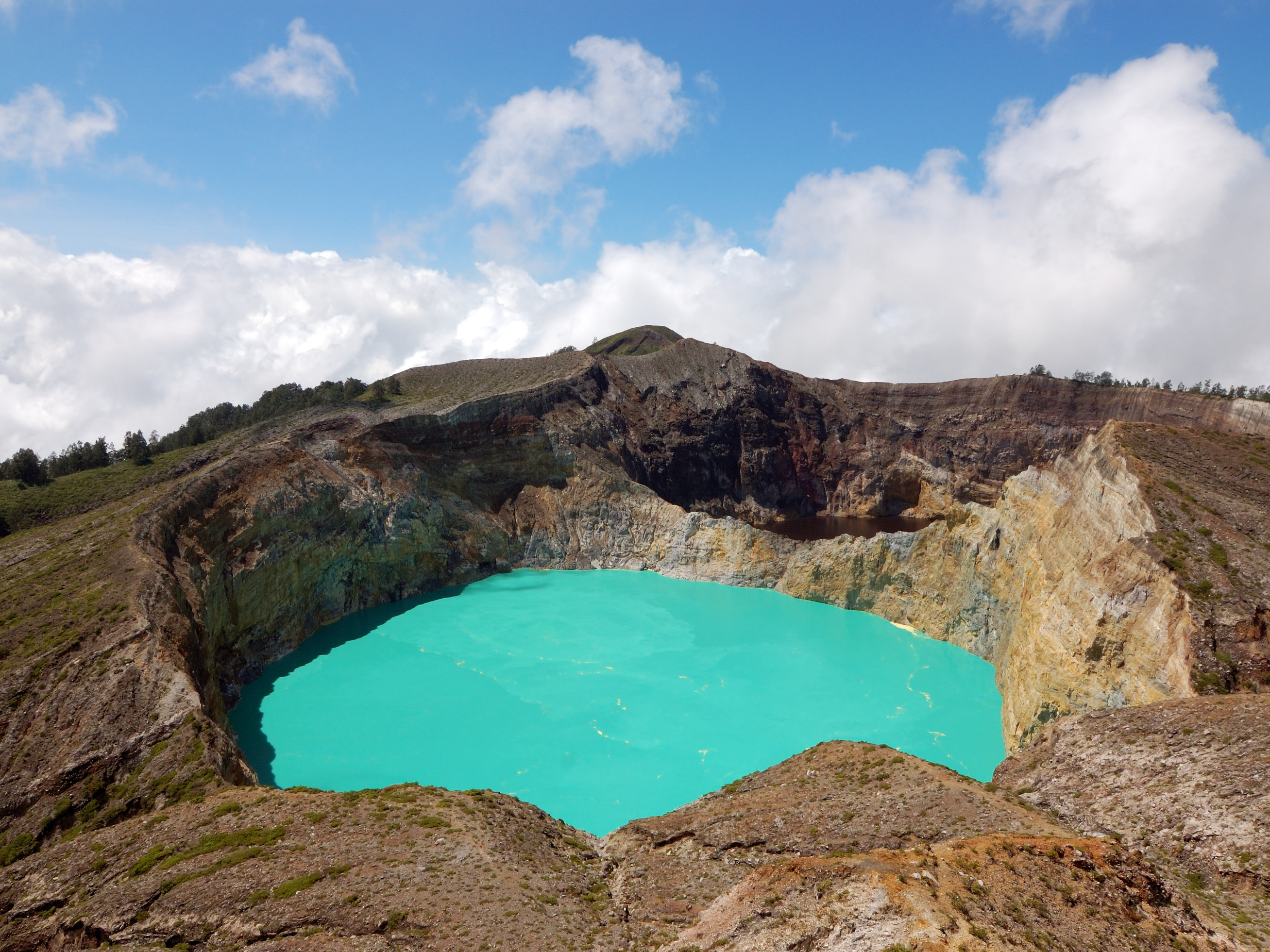
Location Flores Island, Indonesia Coordinates 8°46′S 121°49′E / 8.77°S 121.82°ECoordinates: 8°46′S 121°49′E / 8.77°S 121.82°E Geology Type Complex volcano Last eruption 1968[1] Kelimutu ([kəliˈmutu]) is a volcano, close to the town of Moni in central Flores Island of Indonesia containing three summit crater lakes of varying colors. Tiwu Ata Mbupu (Lake of Old People) is usually blue and is the westernmost of the three lakes. The other two lakes, Tiwu Nuwa Muri Koo Fai (Lake of Young Men and Maidens) and Tiwu Ata Polo (Bewitched or Enchanted Lake) are separated by a shared crater wall and are typically green or red in color, respectively. The lake colors do vary on a periodic basis. Subaqueous fumaroles are the probable cause of active upwelling that occurs at the two eastern lakes.[1]
The lake have been a source of minor phreatic eruptions in historical time. The summit of the compound 1639-m-high Kelimutu volcano is elongated two km in a WNW-ESE direction; the older cones of Kelido and Kelibara are located respectively three km to the north and two km to the south. The scenic lakes are a popular tourist destination. Keli Mutu is also of interest to geologists because the three lakes are different colors yet reside at the crest of the same volcano [2].
According to the local officer at Kelimutu National Park, the colour changed by chemical reaction of any minerals contained in the lake in triggered by volcano gas activity. The closest airports are Maumere, and Ende. There are regular flights to Maumere from Bali. The drive from Maumere to Moni, the town at the base of Keli Mutu, takes about 3 hours.
Contents
Gallery
-

Tiwu Nuwa Muri Koo Fai (Lake of Young Men and Maidens) and Tiwu Ata Polo (Bewitched, or Enchanted Lake)
-
Tiwu Ata Mbupu (Lake of Old People)
-

The Keli Mutu lakes "Lake of Young Men and Maidens" and "Bewitched"
-
See also
References
- ^ a b c "Kelimutu". Global Volcanism Program, Smithsonian Institution. http://www.volcano.si.edu/world/volcano.cfm?vnum=0604-14=.
- ^ Pasternack, Gregory B.; Johan C. Varekamp (1994). "The geochemistry of the Keli Mutu crater lakes, Flores, Indonesia". Geochemical Journal 28 (3): 243–262. doi:10.2343/geochemj.28.243. http://www.terrapub.co.jp/journals/GJ/pdf/2803/28030243.PDF. Here's a link to the abstract
External links
 Media related to Kelimutu at Wikimedia Commons
- Volume 28, No. 3, pp. 137-306 of the Geochemical Journal is a special issue of the journal dedicated to Volcanic lakes.
- Keli Mutu blog
Categories:- Mountains of Indonesia
- Volcanoes of the Lesser Sunda Islands
- Complex volcanoes
- Crater lakes
- Active volcanoes of Indonesia
- Flores Island (Indonesia)
- Sunda Islands geography stubs
-


Wikimedia Foundation. 2010.