- Santa Tecla, El Salvador
-
Santa Tecla — Municipality — 
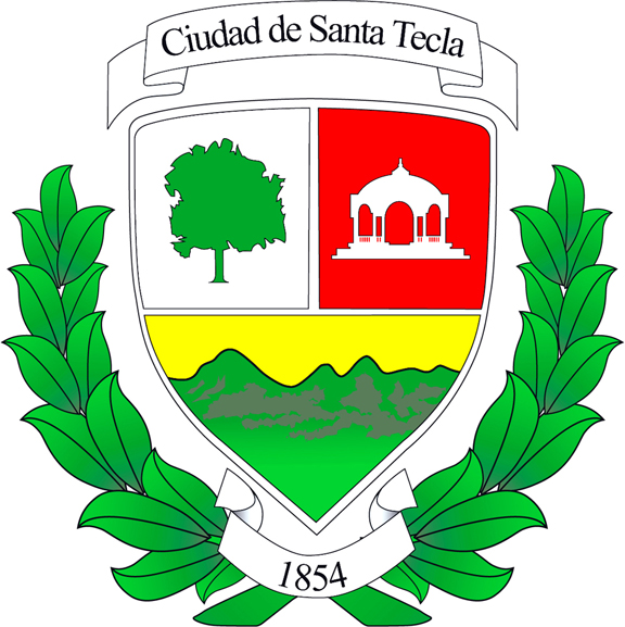
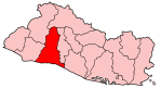
Coat of armsLocation in El Salvador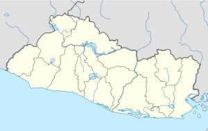
 Santa Tecla
Coordinates: 13°41′N 89°17′W / 13.683°N 89.283°W Country  El Salvador
Department La Libertad Government – mayor Oscar Ortiz Area – Municipality 69.5 sq mi (112.2 km2) – Urban 5.5 sq mi (9.0 km2) Elevation 3,083 ft (940 m) Population (2007) – Municipality 164,171 – Ethnicities Density 674/sq mi (1,086/km2) Time zone Centarl Time (-6) Area code(s) (503) Website http://www.amst.gob.sv/al/alcalde.html Santa Tecla is a municipality in the La Libertad department of El Salvador. It is the capital of the department of La Libertad.[1]
The city was named after Saint Thecla who was a saint of the early Christian Church, and a reported follower of Paul of Tarsus in the 1st century AD. She is not mentioned in the New Testament, but the earliest record of her comes from the apocryphal Acts of Paul and Thecla, probably composed in the early 2nd century.
Santa Tecla is situated at the southern foot of the San Salvador Volcano, and very close to San Salvador (14.5 km, the capital city. The municipality of Antiguo Cuscatlan sits on its eastern border.
Contents
History
Santa Tecla was founded as "Nueva San Salvador" on August 8, 1854 by the president José María San Martín after the capital city was destroyed by an earthquake. It served as capital of the republic from 1855 to 1859 and became departmental capital in 1865. The continued development of the city was spurred by the success of the local coffee industry, becoming a very productive commercial city.
In 2003, the city was renamed "Santa Tecla," which was the historical name of the region prior to the founding of the city. On the occasion of its 150th anniversary(1854–2004) 2 concerts were presented by the renowned tenor, Fernando del Valle, great, great grandson of Andrés del Valle, president of El Salvador in 1876, and a direct descendant of Colonel José María San Martín,[2] President of El Salvador (1854–56). The tenor requested that the first concert take place on September 23, the feast day of the saint for whom the city is named.[3]
Its current governor is Oscar Ortiz, of the FMLN party. The FMLN Party has held the office in Santa Tecla for 5 terms.
Municipal Government and Information
In recent decades, Santa Tecla has received a major influx of new residents, which among other things, has led to the invasion of the main streets by informal sector traders in search of livelihood. The most rapid urban growth and disorderly, occurs in the period 1968 - 2000, when they occur as natural disasters and social civil war in the eighties and the 1986 earthquake that struck San Salvador in particular.
The urban extension to Santa Tecla breaks the boundaries of the restricted nature areas established by the Metro Plan 80-2000 (which regulates land use planning and land use in the municipalities of Greater San Salvador), producing a great impact environment in the foothills of the San Salvador volcano and in the Balsam mountains.
That combination of factors led to the loss of human lives in the Colonia Las Colinas, a development authorized by the Central Government in restricted areas of the Cordillera del Balsamo, during the earthquakes of January and February 2001. This event marked the Municipal Government for the need to plan better and with the participation of the citizenry, the development of the city. In this context, in 2002 the City Council led by Mayor Oscar Ortiz, starts the new participatory strategic planning process concluding with the Participatory Strategic Plan (PEP) of Santa Tecla for the period 2002 to 2012.
Demography
The population of Santa Tecla is mostly mixed, but there are minority families from outside the country as Spanish, Palestinian, French, German, American, British, etc. No indigenous people. Most inhabitants of the city of Santa Tecla are internal migrants from other departments of El Salvador, mainly Santa Ana and Chalatenango.
87% of the population lives in urban areas tecleña, putting Santa Tecla in one of the most urbanized cities in the country. In addition, 18% of the population living in marginalized communities. Santa Tecla has an unemployment rate of 3%. 31% of the population owns a vehicle, while 19% have two or more vehicles. Most homes have the sevicios tecleños basic water and sewer, electric power, telephone and garbage collection.
Cantons
Santa Tecla has the following 15 cantons:
- El Progreso
- Victoria
- El Quequeisque
- Buena Vista
- Los Alvarez
- Loma Larga
- Los Amates
- Santa Tecla
- El Sacazil
- El Limón
- El Matazano
- Ayagualo
- Las Granadillas
- El Triunfo
- Los Pajales
Geography
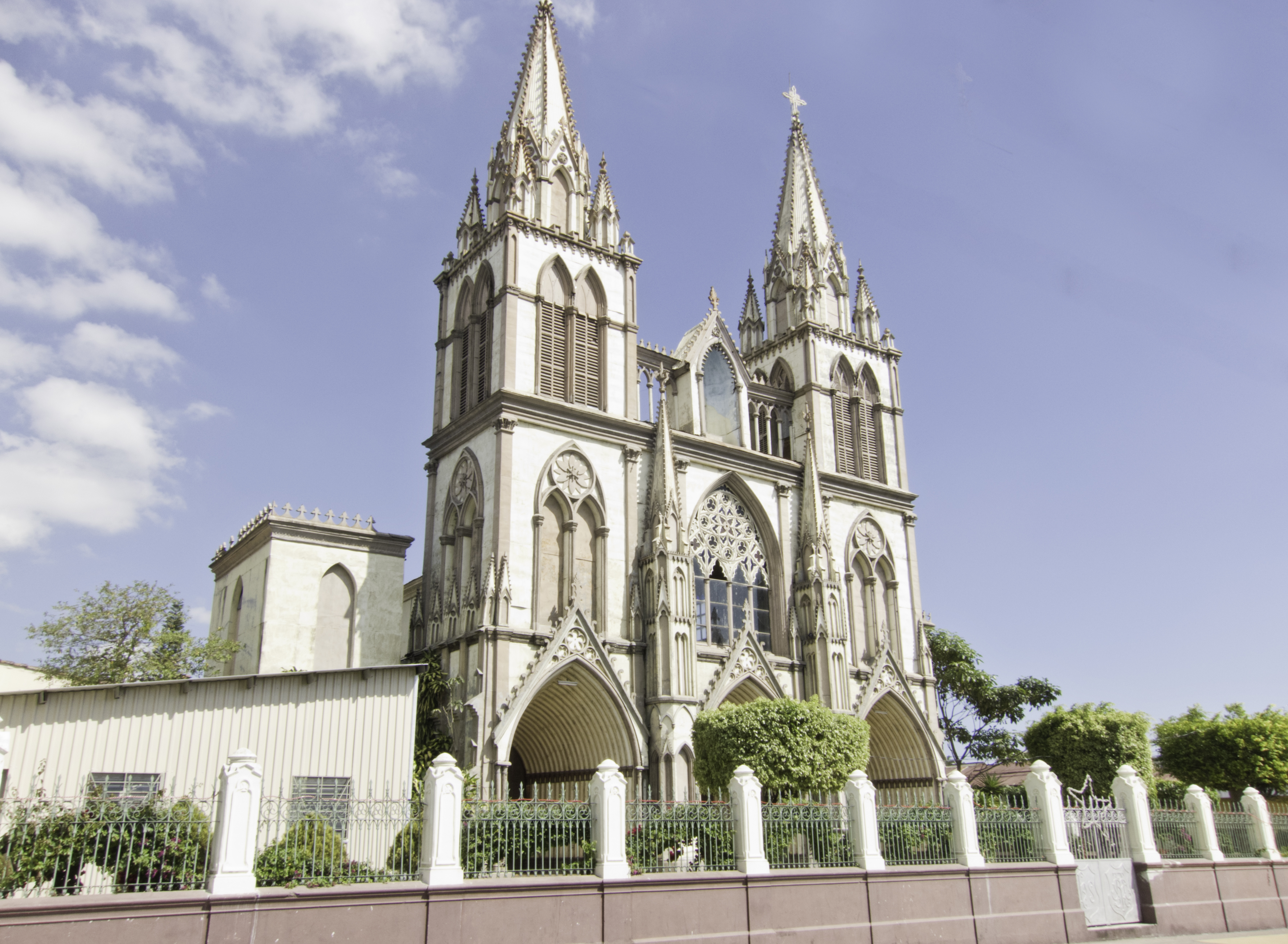
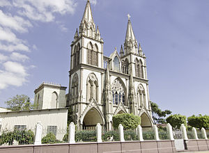 Cathedral del Nuestra Señora del Carmen in downtown Santa Tecla
District Municipality and the Department of La Libertad. It is limited by the following municipalities: to the north, Columbus, San Juan Opico, Quezaltepeque and Nejapa, on the east by San Salvador, Antiguo Cuscatlan, Nuevo Cuscatlan, San Jose Villanueva, and Zaragoza to the south by La Libertad and west by Talnique and Comasagua. It is located between the geographic coordinates 13 ° 44'47 "LN (northern end) and 13 º 32'22" LN (southern end), 89 ° 15'45 "LWG (eastern end) and 89 ° 23'58" LWG (far west) .
Climate
Climate data for Santa Tecla, La Libertad, El Salvador Month Jan Feb Mar Apr May Jun Jul Aug Sep Oct Nov Dec Year Average high °C (°F) 27
(81)27
(81)28
(82)30
(86)29
(84)29
(84)27
(81)28
(82)27
(81)27
(81)27
(81)27
(81)28 Average low °C (°F) 14
(57)15
(59)17
(63)19
(66)19
(66)18
(64)18
(64)18
(64)18
(64)17
(63)17
(63)16
(61)17 Record low °C (°F) 7.1
(44.8)7.6
(45.7)8
(46)11
(52)11
(52)11
(52)11
(52)11
(52)11
(52)8.2
(46.8)7
(45)7
(45)10
(50)[citation needed] Geography
Soil types found in the municipality are: red clay and Lithosols Latosols Alfisols (shallow stony phase of a very rugged mountainous hilly), Andosols and Regosols Inceptisols and Entisols (undulating to hilly stage), Regosols, Clay Latosols Anaosoles reddish, Entisols, Alfisols and Inceptisols (phases rolling to rugged mountain), and Regosols Lithosols. Entisols (phase very rugged mountainous hilly) and Latosol reddish clay, and Lithosols Andosols. Alfisols and Inceptisols (phase rolling to hilly terrain, the stoniness variable). Pyroclastic materials abound, andesitic and basaltic lavas, volcanic detrital sediments with pyroclastic material and lava flows intercalated dacite lavas and adesíticas and basaltic lava flows.
Hydrography
Water the town of Chavarria Zanjón rivers or the Prize, the Pulpit, Guadalupe, Alicante, San Antonio, El Salto, La Periquera, El Chico, El Limon, San Isidro, San Cayetano, Asuchío, Granadillas or La Esmeralda, Siguapate, El Sacazil, Chilam, Agua Caliente, Providence and Comasagua, and streams and jogging, Triadera, Buenos Aires, Portillo, El Limon, El Güistomate, El Sisimite, Santa Teresa or Merliot, Seca, lemon or pylon, Pino, The Go, Los Cedros, El Cantil, Belmont, del Ocho, Palo Verde, Santa Marta, Las Lajas, Water Zarca and cognac.
Terrain
 Parque José San Martin, one of the central parks, at night
The terrain features in the town most notable are the San Salvador volcano or Quezaltepec; the hills of Los Angeles, El Volador, Los Amates, El Convento, La Virgen or Elephant; the hills Los Cedros, Miralvalle, Los Mangos, El Zapote, Las Pools, La Mira, Santa Teresa, Pena Blanca, Long, El Combo, La Papaya, Guadalupe, El Amate, Alicante, El Sacazil, San Juan, El Manzano, The Pantheon, El Convento, El Dorado, The Bullocks, Three Ceibas, the Campo Santo, Las Canoas and the Pulpit in Santa Elena, El Bosque or El Cedral, El Potrero, Los plums, The Franchona, Santa Emilia, El Triunfo, Brazil, Spiders, Santa Elisa, Los Pajales and The Chichipate.
The volcano of San Salvador or Quezaltepec is located 7.1 miles north of the city of Santa Tecla, with an elevation of 1893.39 meters above sea level on the edge of the crater. The main hills are Amates, located 7.5 kilometers west of Santa Tecla, with an elevation of 1,036 meters above sea level, the Virgin or Elephant, located 11.4 miles west of town, elevation 1,011 meters above sea level and El Volador, located 6.3 kilometers southwest of the city, with an elevation of 790 meters above sea level.
Sites of Interest and Shopping
Santa Tecla has several shopping centers including the more the bigger the Merliot Plaza Shopping Center, which also constitutes a source of employment for many, a recreation area.
There are many restaurants, pubs and fast food places, which are sources of employment. Among the sights is the Boqueron Volcano, which erupted and is suitable for hiking, Grutas de Agua Caliente and Periquera.
Santa Tecla is a cultural city. The city is promoting the arts of all kinds: literature, music, painting, theater, cinema ... The main institution for promoting art in Santa Tecla is the Palacio de Bellas Artes.
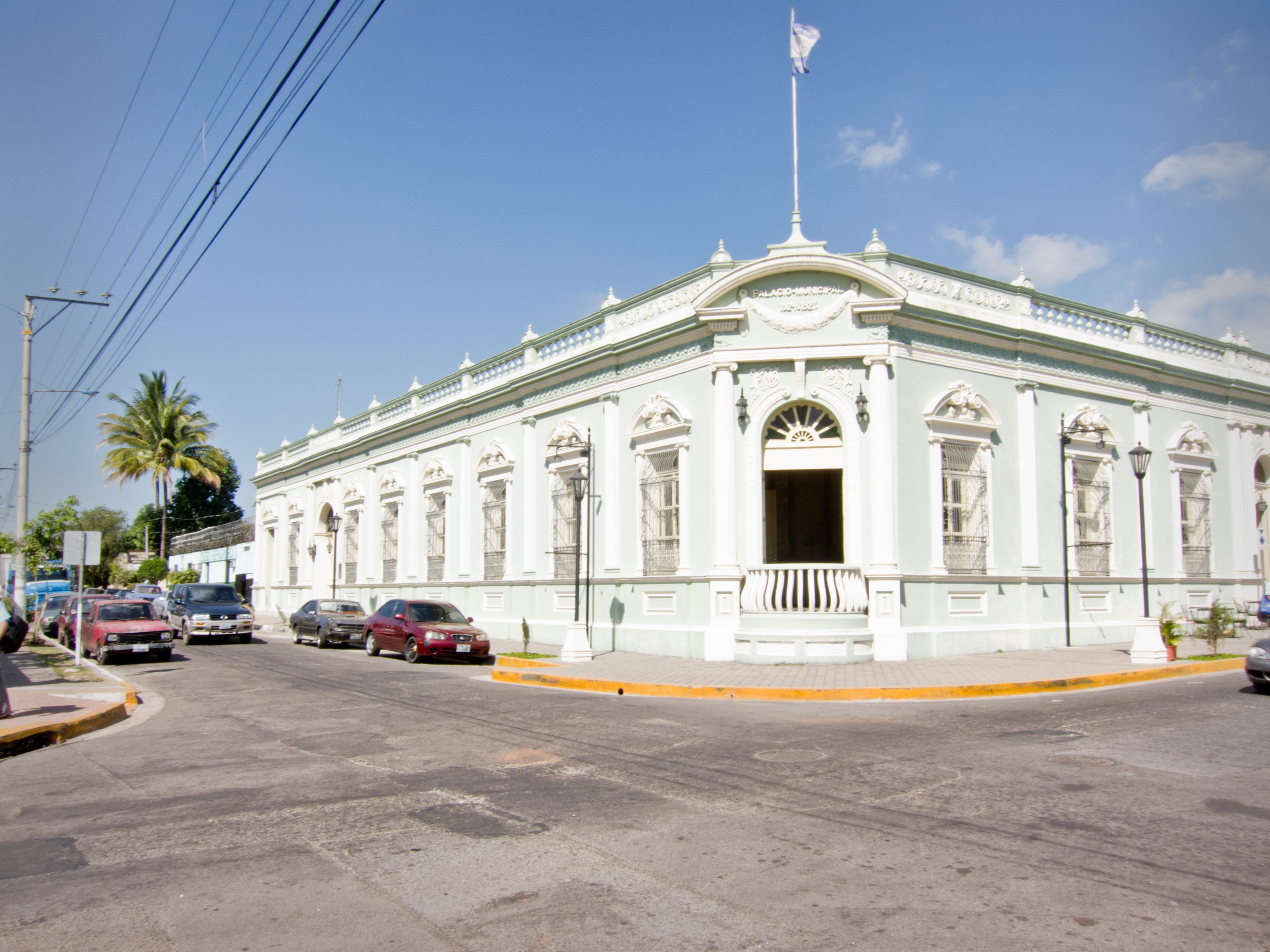
 Palacio Municipal de Bellas Artes of Santa Tecla. This building used to house the City Hall (Alcaldía).
On the other hand, as the courts have Cafetalón and Las Delicias, where professional football teams play. The municipality has one of the nation's largest sports complexes called Resume. In addition, Santa Tecla has its own gym basketball, Gym Adolfo Pineda.
Education
Regarding education, the city of Santa Tecla has approximately sixty public schools and several private schools. Santa Tecla has the lowest percentage of illiteracy in the department of La Libertad, with 9.5% of illiterate people.
Santa Tecla also has the distinction of being the first city in Central America where he founded an institute Salesian. This institute is the Salesian College Santa Cecilia, which is one of the most prestigious schools in Santa Tecla and the country of El Salvador.
Other schools and educational institutions are renowned Santa Tecla: Salesian College Santa Cecilia, St. Agnes College, Colegio Champagnat Colegio Belen Fatima College, Instituto Bethania, French School (French-Spanish), and the British Academy (English Britain).
In the area of higher education, Santa Tecla has one of the best universities in El Salvador, School of Economics and Business and Universidad Dr. Jose Matias Delgado. There are also several lesser universities the most famous American Technological University, UTLA.
Sister Cities
See also
- San Salvador
- Antiguo Cuscatlan
- San Salvador Department
- La Libertad Department
- Concepcion de Ataco
References
- ^ "Santa Tecla, Cronología" ISBN 99923-0-141-4 Recopilada por Dr. Juan José Contreras Callejas, Mauricio Alvarado Cea Campo, Ángela Margarita Alvarado: Consejo National para la Cultura y el arte, CONCULTURA, San Salvador 2004
- ^ http://archive.laprensa.com.sv/20040822/opinion/opinion1.asp La Prensa Grafica, 22. August 2004, La distinguida genealogía de los San Martín
- ^ "Un tenor lírico con raíces tecleñas" by Morena Azucena 22-09-04 VIDA, Page 106 http://www.elsalvador.com
External links
Coordinates: 13°41′N 89°17′W / 13.683°N 89.283°W
Capital: Santa TeclaMunicipalities · Antiguo Cuscatlán · Chiltiupán · Ciudad Arce · Colón · Comasagua · Huizúcar · Jayaque · Jicalapa · La Libertad · Nuevo Cuscatlán · Opico · Quezaltepeque · Sacacoyo · San José Villanueva · San Matías · San Pablo Tacachico · Santa Tecla · Talnique · Tamanique · Teotepeque · Tepecoyo · Zaragoza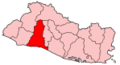
 Categories:
- Populated places in El Salvador
- Municipalities of the La Libertad Department
- Populated places established in 1854


Wikimedia Foundation. 2010.