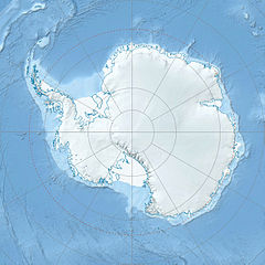
- Belgica Mountains
-
Coordinates: 72°35′S 31°15′E / 72.583°S 31.25°E Belgica Mountains is an isolated chain of mountains about 10 miles (16 km) long, standing 60 miles (97 km) east-southeast of the Sor Rondane Mountains in Queen Maud Land, in the Antarctic. The chain was discovered by the Belgian Antarctic Expedition (1957-58) under Gaston de Gerlache, and named after the ship Belgica, commanded by his father, Lt. Adrien de Gerlache, leader of the Belgian Antarctic Expedition of 1897-99.[1]
List of mountains
- Mount Bastin – 2,000 metres (6,562 ft) (72°32′S 31°15′E / 72.533°S 31.25°E)
A mountain standing 1 nautical mile (1.9 km) north of Mount Perov. Discovered by the Belgian Antarctic Expedition who named it for Captain Frank Bastin, who assisted in the scientific preparation of the expedition.[2]
- Mount Brouwer – 2,460 metres (8,071 ft) 72°35′S 31°26′E / 72.583°S 31.433°E
A mountain between Mount Hoge and Mount Launoit. Discovered by the Belgian Antarctic Expedition, 1957-58, who named it for Carl de Brouwer, a patron of the expedition.[3]
- Mount Gillet – 2,460 metres (8,071 ft) 72°34′S 31°23′E / 72.567°S 31.383°E
A mountain standing just north of Mount Van der Essen. Discovered by the Belgian Antarctic Expedition, 1957-58, who named it for Charles Gillet, a patron of the expedition.[4]
- Mount Hoge – 2,480 metres (8,136 ft) 72°34′S 31°23′E / 72.567°S 31.383°E
A mountain between Mount Van der Essen and Mount Brouwer. Discovered by the Belgian Antarctic Expedition, 1957-58, who named it for Edmond Hoge, member of the scientific committee of the expedition.[5]
- Mount Imbert – 2,495 metres (8,186 ft) 72°35′S 31°28′E / 72.583°S 31.467°E
A mountain standing close northeast of Mount Launoit in the east part of the mountain range. Discovered by the Belgian Antarctic Expedition, 1957-58, who named it for Bertrand Imbert, leader of the French Antarctic Expedition, 1956-57.[6]
- Mount Launoit – 2,470 metres (8,104 ft) 72°34′S 31°27′E / 72.567°S 31.45°E
A mountain between Mount Brouwer and Mount Imbert. Discovered by the Belgian Antarctic Expedition, 1958-59, who named it for Count de Launoit, President of the BRUFINA Society which gave financial assistance to the expedition.[7]
- Mount Perov – 2,380 metres (7,808 ft) 72°34′S 31°12′E / 72.567°S 31.2°E
A mountain just west of the terminus of Norsk Polarinstitutt Glacier. Discovered by the Belgian Antarctic Expedition, 1957-58, who named it for Commander V. Perov, Soviet pilot who came to the aid of four members of the Belgian Antarctic Expedition in December 1958.[8]
- Mount Van Mieghem – 2,450 metres (8,038 ft) 72°36′S 31°14′E / 72.6°S 31.233°E
A mountain standing 1 mi south of Mount Perov. Discovered by the Belgian Antarctic Expedition, 1957-58, who named it for Prof. Jacques Van Mieghem, president of the scientific committee of the expedition.[9]
- Mount Van der Essen – 2,525 metres (8,284 ft) 72°34′S 31°23′E / 72.567°S 31.383°E
A mountain just south of Mount Gillet. Discovered by the Belgian Antarctic Expedition, 1957-58, who named it for Alfred Van der Essen, director at the Ministry of Foreign Affairs and a patron of the expedition.[10]
- Mount Victor – 2,590 metres (8,497 ft) 72°36′S 31°16′E / 72.6°S 31.267°E
A mountain between Mount Van Mieghem and Mount Boe. It was discovered by the Belgian Antarctic Expedition, 1957-58, who named it for the French polar explorer Paul-Émile Victor, a counselor of the expedition.[11]
References
- ^ "Belgica Mountains". Geographic Names Information System, U.S. Geological Survey. http://geonames.usgs.gov/pls/gnispublic/f?p=gnispq:5:::NO::P5_ANTAR_ID:1183. Retrieved 2005-09-27.
- ^ "Mount Bastin". Geographic Names Information System, U.S. Geological Survey. http://geonames.usgs.gov/pls/gnispublic/f?p=gnispq:5:::NO::P5_ANTAR_ID:1063. Retrieved 2010-09-22.
- ^ "Mount Brouwer". Geographic Names Information System, U.S. Geological Survey. http://geonames.usgs.gov/pls/gnispublic/f?p=gnispq:5:::NO::P5_ANTAR_ID:2003. Retrieved 2010-06-12.
- ^ "Mount Gillet". Geographic Names Information System, U.S. Geological Survey. http://geonames.usgs.gov/pls/gnispublic/f?p=gnispq:5:::NO::P5_ANTAR_ID:5682. Retrieved 2009-02-18.
- ^ "Mount Hoge". Geographic Names Information System, U.S. Geological Survey. http://geonames.usgs.gov/pls/gnispublic/f?p=gnispq:5:::NO::P5_ANTAR_ID:6863. Retrieved 2010-06-12.
- ^ "Mount Imbert". Geographic Names Information System, U.S. Geological Survey. http://geonames.usgs.gov/pls/gnispublic/f?p=gnispq:5:::NO::P5_ANTAR_ID:7269. Retrieved 2008-03-20.
- ^ "Mount Launoit". Geographic Names Information System, U.S. Geological Survey. http://geonames.usgs.gov/pls/gnispublic/f?p=gnispq:5:::NO::P5_ANTAR_ID:8585. Retrieved 2010-06-12.
- ^ "Mount Perov". Geographic Names Information System, U.S. Geological Survey. http://geonames.usgs.gov/pls/gnispublic/f?p=gnispq:5:::NO::P5_ANTAR_ID:11629. Retrieved 2010-06-12.
- ^ "Mount Van Mieghem". Geographic Names Information System, U.S. Geological Survey. http://geonames.usgs.gov/pls/gnispublic/f?p=gnispq:5:::NO::P5_ANTAR_ID:15883. Retrieved 2010-06-12.
- ^ "Mount Van der Essen". Geographic Names Information System, U.S. Geological Survey. http://geonames.usgs.gov/pls/gnispublic/f?p=gnispq:5:::NO::P5_ANTAR_ID:15867. Retrieved 2010-06-12.
- ^ "Mount Victor". Geographic Names Information System, U.S. Geological Survey. http://geonames.usgs.gov/pls/gnispublic/f?p=gnispq:5:::NO::P5_ANTAR_ID:16027. Retrieved 2005-09-27.
Categories:- Mountain ranges of Queen Maud Land
- Mount Bastin – 2,000 metres (6,562 ft) (72°32′S 31°15′E / 72.533°S 31.25°E)
Wikimedia Foundation. 2010.

