- Głubczyce
Infobox Settlement
name = Głubczyce

imagesize = 250px
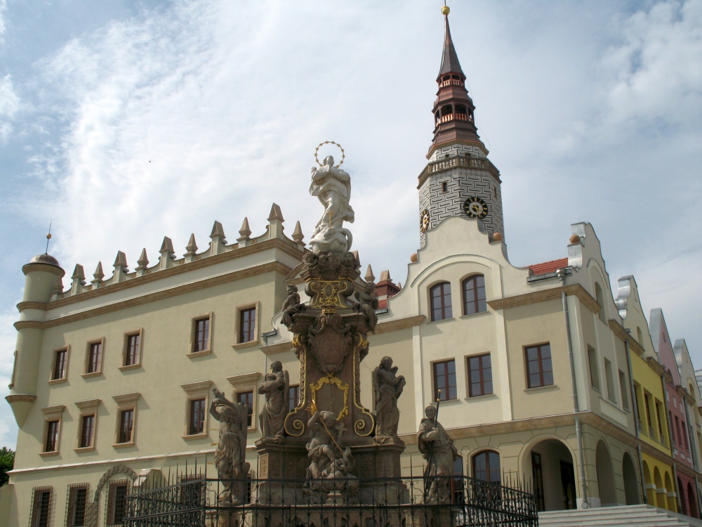
image_caption = Reconstructed town hall and a plague column on main square
image_shield = POL Głubczyce COA.svg
pushpin_
pushpin_label_position = bottom
subdivision_type = Country
subdivision_name = POL
subdivision_type1 = Voivodeship
subdivision_name1 = Opole
subdivision_type2 = County
subdivision_name2 =Głubczyce County
subdivision_type3 =Gmina
subdivision_name3 =Gmina Głubczyce
leader_title = Mayor
leader_name = Jan Krówka
established_title = Established
established_date = 12th century
established_title3 = Town rights
established_date3 = 13th century
area_total_km2 = 12.52
population_as_of = 2007
population_total = 13333
population_density_km2 = auto
timezone = CET
utc_offset = +1
timezone_DST = CEST
utc_offset_DST = +2
latd = 50 | latm = 12 | lats = 4 | latNS = N | longd = 17 | longm = 49 | longs = 29 | longEW = E
postal_code_type = Postal code
postal_code = 48-100
area_code = +48 77
blank_name = Car plates
blank_info = OGL
website = [http://www.glubczyce.pl/ www.glubczyce.pl] Głubczyce [IPA-pl|g|ł|u|p|'|cz|y|c|e] ( _cs. Hlubčice, _de. Leobschütz) is a town in southernPoland , near the border with theCzech Republic . It is located approximately 62 km (38 mi) fromOpole , and just northwest ofOstrava on the Psina River. It is part of Opole Voivodeship, and is the seat ofGłubczyce County .History
.
During this time, a wall stood around the city, complete with watchtowers and a
moat . A large church was also constructed in the town, and was assigned by Ottokar II to the Order of Saint John. In 1298, the town received expanded rights from Venceslaus II. The rights extended to the town were to serve as an example for other towns in the years that followed. In 1365, the town became the seat of a principality, and in 1482, the town was the seat of the Přemyslids. However, the last member of the family entered aFranciscan cloister. The city lost its status as a principality seat in 1503, and the principality ceased to exist. The city was transferred to the control of the principality of Jägerndorf (now Krnov).In 1523, the
Protestant Reformation reached the town, and in 1558, aLutheran church and school were built in the town. In response to this, Franciscans and Jews were expelled from the city. During theThirty Years' War , the city was completely destroyed, most devastatingly by the Swedes in 1645. The city came under the rule ofPrussia in 1743 and was made the capital city of its "Landkreis", or district. In 1781, the town's population stood at only, 2,637. In order to accommodate the city's expansion, the parts of the city's wall were torn down. The population stood at 4,565 in 1825, and 9,546 in 1870.After
Adolf Hitler came to power in 1933, the town hosted schools and training grounds for both the SS and the SA. The town'ssynagogue was burned down in 1938, the same year asKristallnacht . OnMarch 18 ,1945 ,Soviet troops began a siege of the city, which was resisted by the 18th SS Panzergrenadierdivision (Tank grenadiers) and the 371stWehrmacht sdivision. The siege ended onMarch 24 , and the Red Army occupied the town. Approximately forty percent of the town was destroyed in the siege. After the Soviet occupation, the name of the town was changed to Głubczyce, its current name. The city became seat of a county, orPowiat . Głubczyce lost that distinction in 1975, but regained it in 1999.Population over last decade
Gallery
External links
* [http://www.glubczyce.pl/ Municipal website]
* [http://www.leobschuetz.de/ Leobschuetz committee]
Wikimedia Foundation. 2010.

