- Iklin
Towns (Malta)
name = Iklin(L-Iklin)
coa = Iklin_coa.svg
motto =
official_name = L-Iklin
inhabitants_name = Ikliniż (m), Ikliniża (f), Ikliniżi (pl) (code: IKL)
other_names =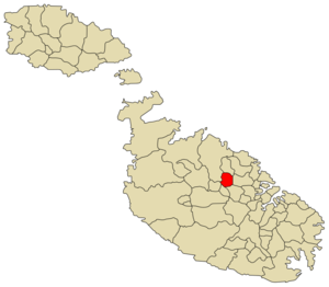
latitude = 35°54 '15"
longitude = 14°27 '16"
area = 1.7
population_total = 3,220 (Nov 2005)
population_density = 1,865
borders =Balzan ,Birkirkara ,Għargħur ,Lija ,Naxxar ,San Ġwann ,Swieqi
saint = holy Family
feast = of St. Michael Sunday beforeSeptember 29
mayor =Anthony Dalli (PN)
website = [http://www.iklin.gov.mt/ iklin.gov.mt]Iklin (English: Iclin) is a relatively modern village in the centre of
Malta , with a population of 3,203 people (Nov 2005), situated betweenBirkirkara ,Naxxar andLija . Iklin detached itself only recently from neighbouring village, Lija. A number of commercial outlets have more recently opened in the area. It also has its own Parish Church. This means that it does not depend any longer on Lija, which is its neighbouring village. In fact such celebrations as the first holy communion and confirmation are celebrated in the Iklin Chapel. Such activities which are organised each year include:
* "Jum l-Iklin" (Iklin's Day)
* a fund-raising activity for the Parish ChurchThere is a small chapel dedicated toSt. Michael . St. Michael's feast is celebrated the Sunday before the29 September . This current chapel seems to have been built in 1615, on the site of a previous chapel. Mgr. Dusina report of the Apostolic Visit in 1575 describes the chapel in a very poor state.Archaeological sites at Iklin
Even though Iklin has only recently developed (the first house was built in
1958 ), it still has a few minor sites of archaeological importance:* a
megalithic site, perhaps the remains of a temple was discovered in1967 by the Teenagers Din l-Art Ħelwa group from St. Aloysius' College. Unfortunately, this site has never been seriously surveyed or studied.
* a secondmegalithic site was studied in1986 during works on the new Birkirkara By-Pass, in the area known as Tar-Raddiena. Two large megaliths, and a few smaller ones are still visible (though often ignored) on this busy road. The ruins were dated, through pottery sherds found during excavation, to the Temple Period.
* the foundations of a Roman Villa were excavated in1975 during construction works. Unfortunately, the site - which seems to have been quite an interesting minor site - was destroyed soon after excavation, in the name of progress.Zones in Iklin
*Ta' Ġnien Fonsu (Alphons Garden's Village)
*Ta' Kieles
*Ta' Simblija
*Tat-Tabib (Doctor's Village)Iklin Main Roads
*Triq Dun Karm (Dun Karm By-Pass)
*Triq Geronimo Abos (Geronimo Abos Street)
*Triq il-Wied (Valley Street)
*Triq in-Naxxar (Naxxar Road)
*Triq San Mikiel (St Micheal Street)External links
* [http://www.iklin.gov.mt/ Iklin Local Council]

Wikimedia Foundation. 2010.