- Umfolozi River
-
Umfolozi River (uMfolozi) River Country South Africa Province KwaZulu-Natal Mouth - coordinates 28°23′32″S 32°25′27″E / 28.39222°S 32.42417°E 

The Umfolozi River (also uMfolozi, Imfolozi or Mfolozi) is a river in KwaZulu-Natal, a province of South Africa. It is formed by the confluence of the Black (Imfolozi emnyama) and White Umfolozi (Imfolozi emhlope) Rivers near the southeastern boundary of the Hluhluwe-Umfolozi Game Reserve. The isiZulu name imFolozi is generally considered to describe the zigzag course followed by both tributaries, though other explanations have been given.[1]
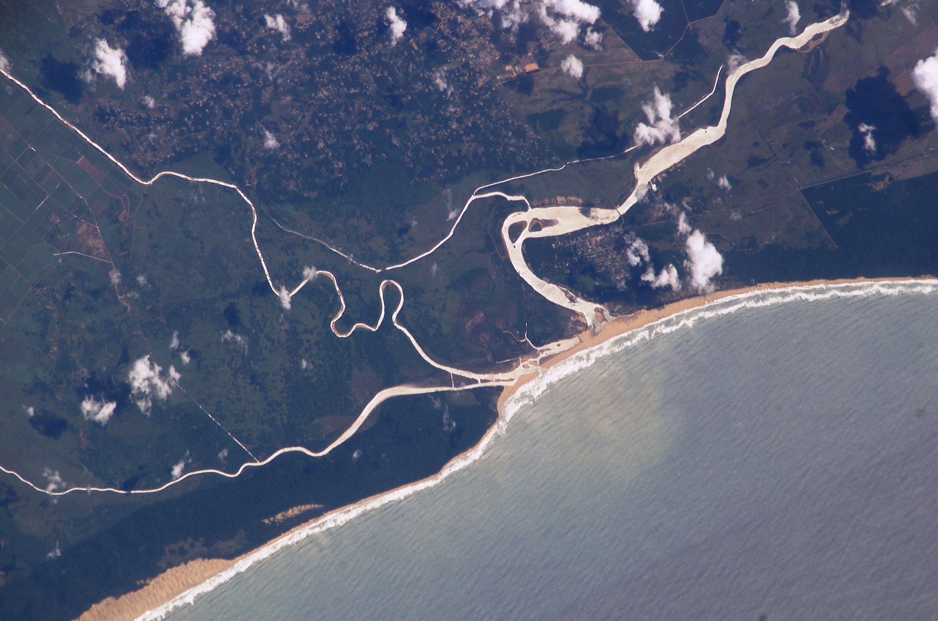
The river flows in an easterly direction to the Indian Ocean at Maphelana, a coastal resort just south of the St Lucia River mouth. It originally meandered over the Monzi Flats, where it split into numerous slow-flowing channels before entering the St. Lucia Estuary at Honeymoon Bend. The slow-moving water and reed beds in channels operated as a natural filtering system that removed silt from the Umfolozi floodwaters and created a rich habitat for numerous species.
During the 1950s, the Umfolozi Landowners Association contained and artificially channeled the river through the Monzi Flats to develop sugarcane farms. The new Umfolozi canal resulted in the unfiltered water depositing its silt load after entering the slower moving St. Lucia Estuary. This caused the estuary mouth to rapidly silt up. There had only been one record of this occurring until that time, during the sustained drought during the 1930s. At 28°20′58″S 31°58′46″E / 28.34944°S 31.97944°E the Black Umfolozi River and the White Umfolozi River, join to form the Umfolozi.
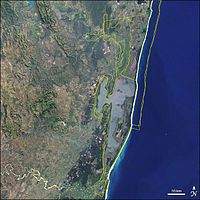
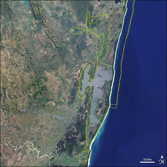
 The Umfolozi's new and old courses near the mouth. The Msunduzi River enters from the left (south), enclosing a wetland. Note silt plume in sea.
The government started a costly dredging operation in the estuary mouth area, but it proved ineffective. After years of dredging, the next plan was to prevent the Umfolozi River from entering the St Lucia estuary. The Umfolozi River was canalized straight out to sea at Maphelana. The impact of this decision continues; the silt plume from the river is often blown by strong south winds as far north as Sodwana Bay, 100 km away. The changes threaten the coral reefs, which provide fish habitat and protect the shore. In addition, it jeopardizes the associated good snorkeling available at Cape Vidal, part of iSimangaliso Wetland Park, a UNESCO World Heritage Site.
External links
See also
- List of rivers of South Africa
- List of reservoirs and dams in South Africa
- List of Water Drainage Area's of South Africa
- Water Management Areas
References
Categories:- Rivers of South Africa
- Umfolozi River
- South Africa geography stubs

Wikimedia Foundation. 2010.