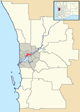
Naval Base, Western Australia
Look at other dictionaries:
Naval base — The French Navy has a flotilla based in Réunion, comprising (from left to right on the photo): the Southern patrol ship Albatros, the frigate Floréal, the P400 class patrol vessels La Rieuse and La Boudeuse and the patrol boat of the Gendarmerie… … Wikipedia
Western Australia — Western Australian. a state in W Australia. 1,273,624; 975,920 sq. mi. (2,527,635 sq. km). Cap.: Perth. * * * State (pop., 2001: 1,906,114), western Australia. Covering 976,790 sq mi (2,529,880 sq km), it constitutes one third of the continent s… … Universalium
Garden Island (Western Australia) — Garden Island is a slender island about ten kilometres long and one and a half kilometres wide, lying about five kilometres off the Western Australian coast.(coord|32|11|36|S|115|40|16|E|type:isle region:AU)Like Rottnest Island and Carnac Island … Wikipedia
Hope Valley, Western Australia — Infobox Australian Place | type = suburb name = Hope Valley city = Perth state = wa caption = lga = Town of Kwinana postcode = 6165 est = pop = 213 (2006 census)Census 2006 AUS|id=SSC51651|name=Hope Valley (State Suburb)|quick=on|accessdate=2008… … Wikipedia
Pelican Point, Western Australia — Infobox Australian Place | type = suburb name=Pelican Point city=Bunbury state=wa caption= lga=City of Bunbury area=2.2 postcode=6230 pop=765 (2006 Census) dist1=6 | location1=Bunbury est=1997 fedgov=Forrest stategov=Leschenault propval=$610,000… … Wikipedia
Kwinana Beach, Western Australia — Infobox Australian Place | type = suburb name = Kwinana Beach city = Perth state = wa caption = lga = Town of Kwinana postcode = 6167 stategov = Kwinana fedgov = Brand near nw = near n = Naval Base near ne = Hope Valley near w = near e = Postans… … Wikipedia
Exmouth, Western Australia — Infobox Australian Place | type = town name = Exmouth state = wa caption = Location of Exmouth, Western Australia lga = Shire of Exmouth postcode = 6707 est = 1964 pop = 1,844 pop footnotes= elevation= elevation footnotes= loc x = 21 loc y = 127… … Wikipedia
Fremantle, Western Australia — Infobox Australian Place | type = suburb name = Fremantle city = Perth state = wa caption = Aerial view of Fremantle port lga = City of Fremantle postcode = 6160 est = 1829 pop = 7,643Census 2001 AUS|id=SSC51481|name=Fremantle (State… … Wikipedia
List of major roads in Perth, Western Australia — This page details the major roads in the greater Perth conurbation, in Western Australia.A list of the routes (most involving multiple roads) is available at List of road routes in Perth, Western Australia.Freeways in Perth (by road route… … Wikipedia
List of road routes in Perth, Western Australia — This is a list of the road routes in Perth, Western Australia. A list of road routes in Rural Western Australia is available at List of road routes in rural and remote Western Australia.For a list of freeways, highways and roads, see List of… … Wikipedia

