- Audnedal
Infobox Kommune
name = Audnedal
idnumber = 1027
county = Vest-Agder
landscape = Sørlandet
capital =Byremo
demonym = Audnedøl
language = Neutral
munwebpage = www.audnedal.kommune.no
governor = Tønnes Seland (Bygdelista)
governor_as_of = 2003
arearank = 302
area = 251
arealand = 236
areapercent = 0.08
population_as_of = 2004
populationrank = 362
population = 1,568
populationpercent = 0.03
populationdensity = 7
populationincrease = -0.6
lat_deg = 58 | lat_min = 22 | lat_sec = 48 | lon_deg = 7 | lon_min = 22 | lon_sec = 12
utm_zone = 32V | utm_northing = 6472178 | utm_easting = 0404696 | geo_cat = adm2ndAudnedal is a municipality in the county of
Vest-Agder ,Norway . The new municipality of Audnedal was created on 1 January 1964 after the merger ofGrindheim andKonsmo .The old municipality (see
Undal ) had quite different borders: It was established as a municipality on 1 January 1838 (seeformannskapsdistrikt ) but in 1845 it was divided intoNord-Audnedal (divided inKonsmo andVigmostad in 1911) andSør-Audnedal (Spangereid separated in 1899).It is an inland municipality, and
Åseral municipality borders it to the north,Hægebostad to the west,Lyngdal andLindesnes to the south, andMarnardal to the east. In the north-east it bordersEvje og Hornnes in the county ofAust-Agder .General information
Name
The
Old Norse form of the name was "Auðnudalr". The first element is thegenitive case of the river name "Auðna" (nowAudnedalselva ) and the last element is "dalr" which means "valley " or "dale". The river name is derived from the Norse word "auðn" which means "destruction" (because of flooding).Coat-of-arms
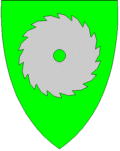
The coat-of-arms is from modern times. They were granted on 30 August 1991. It shows a blade of a
circular saw to represent the timber and forestry industries in the municipality. [cite web|url=http://www.ngw.nl/int/nor/a/audnedal.htm|author=Norske Kommunevåpen|date=1990|title=Nye kommunevåbener i Norden|accessdaymonth=27 September|accessyear=2008]Attractions
*Recommended
hiking trips, among other places in the area, are "Blomliknuten".*The local
museum located on Sveindal is also a noteworthy visit.*If you enjoy the art of
fishing , you should drop by the river "Mandalselva".Salmon weighing several kilograms can be caught here.References
Wikimedia Foundation. 2010.