- Suldal
Infobox_Kommune
name = Suldal
idnumber = 1134
county = Rogaland
landscape = Ryfylke
capital = Sand
governor = Andreas Drarvik (Sp)
governor_as_of = 2003
arearank = 39
area = 1736
arealand = 1588
areapercent = 0.54
population_as_of = 2004
populationrank = 235
population = 3,895
populationpercent = 0.09
populationdensity = 2
populationincrease = -4.9
language = Nynorsk
lat_deg = 59 | lat_min = 28 | lat_sec = 6 | lon_deg = 6 | lon_min = 29 | lon_sec = 59
utm_zone = 32V | utm_northing = 6594877 | utm_easting = 0358343 | geo_cat = adm2nd
munwebpage = www.suldal.kommune.noSuldal is a municipality in the northeast of
Rogaland county,Norway located in theRyfylke historically traditional district.The parish of "Suledal" was established as a municipality January 1, 1838 (see
formannskapsdistrikt ). Søvde was separated from Suldal in 1842. The municipalities ofErfjord and Sand, most of Jelsa, and some parts ofImsland andVikedal , were merged with Suldal January 1, 1965.On the north the municipality is bordered by
Sauda andOdda , on the east byVinje andBykle , on the south byHjelmeland , and on the west byVindafjord . Across theJelsafjord and Vindafjord lieFinnøy andTysvær municipalities.The
Sandsfjord andHylsfjord lie within Suldal, as does lakeSuldalsvatnet . TheSaudafjord lies partially within the boundary of Suldal. TheErfjord and the lakeBlåsjø also lie on the boundary of Suldal.Sand i Ryfylke, is a village in Suldal.
The name
The Norse form of the name was "Súladalr". The first element is probably the plural genitive case of "súla" f 'pillar, column' (and then referring to the mountain pass
Suldalsporten ), the last element is "dalr" m 'valley, dale'.Until 1891 the name was written "Suledal".
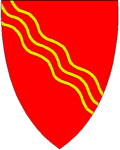
Coat-of-arms
The coat-of-arms is from modern times (1976). The lines represent the river of
Suldalslågen .History
Suldal municipality has a long history of trade connections to the
Setesdal valley to the east. The main mountain plateau trade route led east from Suldal municipality in Rogaland toBykle municipality inAust-Agder county.
Wikimedia Foundation. 2010.