- Tikhatar
-
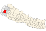
Tikhatar — Village development committee — Location in Nepal Coordinates: 29°10′N 81°01′E / 29.16°N 81.01°ECoordinates: 29°10′N 81°01′E / 29.16°N 81.01°E Country  Nepal
NepalZone Seti Zone District Doti District Population (1991) - Total 5,222 Time zone Nepal Time (UTC+5:45) Tikhatar is a village development committee in Doti District in the Seti Zone of western Nepal. At the time of the 1991 Nepal census it had a population of 5222 people living in 958 individual households.[1]
References
- ^ "Nepal Census 2001". Nepal's Village Development Committees. Digital Himalaya. http://www.digitalhimalaya.com/collections/nepalcensus/form.php?selection=1. Retrieved 19 November 2008.
History
This village developement committee has a great history of itself. The war between Gorkha and Kingdom of Doti was fougt at bank of the seti river. Malla of Budhakot, Bogtan and Shahi of Dumrakot (this VDC) fought war against Nepali Gorkha,s expansion. There is a front(battel field) called NAARI-DANG and reinforcement camp at Kuthakot (most probably this place is also in this VDC)
External links
Banalek · Banja Kakani · Barchhen · Basudevi · Bhawardanda · Bhdhegau · Bhumirajmandau · Changra · Chhapali · Chhatiwan · Dahakalikasthan · Daud · Dhanglagau · Dhirkamandau · Durgamandau · Gadasera · Gaguda · Gaihragau · Ganjari · Ghanteswor · Girichauka · Jijodamandau · Kadamandau · Kalena · Kalikasthan · Kanachaur · Kapalleki · Kedar Akhada · Khatiwada · Khirsain · Ladagada · Lamikhal · Lana Kedareswor · Latamandau · Laxmi Nagar · Mahadevsthan · Mannakapadi · Mudabhara · Mudhegau
· Nirauli · Pachanali · Pokhara · Ranagau · Sanagau · Saraswotinagar · Satphari · Simchaur · Tijali · Tikha · Tikhatar · Toleni · Wagalek · Warpata Categories:
- Populated places in Doti District
- Seti Zone geography stubs
Wikimedia Foundation. 2010.

