Orava Magura

Orava Magura
Orava Magura

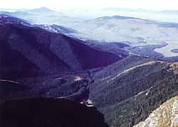
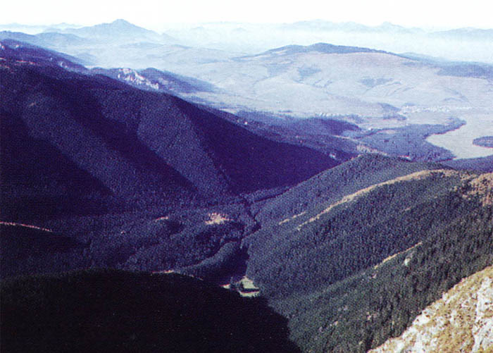
The Orava Magura (in Slovak, Oravská Magura) is a mountain range in the Žilina Region of northern central Slovakia. The range is part of the Central Beskids, which are themselves part of the Outer Western Carpathians.

The Orava Magura is a sandstone massif, densely forested, with primarily spruce and beech, with cultivated birch and hazel. The highest peak of the range is Minčol, 1394 meters, along with Paracel (1325 meters), Buda (1222 meters), and some others.

The most important tourist resorts include Tvrdošín, Zázrivá, and Dolný Kubín. The region is also home to the Horná Orava Protected Landscape Area.


Wikimedia Foundation. 2010.

Игры ⚽ Поможем решить контрольную работу

Look at other dictionaries:

  • Landschaftsschutzgebiet Horná Orava — Chránená krajinná oblasť Horná Orava Oravská Magura …   Deutsch Wikipedia

  • Oravská Magura — 49.28333333333319.333333333333 Koordinaten: 49° 17′ N, 19° 20′ O …   Deutsch Wikipedia

  • Horná Orava Protected Landscape Area — Infobox protected area name = Horná Orava Protected Landscape Area CHKO Horná Orava iucn category = V caption = Oravská Magura Mts. location = Northern Slovakia lat degrees = 49 lat minutes = 34 lat seconds = lat direction = N long degrees = 19… …   Wikipedia

  • Waldeisenbahn Orava — Waldbahn Vychylovka Streckennummer: 910 (417) Streckenlänge: 29,024 km Spurweite: 760 mm (Bosnische Spur) Maximale Neigung …   Deutsch Wikipedia

  • Divisions of the Carpathians — Map of the main divisions of the Carpathians. 1. Outer Western Carpathians 2. Inner Western Carpathians 3. Outer Eastern Carpathians 4. Inner Eastern Carpathians 5. Southern Carpathians 6. Western Romanian Carpathians 7. Transylvanian Plateau 8.… …   Wikipedia

  • Secciones de los Cárpatos — Mapa de las principales secciones de los Cárpatos. 1. Cárpatos occidentales exteriores 2. Cárpatos occidentales interiores 3. Cárpatos orientales exteriores 4. Cárpatos orientales interiores 5. Cárpatos meridionales 6. Cárpatos rumanos… …   Wikipedia Español

  • Gliederung der Karpaten — Die Gliederung der Karpaten ist nicht einheitlich festgelegt. Während z. B. in der Slowakei eine flächendeckende, systematische Einteilung existiert, gibt es insbesondere für die Ukraine nur lückenhafte, teilweise auch widersprüchliche… …   Deutsch Wikipedia

  • Námestovo — Coordinates: 49°24′10″N 19°28′53″E / 49.40278°N 19.48139°E / 49.40278; 19.48139 …   Wikipedia

  • Waldbahn Vychylovka — Streckennummer (DB): 910 (417) Streckenlänge: 29,024 km Spurweite: 760 mm (Bosnische Spur) Maximale …   Deutsch Wikipedia

  • Geomorphological division of Slovakia — This page gives an overview of the geomorphological division of Slovakia. It is ordered in a hierarchical form, belonging to the Alps Himalaya System and to the sub systems of the Carpathian Mountains and of the Pannonian Basin. These subsystems… …   Wikipedia

Share the article and excerpts

Direct link
Do a right-click on the link above
and select “Copy Link”