Orakei Basin

Orakei Basin
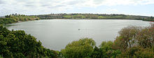
View of Orakei Basin looking north-east.

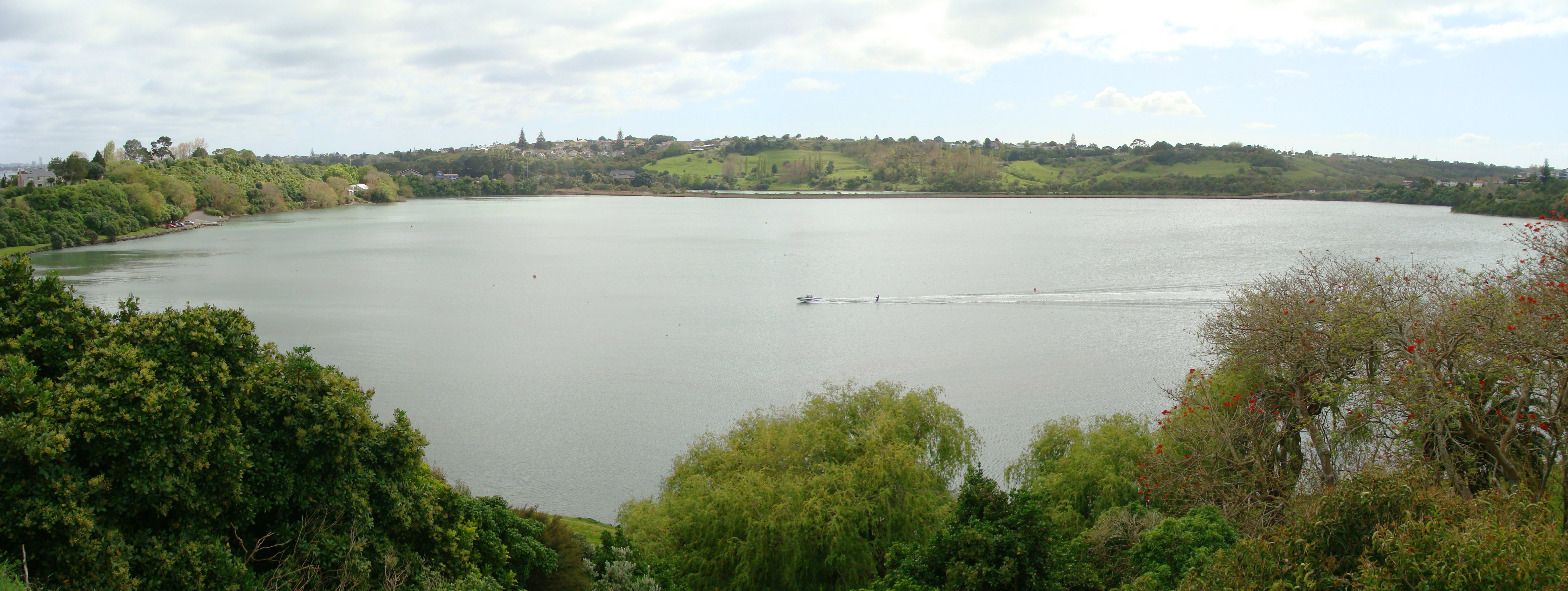
Orakei Basin is one of the volcanoes in the Auckland Volcanic Field. It has an explosion crater around 700 m wide, with a surrounding tuff ring. After eruption about 85,000 yrs ago, it became a freshwater lake that had an overflow stream in the vicinity of present Orakei Rd bridge. As sea level rose after the end of the Last Ice Age, the lake, which by then had shallowed to a swamp, was breached by the sea and has been a tidal lagoon ever since. A tidal lagoon, it is popular for watersports. A railway line (the North Island Main Trunk, branded as the Eastern Line for suburban services) runs through the north side of the basin.

References

  • City of Volcanoes: A geology of Auckland - Searle, Ernest J.; revised by Mayhill, R.D.; Longman Paul, 1981. First published 1964. ISBN 0-582-71784-1.
  • Volcanoes of Auckland: The Essential Guide. Hayward, B.W., Murdoch, G., Maitland, G.; Auckland University Press, 2011.

Coordinates: 36°52′02″S 174°48′47″E / 36.867124°S 174.81308°E / -36.867124; 174.81308


Wikimedia Foundation. 2010.

Игры ⚽ Поможем написать реферат

Look at other dictionaries:

  • Orakei — View of Hobson Bay looking northwards with Orakei visible in the far right distance, under Rangitoto Island. Basic information Local authority Auckland City …   Wikipedia

  • Remuera — Infobox New Zealand suburbs name =Remuera caption1 =Location of Remuera city1 =Auckland City city2 = ward = established = area = population =6,324 popdate =2001 trainstations = ferryterminals = airports = hospitals = north =(Hobson Bay )… …   Wikipedia

  • Auckland volcanic field — The Auckland volcanic field is a generally monogenetic volcanic field in the North Island of New Zealand. Basaltic in nature, it underlies much of the metropolitan area of Auckland. The field s many vents have produced a diverse array of… …   Wikipedia

  • Waitemata Harbour — The Waitemata Harbour is the main access by sea to Auckland, New Zealand. For this reason it is often referred to as Auckland Harbour , despite the fact that it is only one of two harbours surrounding the city, and is crossed by the Auckland… …   Wikipedia

  • Geyser — For other uses, see Geyser (disambiguation). Strokkur geyser, Iceland …   Wikipedia

  • Auckland — This article is about the Auckland metropolitan area. For the wider region, see Auckland Region. For the local authority, see Auckland Council. For all other uses, see Auckland (disambiguation). Auckland Tāmaki Makaurau (Māori)   Main… …   Wikipedia

  • Taupo-Vulkanzone — Mount Ngauruhoe Satellitenfoto des Lake Taupo …   Deutsch Wikipedia

  • Freemans Bay — Infobox New Zealand suburbs name = Freemans Bay caption1 = city1 = Auckland City city2 = ward = established = 1840s area = population = 3,678 popdate = 2001 trainstations = ferryterminals = airports = hospitals = north = Western Reclamation… …   Wikipedia

  • Auckland — Saltar a navegación, búsqueda Para otros usos de este término, véase Auckland (desambiguación). Auckland …   Wikipedia Español

  • Géiser — Clepsydra en Yellowstone. Un géiser (islandés …   Wikipedia Español

Share the article and excerpts

Direct link
Do a right-click on the link above
and select “Copy Link”