Olsztyn, Silesian Voivodeship
Look at other dictionaries:
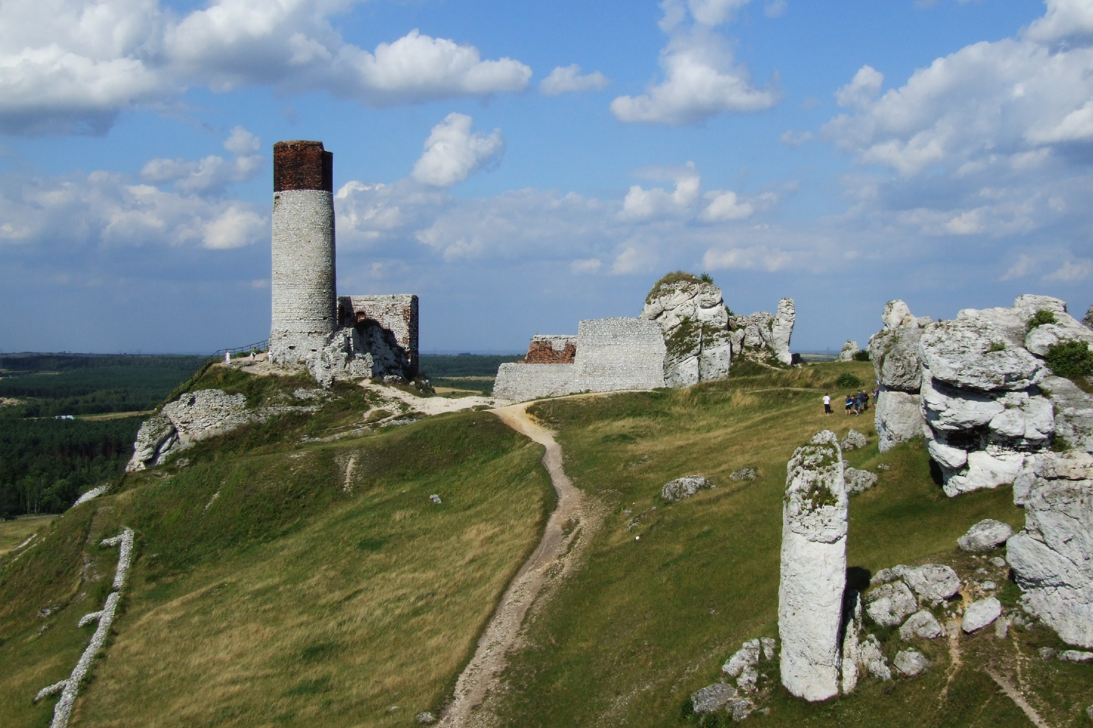
Olsztyn (disambiguation) — Olsztyn (formerly Allenstein) is a city in north eastern Poland. Olsztyn may also refer to: Olsztyn Voivodeship, a former administrative unit in Poland Olsztyn, Silesian Voivodeship, a village in south Poland with ruins of a 14th century castle… … Wikipedia
Gmina Janów, Silesian Voivodeship — Infobox Settlement name = Gmina Janów other name = Janów Commune settlement type = Gmina total type = Total image shield = POL gmina Janów (pow częstochowski) COA.svg subdivision type = Country subdivision name = POL subdivision type1 =… … Wikipedia
Voivodeship — This article concerns both historical and contemporary voivodeships in various countries. For more on the divisions of modern and historical Poland, see Voivodeships of Poland. A voivodeship, also spelled voivodship, voivodina or vojvodina… … Wikipedia
Warmian-Masurian Voivodeship — Województwo warmińsko mazurskie Voivodeship … Wikipedia
Gmina Olsztyn — Olsztyn Commune Gmina Coordinates (Olsztyn) … Wikipedia
Częstochowa Voivodeship — (Polish: województwo częstochowskie) was a unit of administrative division and local government in Poland in years 1975–1998, superseded mainly by Silesian Voivodeship, with a few eastern gminas attached to the freshly created Świę … Wikipedia
List of counties in Poland — Division of Poland into powiats (counties) … Wikipedia
List of Polish gminas/O — *Gmina Oborniki (urban rural, Oborniki County, Greater Poland Voivodeship, 340.16 km², 31,541) *Gmina Oborniki Śląskie (urban rural, Trzebnica County, Lower Silesian Voivodeship, 153.75 km², 17,838) *Gmina Obrazów (rural, Sandomierz County,… … Wikipedia
List of Polish gminas/S — *Gmina Sabnie (rural, Sokołów County, Masovian Voivodeship, 107.92 km², 3,941) *Gmina Sadki (rural, Nakło County, Kuyavian Pomeranian Voivodeship, 153.69 km², 7,149) *Gmina Sadkowice (rural, Rawa County, Łódź Voivodeship, 121.08 km², 5,725)… … Wikipedia
List of Polish gminas/B — *Gmina Babiak (rural, Koło County, Greater Poland Voivodeship, 133.58 km², 7,920) *Gmina Babice (rural, Chrzanów County, Lesser Poland Voivodeship, 54.47 km², 8,803) *Gmina Babimost (urban rural, Zielona Góra County, Lubusz Voivodeship, 92.75 km² … Wikipedia


 Olsztyn
 Poland