- Olle road
-
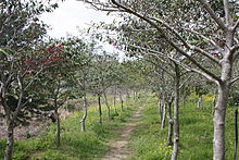
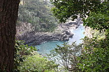
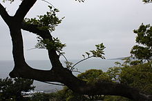
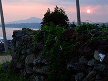
Ollegil (Olle road) refers to a 12-route walking trail in Jeju Island, South Korea. Aided by a recent "walking boom" in South Korea, Ollegil is now a tourist attraction, which attracts not only visitors from mainland South Korea, but also foreigners who have a taste for hiking; according to a 2008 statistic on the official Ollegil web, over 1.2 million people visited Ollegil and it brought a $25 billion in economic benefits to South Korea.[1]
Contents
Origin of its name
The term Ollegil is made up of two parts: "Olle" and "gil." While "gil" is an ordinary Korean word for a pathway or a road (which can also be used as suffix), "Olle" is a distinctive Jeju dialect.
The official Ollegil website explains the meaning of its name as the following: Olle is the Jeju word for a narrow pathway that is connected from the street to the front gate of a house.... It has the same sound as would you come? in Korean, so Jeju's Olle sounds the same as Would you come to Jeju?[2]
Combining these two terms, a neologism "Ollegil" was formed, referring to the hiking course developed in Jeju Island.
Opening the Ollegil
Ollegil was founded by Suh Myungsook, who used to be the chief editor of Sisa Journal, a South Korean weekly news magazine. Exhausted after all the strenuous years as the chief editor, she felt a need to refuel herself. As the way to refresh herself, she walked Camino de Santiago. Suh Myungsook was highly impressed and inspired from the trip, so she decided to make a similar hiking trail—but, in her own home town of Jeju Island, South Korea. After organizing a team for her goal, she started a time consuming project for discovering [or more precisely creating] walkable roads in Jeju. Roads cars can't go or pathways that barely had a touch of human hand all fell under her project. Finally, in September 2007, Suh Myungsook was able to open her first trail route to public. She and her team continued to explore Jeju Island, and the total length of pathways that are together called Ollegil now adds up to 200 km.[3]
Routes
Route 1
It was open to public in September 2007. It is the first one to be opened among 12 routes in Jeju Island. "Walkers can experience views of the magnificent sea and unique oreum (small inactive volcanoes) on the route."[4]
Route 2
Visitors can enjoy Jeju Island's eastern coastline as they walk by. They can also take a look at Honinji, a wedding pond with a special myth attached to it.[5]
Route 3
At the Tong Oreum and Dokjabong, visitors can experience both the beautiful scenery and the volcanic hills of Jeju Island. Along the route, there is a Kim, Young-gab Gallery, which visitors may find enjoyable.[6]
Route 4
Walkers can see traditional women divers called "Haeyno" during their hike. They can also enjoy the path in Ganungae, which has recently been restored after 35 years. Mang Oreum and Gusun Saemi also provide beautiful scenery.[7]
Route 5
Seongsan Ilchulbong can be seen clearly from this path, and visitors can enjoy the sea atmosphere as they walk.[8]
Route 6
Visitors are leaded to the streets of Seogwipo city, where they can experience the local life as well as visit the famous Korean painter Lee, Joong-seop's residence. Beginning hikers tend to find this course easier than other routes.[9]
Route 7
As a seaside walking trail, walkers can enjoy the beautiful coastline of the island. Along the Subong-ro, hikers can enjoy in the midst of pampas grass and wild flowers.[10]
Route 8
Only divers in Jeju Island used to use this trail. Visitors to Jusangjoelli can see stone pillars from the eruption of Mt. Halla.[11]
Route 9
This course is distinctive in the sense that its road passes through valleys. For instance, hikers walk through Andeok Valley, a forested valley.[12]
Route 10
When hikers reach the peak of Mt. Songak, they can see Marado, the southernmost island of Korea. Visitors can also see Mt. Sanbag, the mountain that formed Jeju Island with its eruption.[13]
Route 11
On this route, visitors can experience the history of Korea and Jeju Island at Alturu Airfield, Udal Oreum, and sacred ground of Jung.[14]
Route 12
Visitors can enjoy the fields, coasts, and oreums of Jeju altogether on this course.[15]
Route signs
Suh Myungsook had a clear principle when she worked on the route signs of Ollegil: to only use a sign in forks, to use eco-friendly materials, and to make it go along with nature but easily seen.
She was inspired by the route signs she saw in Santiago. The signs were made up of shells or rocks, and only yellow arrows were painted on them. Similarly but distinctively, She decided to lacquer blue arrows on rocks, because blue was the color that people walking on Ollegil could always see in the skies and seas of Jeju. For the routes on which she could not find rocks, she tied blue ribbons on nearby trees. However, she soon found it necessary to slightly alter her original plan; Spraying lacquer could damage rocks, a consequence that conflicted with her conviction to not harm nature. In this context, instead of lacquering the arrows with blue, Suh Myungsook chose to paint the arrows. Meanwhile, a few hikers complained that they could not see the blue ribbons well enough, so she tied a yellow ribbon along with the blue one so that the signs could be better seen.[16] In addition, Ganse(간세), the symbol of the Olle Road, and the name of a pony, became one of route signs.[17]
The ripple effect of Ollegil
The popularity and support people gave to Ollegil has influenced other South Korean regional districts to model Ollegil and come up with their own regional variation of it: Dullegil of Jirisan, Jigetgil of South Sea, and Yetgil of Mudeungsan.[18] The local government of Chungcheongnam-do also has plans to expand its trails and build walking routes modeled after Ollegil ("Solbaramgil") in its 16 counties.[19]
Ollegil nearly became a byword for trails in South Korea; New trails are often compared to Ollegil or described as a regional variation of Ollegil when they are first introduced. One news article depicted the trail going around Bukhansan as a "Ollegil in the heart of the city."[20].
References
- ^ [1]
- ^ http://www.jejuolle.org:8080/eng/about/ab_intro.html
- ^ http://www.jejuolle.org:8080/eng/about/ab_intro.html
- ^ http://www.jejuolle.org:8080/eng/course/co_course.html?csno=1
- ^ http://www.jejuolle.org:8080/eng/course/co_course.html?csno=2
- ^ http://www.jejuolle.org:8080/eng/course/co_course.html?csno=3
- ^ http://www.jejuolle.org:8080/eng/course/co_course.html?csno=4
- ^ http://www.jejuolle.org:8080/eng/course/co_course.html?csno=5
- ^ http://www.jejuolle.org:8080/eng/course/co_course.html?csno=6
- ^ http://www.jejuolle.org:8080/eng/course/co_course.html?csno=7
- ^ http://www.jejuolle.org:8080/eng/course/co_course.html?csno=8
- ^ http://www.jejuolle.org:8080/eng/course/co_course.html?csno=9
- ^ [2]
- ^ http://www.jejuolle.org:8080/eng/course/co_course.html?csno=11
- ^ http://www.jejuolle.org:8080/eng/course/co_course.html?csno=12
- ^ Suh Myungsook, "제주 걷기 여행" p. 265–272
- ^ https://www.jejuolle.org/story/ganseStory.jsp
- ^ http://www.kado.net/news/articleView.html?idxno=488435
- ^ http://news.donga.com/3/all/20100811/30454153/1
- ^ http://news.sbs.co.kr/section_news/news_read.jsp?news_id=N1000785240
External links
Categories:- Visitor attractions in Jeju-do
Wikimedia Foundation. 2010.


