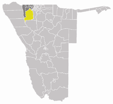
Okahao

Okahao
Okahao constituency

Okahao is a town in the Omusati Region of northern Namibia and the district capital of the Okahao electoral constituency. It is situated in the Ongandjera tribal area 73 kilometers west of Oshakati on the main road MR123 (Outapi - Tsandi - Okahao).

The area around Okahao is flat, arable land which is mainly used for subsistence farming.

Contents

Infrastructure

Okahao has an airstrip (ICAO code: FYOH,[1] IATA code: none), a clinic, and two hospitals.[citation needed]

Okahao has one combined school (Nangombe Combined School), one primary school (Okahao Primary School), and one private school. There is also the Okahao community library, a Police station and a prison. Several ministries have representation in the town. The Ongozi Lodge caters for tourists.[citation needed]

As of November 2009, the mayor of Okahao was David Uuzombala Isai.[2]

Political instability

In the run up to the 2009 general election, campaigners for the Rally for Democracy and Progress were driven out of the town by school children.[3]

External links

References

Coordinates: 17°53′S 15°6′E / 17.883°S 15.1°E / -17.883; 15.1


Wikimedia Foundation. 2010.

Игры ⚽ Нужна курсовая?

Look at other dictionaries:

  • Okahao — Details …   Deutsch Wikipedia

  • Okahao Constituency — in the Omusati Region Okahao Constituency is an electoral constituency in the Omusati Region of Namibia. It has 26,035 inhabitants,[1] its district capital is the settlement of Okahao …   Wikipedia

  • Liste der Krankenhäuser in Namibia — Dies ist eine Liste der Krankenhäuser, Gesundheitszentren und Kliniken in Namibia. Das Gesundheitssystem in Namibia wird vom Ministerium für Gesundheit und Soziale Dienste (englisch Ministry of Health Social Services) koordiniert und… …   Deutsch Wikipedia

  • Ongandjera — is settlement near Okahao in the Omusati Region northern Namibia. Historically part of Ovamboland, Ongandjera is also a traditional kingship. It is the birthplace of Sam Nujoma, the country s first President.[1] In 1917, South Africa stripped the …   Wikipedia

  • Omusati Region —   Region   Location of the Omusati Region in Namibia Country Namibia …   Wikipedia

  • Liste der Nationalen Denkmäler in Namibia — Inhaltsverzeichnis 1 Archäologie 1.1 Relikte 1.2 Felsgravuren 1.3 Felsmalereien 2 …   Deutsch Wikipedia

  • Liste der Wahlkreise in Namibia — Namibia besteht aus 13 Regionen, in denen es insgesamt 107 Wahlkreise gibt. Diese sind für die allgemeine Wählerregistrierung und die Regionalratswahlen von Bedeutung. Im Rahmen der Wahl zur Nationalversammlung und der Präsidentschaftswahl kann… …   Deutsch Wikipedia

  • Ombalantu — Details …   Deutsch Wikipedia

  • Sam Nujoma — Sam Nujoma, 2003 Samuel Daniel Shafiishuna Nujoma (meistens nur Sam Nujoma genannt, * 12. Mai 1929 in Ongandjera bei Okahao in der Region Omusati, Südwestafrika, heute Namibia) war vom 21. März 1990 bis zum 20. März 2005 Präsident der Republik… …   Deutsch Wikipedia

  • Uutapi — Details …   Deutsch Wikipedia

Share the article and excerpts

Direct link
Do a right-click on the link above
and select “Copy Link”