- Ocean Park (Santurce)
-
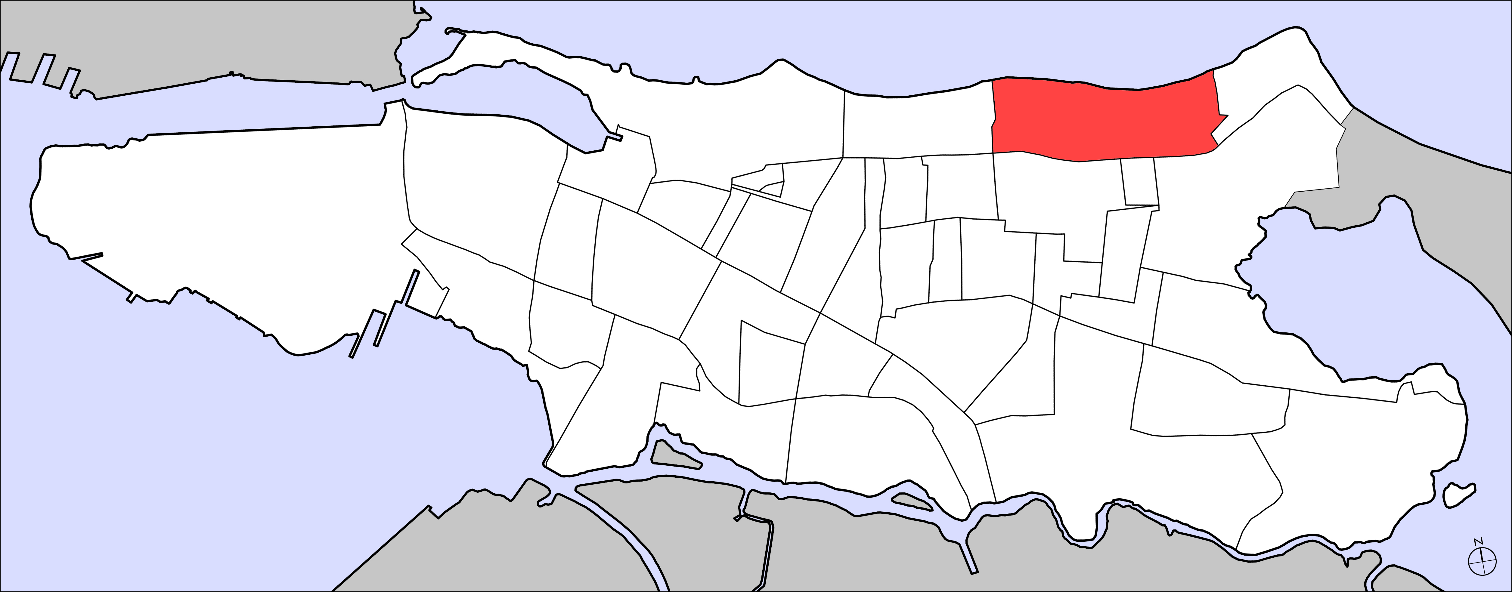
Ocean Park — Sector (of Santurce) — Geolocation in Santurce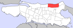 2000 Census map
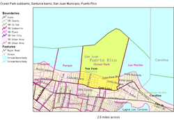
District Santurce Borough San Juan Population - Total 1,976 (2000 U.S. Census) Ocean Park is an upscale beachfront community within the district of Santurce, San Juan, Puerto Rico.
Location
Ocean Park has a land area of 0.52 square kilometres (0.20 sq mi) and a resident population of 1,976 inhabitants according to the 2000 United States Census.[1] About one kilometer off the beach is the small rocky Island Stone which is also part of the sector measuring about 100 by 50 meters.
Ocean Park is bound on the east by Calle Guerrero Noble and its straight extension to the beach, a short piece of Calle Cacique running east to connect to Calle Teniente Rivera, and the connecting piece of Calle Soldado Cruz to Calle Loíza. The southern border runs up to Calle Loíza, but excluding same. In the west, it is Calle María Mozco (northern part) and Calle Santa Ana. The north is bordered by the beach and the Atlantic Ocean. Right trough the centre runs Avenida McLeary where cafes, pubs and some services line the street.
Ocean Park is located between Condado and Isla Verde beaches making it an essential tranquil, tree-lined street residential neighborhood, with numerous examples of single family homes from the decades between 1930 and 1950. Small Bed & Breakfast Inns which blend in with the residential community also dot the area. Its wide ocean front and offshore reefs prevent large waves from reaching the beach, which is popular with trendy beachgoers. Strong seasonal onshore trade winds make the area popular for kitesurfing and windsurfing.
At the right of the district is the Parque Barbosa and the residential area of Santa Teresita forms the eastern part of the district. Parque Barbosa is the home of the último trolley ("last tram") which was the last electric streetcar that crossed the streets of San Juan from 1901 to 1946 and was placed in the park and operated as a restaurant, hence the name, último trolley.[citation needed]
References
Categories:- District of Santurce
- Borough of San Juan

Wikimedia Foundation. 2010.