- Oakley Creek
-
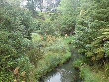 In the northern parts, closer to the Waitemata Harbour, the creek is relatively unmodified, though water quality is still degraded.[1]
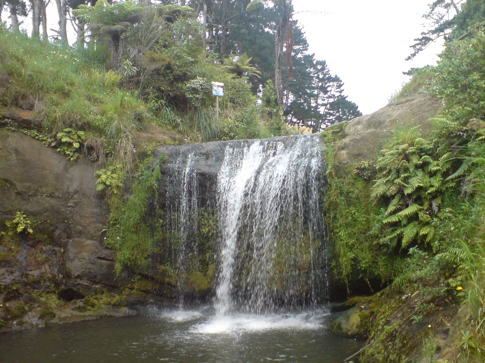
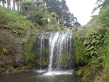 Slightly further south, the Oakley Creek waterfall.
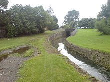 The rock-lined upper channel of the stream.
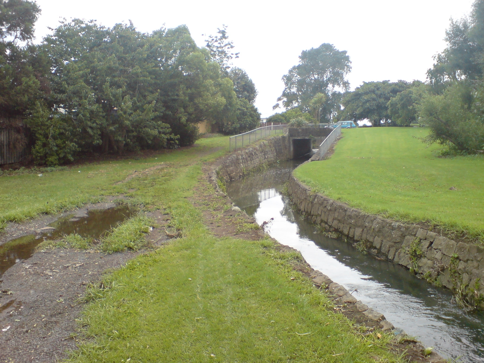
Oakley Creek (Māori name Te Auaunga) is a creek in Auckland, New Zealand. While heavily human-modified (being surrounded for most of its length by suburban development, especially in the upper reaches), it has a number of important ecological features, such as having the former Auckland City's only natural waterfall (which is also the largest in urban Auckland).[2]
The least modified regions, with mostly natural channels and significant riparian vegetation exists between approximately Blockhouse Bay Road and the inlet at the northern edge of Waterview.[1] A walkway runs along a good part of the creek in the section northwest of Mt Albert.[3] This area of the creek is also significant for a relatively large number of archeologically significant sites, due to the use of the creek by Maori reaching inland from the inlet (landing sites and settlement remnants), and due to the later lack of strong European settlement along this part of the area.[1]
The creek has also inspired a local community group, "Friends of Oakley Creek" which is working to restore it to a more natural state, and improve the water quality. One of the group's major concerns is the impact of the SH20 Waterview Connection on the stream, i.e. the form this motorway is to take under or near the creek.[4] Other concerns include the high levels of metals in the stream, such as zinc, copper and lead, from its urbanised catchment, and the fact that the culvert under Great North Road impedes fish migration.[1]
As one of the results of community interest in the revitalisation of the stream, a set of Oakley Creek Rehabilitation Guidelines was developed for the works that will occur near or at the stream during the Waterview motorway project. These primarily include removing the currently rock-lined, tight channelisation of the stream, and reintroducing a riparian margin. Auckland Council has since adapted the NZTA/Boffa Miskell-developed guidelines for some areas of the stream not affected by the motorway.[5]
References
- ^ a b c d Waterview Connection - Assessment of Environmental Effects: Part C. New Zealand Transport Agency. August 2010. pp. 8.19-8.22.
- ^ "Unitec, five parks at risk in road plan". The New Zealand Herald. 2 April 2002. http://www.nzherald.co.nz/nz/news/article.cfm?c_id=1&objectid=1292795. Retrieved 24 April 2010.
- ^ Waterview Connection - Assessment of Environmental Effects: Part C. New Zealand Transport Agency. August 2010. pp. 8.14–8.17.
- ^ "Keith Rankin: Motorway Choices". Scoop Independent News. 14 December 2005. http://www.scoop.co.nz/stories/HL0512/S00158.htm. Retrieved 24 April 2010.
- ^ "Ecology an important consideration at Waterview". Boffa Miskell News, Issue 26: p. 08. Winter 2011.
External links
- Friends of Oakley Creek (community groupd dedicated to preserving and enhancing the creek)
- The Creek Abides (photographic collection centred around the creek)
Categories:- Geography of Auckland
- Rivers of the Auckland Region
- Auckland Region geography stubs

Wikimedia Foundation. 2010.