- Nottingham Parksmart
-
Coordinates: 52°57′07″N 1°08′56″W / 52.952°N 1.149°W
Nottingham Parksmart 
Nottingham Parksmart is a parking scheme which divides Nottingham city centre into five distinctive zones to aid parking in the city, and to help tourists find attractions.
Plans
The plan first appeared in early 2004, and integration began in 2008. In August 2009, pedestrian signs were set up in the city centre for tourists. The signs have the logo of their respective zone, a map of the whole city, and the attractions near to the sign. Road signs have also gone up, indicating the zones, and more are planned soon. Electronic signs have also gone up in the city, and were integrated with the city's car parks in October 2009.
Zones
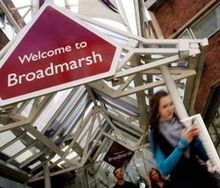
- Broadmarsh
- The Broadmarsh zone is in the south of the city, and contains Westfield Broadmarsh, the Courts and Nottingham railway station.
- Castle
- As the name might suggest, Nottingham castle can be found in this zone. Castle is the largest zone, and covers the western side of the city centre. Standard Hill, where King Charles I declared the English Civil War is also in this zone, as is the site of the old General Hospital. The Albert Hall can be found in the north of the zone, next to Nottingham Playhouse.
- Lace Market
- The Lace Market zone was once the centre of Nottingham's lace industry. It now contains stylish apartments and restaurants, and contains the area of Hockley Village. The TrentFM Arena and National Ice Centre is located in the east of the Lace Market zone.
- Royal
- The Royal Zone is just north of the Old Market Square, and is named after the Royal Centre, which consists of the Theatre Royal and the Royal Concert Hall. The Corner House complex is situated opposite these, with Trinity Square behind it. Nottingham Trent University's city campus is also in this zone.
- Victoria
- The Victoria Zone's central feature is the Victoria Centre, formerly Nottingham Victoria railway station.
External links
Categories:
Wikimedia Foundation. 2010.


