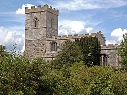
North Muskham

North Muskham

North Muskham is a village located between the River Trent and the A1 road near Newark-upon-Trent, in Nottinghamshire, England. It is close to the border with Lincolnshire.The village appears in the Domesday Book as Muscham.[1] There is a medieval parish church dedicated to St Wilfrid.

The village has a population of 943 (2001 census) with around 360 properties.[2]

There are currently two public houses: 'The Muskham Ferry' and 'The Crown'.

See also

References


External links

Media related to North Muskham at Wikimedia Commons


Coordinates: 53°08′N 0°51′W / 53.133°N 0.85°W / 53.133; -0.85


Wikimedia Foundation. 2010.

Игры ⚽ Поможем решить контрольную работу

Look at other dictionaries:

  • St. Wilfrid's Church, North Muskham — Coordinates: 53°07′08″N 00°48′32″W / 53.11889°N 0.80889°W / 53.11889; 0.80889 …   Wikipedia

  • St. Wilfrid's Church, South Muskham — Coordinates: 53°06′25″N 00°48′56″W / 53.10694°N 0.81556°W / 53.10694; 0.81556 …   Wikipedia

  • Diocese of Southwell and Nottingham — Location Ecclesiastical province York Archdeaconries Newark, Nottingham Statistics Parishes …   Wikipedia

  • List of places in Nottinghamshire — This is a list of settlements in the ceremonial county of Nottinghamshire, England. See the list of places in England for places in other counties.compactTOC NOTOC AAlverton, Annesley, Annesley Woodhouse, Arnold, Askham, Aslockton, Aspley,… …   Wikipedia

  • Newark and Sherwood — District   District   Shown within Nottinghamshire Sov …   Wikipedia

  • List of civil parishes in Nottinghamshire — This is a list of civil parishes in the ceremonial county of Nottinghamshire, England.AshfieldMost of the district: that is the former urban districts of Hucknall, Kirkby in Ashfield, and Sutton in Ashfield is unparished.*Annesley 1 *Felley 1… …   Wikipedia

  • Thurgarton (wapentake) — Thurgaton was a wapentake (equivalent to a hundred) of the historic county of Nottinghamshire, England. It extended north eastwards from Nottingham. The River Trent formed most of the eastern boundary. It consisted of the parishes of Averham,… …   Wikipedia

  • Church of St. Michael and All Angels, Averham — Coordinates: 53°04′52″N 00°51′44″W / 53.08111°N 0.86222°W / 53.08111; 0.86222 …   Wikipedia

  • St. Wilfrid's Church, Kelham — Coordinates: 53°05′25″N 0°50′47″W / 53.09028°N 0.84639°W / 53.09028; 0.84639 …   Wikipedia

  • List of bus routes in Essex — A map which shows the area these services operate in. This is a list of bus routes in Essex, United Kingdom.[1] The major operators in the Essex area are First Essex, Hedingham Omnibuses and Regal Busways. Other operators in …   Wikipedia

Share the article and excerpts

Direct link
Do a right-click on the link above
and select “Copy Link”