- Msallata
-
Msallata
مسلاتة
Al Qasabat— Town — Location in Libya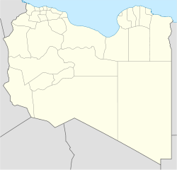
 Msallata
Coordinates: 32°34′56″N 14°02′24″E / 32.58222°N 14.04°E Country  Libya
LibyaRegion Tripolitania District Murqub Elevation[1] 227 m (745 ft) Population (2004)[1] – Total 23,702 Time zone UTC+2 Msallata (also Al Qasabat, Cussabat and El-Gusbát) is a town in the northwestern part of Libya, in the Murqub District. It has a population of nearly 24,000[1], and was historically a center of Islamic studies. It is also known for olive tree farming and olive oil production. The Tripolian Republic was announced in Msallata on 16 November 1918 which was the first republic in the Arab world. Along with the city of Tarhuna, it gave its name to the former Libyan district of Tarhuna wa Msalata.
Contents
Etymology
There has not been any research on the etymology of the name Msallata, but there is some speculation as to its origins. One theory is that the name comes from the plural of the Arabic word for obelisk masalla which is masallat because the city is the home of 22 tall buildings called qasaba. Others speculate that the name comes from the Arabic word salt (scrubbing), which also has the more specific meaning of 'scrubbing olive from its tree', with M in the beginning being a variant of the Himyarite definite article am-. Supporters of this argument mention the fact that Msallata is famous for its olive production. However, none of these claims have been scientifically substantiated.
During the 2011 civil war
Main article: 2011 Msallata clashesReuters reported clashes in Msallata on 3 August, in which three people were killed.[2] By 5 August, AFP was reporting that the town, whose residents had joined the rebellion in its early stages,[3] had come under siege. Government troops controlled the roads leading into the town, had cut off electricity and communications and had begun arresting people in the suburbs.[4]
See also
- List of cities in Libya
- Tarhuna District
- Tarhuna wa Msalata District
References
- ^ a b c Wolfram Alpha
- ^ Reuters, 4 August 2011, here
- ^ See message of allegiance to NTC at [1]
- ^ "Libyan rebels report town under siege". Times Live. 6 August 2011. http://www.timeslive.co.za/africa/2011/08/06/libyan-rebels-report-town-under-siege. Retrieved 9 October 2011.
Coordinates: 32°34′56″N 14°02′24″E / 32.58222°N 14.04°E
Murqub District, LibyaCapital Khoms
Towns and villages Bani Hasan • Msallata • TarhunaCategories:- Populated places in Murqub District

Wikimedia Foundation. 2010.