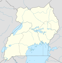
- Ngoma, Uganda
-
Ngoma Map of Uganda showing the location of Ngoma Coordinates: 01°10′48″N 32°01′05″E / 1.18°N 32.01806°E Country  Uganda
Region Central Uganda District Nakaseke District Constituency Nakaseke North Government - Member of Parliament Syda Bbumba Time zone EAT (UTC+3) Ngoma is a small town in Nakaseke District, Central Uganda. It is one of the municipalities within Nakaseke District.[1] Other municipalities in the district include:
- Kapeeka
- Nakaseke
- Semuto
- Wakyaato
Contents
Location
Ngoma is located approximately 76 kilometres (47 mi), by road, northwest of Luweero, the largest town in the sub-region.[2] This location is approximately 139 kilometres (86 mi), by road, northwest of Kampala, Uganda's capital and largest city.[3] The coordinates of the town are:01 10 48N, 32 01 05E (Latitude:1.18000; Longitude:32.0180).
Population
The exact population of Ngoma is not known at this time.
Landmarks
The landmarks within the town limits or near the town include:
- The offices of Ngoma Town Council
- Ngoma Central Market
External links
See also
- Nakaseke District
- Luweero Triangle
- Central Region, Uganda
References
 Nakaseke District
Capital: Nakaseke Counties and
sub-countiesNakaseke County · Kapeeka Sub-county · Ngoma Sub-county · Kinyogoga Sub-county · Wakyaato Sub-county · Nakaseke Sub-county · Kaasangombe Sub-county · Semuto Sub-county · Kikamulo Sub-countyTowns and
villagesButalangu · Nakaseke · Kapeeka · Ngoma · Kinyogoga · Wakyaato · Kaasangombe · Semuto · Kikamulo · KiwokoNotable
landmarksEducation Oliver Tambo School of Leadership · Nakaseke Teacher Training CollegeNotable people Syda Bbumba · Salim SalehCategories:- Nakaseke District
- Populated places in Uganda
- Cities in the Great Rift Valley
Wikimedia Foundation. 2010.

