- Nazigo
-
Nazigo Map of Uganda showing the location of Nazigo.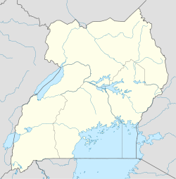
 Nazigo
Coordinates: 00°38′31″N 32°59′24″E / 0.64194°N 32.99°E Region Central Region District Kayunga District County Ntenjeru County Sub-county Nazigo Sub-county Elevation 1,100 m (3,609 ft) Time zone EAT (UTC+3) Nazigo is a town in Kayunga District, Central Region, Uganda.
Contents
Location
The town is located on the main road between Kayunga in Kayunga District and Njeru in Buikwe District. This location is approximately 16 kilometres (9.9 mi), by road, south of Kayunga, where the district headquarters are located, [1] and approximately 40 kilometres (25 mi), by road, north of Njeru in Buikwe District.[2] The coordinates of Nazigo are:00 38 31N, 32 59 24E (Latitude:0.6420; Longitude:32.9900).
Overview
Nazigo is the location of the headquarters of Nazigo Sub-county, one of the four sub-counties in Ntenjeru County, a constituent of Kayunga District. The town is also the home of Nazigo Teacher Training College (Nazigo TTC), administered by the Church of Uganda. Negotiations are underway, between the Church of Uganda and Muteesa I Royal University, for the university to take over the college and transform it into its Faculty of Education, thus creating a campus in Nazigo.
Population
The exact population of Nazigo is not known as of March 2011.
Landmarks
The landmarks within town or close to its borders include:
- The offices of Nazigo Town Council
- Nazigo Central Market
- Nazigo Police Station
- The headquarters of Nazigo Sub-county.
- Nazigo Health Centre III - A health unit administered by the Uganda Ministry of Health
- The Kayunga-Njeru Road - The all-weather, tarmac road passes through Nazigo in a north to south direction
- The Nazigo Campus of Muteesa I Royal University - When established it will occupy the campus of Nazigo Teacher Training College and transform into the Faculty of Education
External links
- Location of Nazigo At Google Maps
- Website of Muteesa I Royal University
- Nazigo Page At Travelingluck.com
See also
- Kayunga District
- Kayunga
- Ntenjeru
- Bbaale
References
 Kayunga DistrictCapital: Kayunga
Counties and
sub-countiesBbaale County · Ntenjeru County · Bbaale Sub-county · Garilaya Sub-county · Kayonza Sub-county · Kitibwa Sub-county · Kayunga Sub-county · Busaana Sub-county · Nazigo Sub-county · Kangulumira Sub-county
Towns and villages Economy PostBank Uganda · Stanbic Bank · Uganda Finance Trust LimitedNotable andmarks River Sezibwa · Kayunga HospitalEducation Nazigo Teacher Training CollegeNotable people Sulaiman MadadaCategories:- Populated places in Uganda
- Cities in the Great Rift Valley
- Kayunga District

Wikimedia Foundation. 2010.