- Nathpa Jhakri Dam
-
Nathpa Jhakri Dam Location of Nathpa Jhakri Dam Location Himachal Pradesh
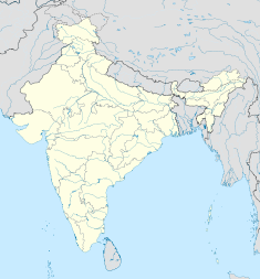
IndiaCoordinates 31°33′50″N 77°58′49″E / 31.56389°N 77.98028°ECoordinates: 31°33′50″N 77°58′49″E / 31.56389°N 77.98028°E Construction began 1993 Opening date 2004 Construction cost US$2 billion Owner(s) SJVN Ltd Dam and spillways Type of dam Concrete gravity Height 62.5 m (205 ft) Length 185 m (607 ft) Volume 200,000 m3 (261,590 cu yd) Impounds Satluj River Spillway capacity 5,660 m3/s (199,881 cu ft/s) Reservoir Capacity 3,430,000,000 m3 (2,780,746 acre·ft) Active capacity 3,030,000,000 m3 (2,456,461 acre·ft) Surface area 234.5 m (769 ft)[1] Power station Commission date 2004 Hydraulic head 428 m (1,404 ft) Turbines 6 × 250 MW Francis-type Installed capacity 1,500 MW The Nathpa Jhakri Dam is a concrete gravity dam on the Satluj River in Himachal Pradesh, India. The primary purpose of the dam is hydroelectric power production and it supplies a 1,500 MW underground power station with water. Before reaching the power station, water is diverted through a 27.4 km (17 mi) headrace tunnel. Construction on the project began in 1993 and it was complete in 2004. The last two of the 250 MW Francis turbine-generators went online in March 2004. It is owned by SJVN Ltd. [2]
Contents
Sponsors and investors
- Sponsor Nathpa Jhakri Power Corporation
- Kvaerner / ABB / Siemens / Sulzer Escher Wyss
- Impregilo / Foundation Corporation ( Construction)
- BHEL
References
- ^ "India: National Register of Large Dams 2009". Central Water Commission. http://www.cwc.nic.in/main/downloads/National%20Register%20of%20Large%20Dams%202009.pdf. Retrieved 10 July 2011.
- ^ "Nathpa - Jhakri Hydroelectric Project, Himachal Pradesh, India". Geological Survey of India. http://www.portal.gsi.gov.in/gsiDoc/pub/cs_nathpajhakri_hep.pdf. Retrieved 7 August 2011.
See also
External links
Categories:- Hydroelectric power stations in Himachal Pradesh
- Dams in Himachal Pradesh
- Gravity dams
- Dam stubs
Wikimedia Foundation. 2010.

