- Nangeen
-
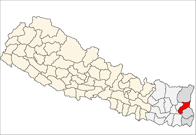
Nangeen — Village development committee — Location in Nepal
 Nangeen
Coordinates: 27°09′N 87°50′E / 27.15°N 87.83°ECoordinates: 27°09′N 87°50′E / 27.15°N 87.83°E Country  Nepal
NepalZone Mechi Zone District Panchthar District Population (1991) – Total 3,264 Time zone Nepal Time (UTC+5:45) Nangeen is a village development committee in Panchthar District in the Mechi Zone of eastern Nepal. At the time of the 1991 Nepal census it had a population of 3264 people living in 578 individual households.[1]
References
- ^ "Nepal Census 2001". Nepal's Village Development Committees. Digital Himalaya. http://www.digitalhimalaya.com/collections/nepalcensus/form.php?selection=1. Retrieved 12 December 2008.
Aangna, Aangsarang, Aarubote, Ambarpur, Bharpa, Chilingdin, Chokmagu, Chyangthapu, Durdimba, Ekteen, Embung, Falaicha, Hangum, Khandrung, Khunga, Kurumba, Lalikharka, Limba, Lungrupa, Luwamfu, Mangjabung, Mauwa, Memeng, Nagi, Nangeen, Nawamidanda, Olane, Oyam, Panchami, Parangbung, Pauwa Sartap, Phaktep, Phidim, Prangbung, Rabi, Rani Gaun, Ranitar, Salleri, Sarangdanda, Sidin, Siwa, Sumang, Syangrumba, Tharpu, Yangnam, Yasok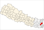 Categories:
- Populated places in Panchthar District
- Mechi Zone geography stubs

Wikimedia Foundation. 2010.