- N'Gorkou
-
N'Gorkou — Commune and village — Location in Mali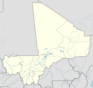
 N'Gorkou
Coordinates: 15°39′33″N 3°42′56″W / 15.65917°N 3.71556°WCoordinates: 15°39′33″N 3°42′56″W / 15.65917°N 3.71556°W Country  Mali
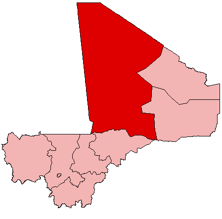
MaliRegion Tombouctou Region Cercle Niafunké Cercle Area[1] – Total 879 km2 (339.4 sq mi) Population (2009 census)[2] – Total 24,381 – Density 27.7/km2 (71.8/sq mi) Time zone GMT (UTC+0) N'Gorkou is a village and rural commune of the Cercle of Niafunké in the Tombouctou Region of Mali. The commune includes around 54 small settlements.
References
- ^ (in French) Schéma Directeur de Lutte Contre l’Ensablement dans le Nord du Mali (6ème et 7ème Régions): Monographie de la Commune de N'Gorkou, Ministère de l’Environnement et de l’Assainissement, République du Mali, 2004, http://www.environnement.gov.ml/uploads/sifor/monographie/MonoNGorkou.pdf
- ^ (in French) Resultats Provisoires RGPH 2009 (Région de Tombouctou), République de Mali: Institut National de la Statistique, http://instat.gov.ml/documentation/tombouctou.pdf.
External links
- (in French) Plan de Sécurite Alimentaire Commune Rurale de N'Gorkou 2006-2010, Commissariat à la Sécurité Alimentaire, République du Mali, USAID-Mali, 2006, http://www.aec.msu.edu/fs2/mali_fd_strtgy/plans/tombouctou/niafunke/psa_ngorkou.pdf.
 Communes and towns of the Tombouctou RegionCapital: Timbuktu
Diré Cercle 
Goundam Cercle Goundam (Goundam) · Alzounoub (Sonima) · Bintagoungou (Bintagoungou) · Douekire (Douekire) · Adarmalane (Adarmalane) · Gargando (Gargando) · Issa Bery (Toucabangou) · Kaneye (Kaneye) · Doukouria (Doukouria) · M'Bouna (M'Bouna) · Tilemsi (Kel Malha) · Tele (Hangabéra) · Essakane (Essakane) · Raz El Ma (Raz El Ma) · Tin Aicha (Tin Aicha) · Tonka (Tonka)Gourma-Rharous Cercle Niafunké Cercle Timbuktu Cercle Tombouctou (Tombouctou) · Lafia (Aglal) · Alafia (Toya) · Ber (Ber) · Bourem-Inaly (Bourem-Inaly) · Salam (Agouni)Categories:- Tombouctou Region geography stubs
- Populated places in the Tombouctou Region
- Communes of Mali

Wikimedia Foundation. 2010.